Republic, Michigan
| Republic, Michigan | |
|---|---|
| Census-designated place (CDP) & Unincorporated community | |
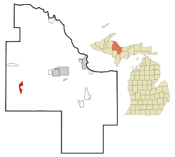 Location of Republic within Marquette County, Michigan | |
| Coordinates: 46°24′24″N 87°58′32″W / 46.40667°N 87.97556°W | |
| Country | United States |
| State | Michigan |
| County | Marquette |
| Townships |
Republic, Humboldt |
| Area | |
| • Total | 3.9 sq mi (10.1 km2) |
| • Land | 3.6 sq mi (9.3 km2) |
| • Water | 0.3 sq mi (0.8 km2) |
| Elevation[1] | 1,522 ft (464 m) |
| Population (2000) | |
| • Total | 276 |
| • Density | 170.1/sq mi (65.7/km2) |
| Time zone | Eastern (EST) (UTC-5) |
| • Summer (DST) | EDT (UTC-4) |
| ZIP code | 49879 |
| Area code(s) | 906 |
| FIPS code | 26-67980[2] |
| GNIS feature ID | 634306[1] |
Republic is an unincorporated community in Marquette County in the U.S. state of Michigan. It is also a census-designated place (CDP) for statistical purposes, covering a narrow, roughly crescent-shaped area along several miles of M-95. Most of the CDP is within Republic Township, although a small portion of the CDP extends north into Humboldt Township[3]
Republic is also the name of the post office for ZIP code 49879, which includes the CDP as well as most of the rest of Republic Township and a small portion of Mansfield Township in Iron County.[4]
The population of the CDP was 614 at the 2000 census.[5] The population of the 49879 ZCTA in 2000 was 996.[6]
History
A post office called Republic has been in operation since 1873.[7] The community was named after the Republic Iron Company.[8]
Geography
According to the United States Census Bureau, the community has a total area of 3.9 square miles (10 km2), of which 3.6 square miles (9.3 km2) is land and 0.3 square miles (0.78 km2) (7.67%) is water.
Demographics

As of the census[2] of 2000, there were 614 people, 276 households, and 187 families residing in the community. The population density was 170.1 per square mile (65.7/km²). There were 356 housing units at an average density of 98.6 per square mile (38.1/km²). The racial makeup of the community was 98.05% White, 1.63% Native American, and 0.33% from two or more races.
There were 276 households out of which 26.4% had children under the age of 18 living with them, 52.5% were married couples living together, 10.1% had a female householder with no husband present, and 31.9% were non-families. 30.1% of all households were made up of individuals and 17.4% had someone living alone who was 65 years of age or older. The average household size was 2.22 and the average family size was 2.67.
In the community the population was spread out with 21.2% under the age of 18, 4.9% from 18 to 24, 23.8% from 25 to 44, 25.6% from 45 to 64, and 24.6% who were 65 years of age or older. The median age was 45 years. For every 100 females there were 90.7 males. For every 100 females age 18 and over, there were 87.6 males.
The median income for a household in the community was $24,545, and the median income for a family was $29,659. Males had a median income of $24,875 versus $18,472 for females. The per capita income for the community was $14,793. About 10.7% of families and 15.1% of the population were below the poverty line, including 19.1% of those under age 18 and 16.2% of those age 65 or over.
Education
Republic is served by the Republic-Michigamme School District, which operates the Republic-Michigamme High School.
Unique Features
From 1980 to 2004, the US Navy operated an extremely low frequency (76 Hz) submarine communication site near Republic under Project ELF.[9][10][11]
References
- 1 2 U.S. Geological Survey Geographic Names Information System: Republic, Michigan
- 1 2 "American FactFinder". United States Census Bureau. Retrieved 2008-01-31.
- ↑ Republic CDP, Michigan - Reference Map - American FactFinder, U.S. Census Bureau, 2000 census
- ↑ 49879 5-Digit ZCTA, 498 3-Digit ZCTA - Reference Map - American FactFinder, U.S. Census Bureau, 2000 census.
- ↑ Geographic Area: Republic CDP, Michigan, Data Set: Census 2000 Summary File 1 (SF 1) 100-Percent Data, DP-1. Profile of General Demographic Characteristics: 2000, U.S. Census Bureau, 2000 census.
- ↑ Geographic Area: 49879 5-Digit ZCTA, Data Set: Census 2000 Summary File 1 (SF 1) 100-Percent Data, DP-1. Profile of General Demographic Characteristics: 2000, U.S. Census Bureau, 2000 census.
- ↑ "Marquette County". Jim Forte Postal History. Retrieved 26 March 2015.
- ↑ Chicago and North Western Railway Company (1908). A History of the Origin of the Place Names Connected with the Chicago & North Western and Chicago, St. Paul, Minneapolis & Omaha Railways. p. 117.
- ↑ https://www.hep.wisc.edu/~prepost/ELF.pdf
- ↑ http://www.miningjournal.net/page/content.detail/id/584573/AFTER-ELF.html?nav=5006
- ↑ http://www.nmu.edu/archives/sites/DrupalArchives/files/UserFiles/MSS-249.html
Municipalities and communities of Marquette County, Michigan, United States | ||
|---|---|---|
| Cities | 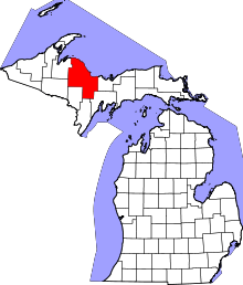 | |
| Charter townships | ||
| General law townships | ||
| CDPs | ||
| Other unincorporated communities | ||
| Indian reservation | ||
Coordinates: 46°24′24″N 87°58′32″W / 46.40667°N 87.97556°W