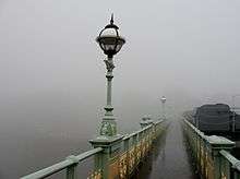
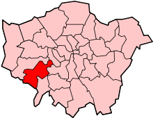
Richmond Lock and Footbridge
 | |
| Waterway | River Thames |
|---|---|
| County | Greater London |
| Maintained by | Port of London Authority |
| First built | 1894 |
| Length | 250 feet (76.2 m) |
| Width | 26 feet 8 inches (8.1 m) |
| Fall | Half tide lock (10 feet (3 m)) |
| Above sea level | 0 |
| Heritage status | Grade II* listed structure |
| Coordinates | 51°27′44″N 0°19′02″W / 51.46222°N 0.31722°WCoordinates: 51°27′44″N 0°19′02″W / 51.46222°N 0.31722°W |
Richmond Lock and Footbridge is a lock and pedestrian bridge, situated on the River Thames in south west London, England and is a Grade II* listed structure.[1] It is the furthest downstream of all the Thames locks and is the only one owned and operated by the Port of London Authority. It was opened in 1894 and is situated close to the centre of Richmond in the south western suburbs of London. It connects Richmond on the east bank with the neighbouring district of St. Margarets on the west bank during the day, but is now closed at night to pedestrians - after 19:30 GMT or after 21:30 when BST is in use.
Description
The Richmond lock and weir complex was built between 1891 and 1894 by the Thames Conservancy to maintain a navigable depth of water upstream of Richmond. This then ensures that there is always at least a 1.72m depth of water in the River between Richmond and Teddington.[2][3][4][5] In 1908 an Act transferred responsibility for the Thames from a point 350 yards (320 m) below Teddington Lock to the Port of London Authority, and this included Richmond Lock.[6]
When the old London Bridge was demolished in 1832, the removal of the palisades, constructed to protect the bridge, resulted in the tides on the Thames rising and falling far more rapidly than they had done. This, together with dredging of the lower river, meant that for long periods the Thames at Twickenham and Richmond was little more than a stream running through mudbanks. In 1890, after many years of petitioning, an act of parliament was enacted to build a half-lock and weir downstream of Richmond Bridge (Richmond Footbridge, Sluice, Lock and Slipway Act 1890).

To restore the river to its former state a barge lock was constructed against the Surrey side joined by a weir to three roller slipways for small craft on the Middlesex side. As a superstructure was required to operate the sluice mechanism, it was agreed to construct this in the form of two footbridges.[7][8]
The bridge was formally opened on 19 May 1894 by the then Duke of York (who later became King George V) having cost £61,000 to construct.
Technically, Richmond Lock is a half-tide lock and barrage, which also incorporates a public footbridge. The footbridge crosses the conventional lock, the slipway and the barrage, which comprises three vertical steel sluice gates suspended from the footbridge structure. These gates weigh 32 tons each and are 66 feet in width and 12 feet in depth. The lock permits passage of vessels up to 250 feet long by 26 feet 8 inches wide.
For about two hours each side of high tide, the sluice gates which make up the barrage are raised into the footbridge structure above, and river traffic can pass through the barrage unimpeded. For the rest of the tidal cycle the sluice gates are closed, and ships and boats must use the lock alongside the barrage at a cost of £5 per boat . Rowing boats and kayaks can use the slipway. The sluice gates were originally manually operated by the lock keepers, who lived under pedestrian steps on each bank of the river.
The barrage has the effect of maintaining the water level between Richmond Lock and Teddington Lock (the next lock upstream) at or above half-tide level. The maximum fall of the lock is 10 feet.
From the date of the bridge's opening until some time during World War II, a toll of one (old) penny was charged to any pedestrian who wished to cross the bridge. However, a sightseer who went onto the bridge and then left at the same side had to pay twopence.[9] The toll booths and the remains of the turnstile housings remain on the bridge to this day. Since the bridge is actually two footbridges that are not connected, one either side of the sluice mechanisms, four toll booths and turnstiles had to be provided to collect the tolls
See also
References
- ↑ Historic England. "Details from image database (432275)". Images of England. accessed 27 November 2008
- ↑ "The River Thames - Lock Details". www.the-river-thames.co.uk. Retrieved 2007-10-31.
- ↑ "Richmond Lock and Weir". Port of London Authority. Retrieved 2007-10-31.
- ↑ "Mechanism - Richmond Lock". The Victorian Web. Retrieved 2007-10-31.
- ↑ "Richmond Lock 2003". Christine Northeast. Retrieved 2007-10-31.
- ↑ Fred S. Thacker The Thames Highway: Volume 1 General History David & Charles 1968
- ↑ "Richmond Lock, London". Just Tour Limited. Retrieved 2007-10-31.
- ↑ "Richmond Footbridge". John Cooper. Retrieved 2007-10-31.
- ↑ Thames Bridges from Dartford to the Source - Neil Davenport
| Wikimedia Commons has media related to Richmond Lock and Footbridge. |
External links
| Next crossing upstream | River Thames | Next crossing downstream |
| Twickenham Bridge | Richmond Lock and Footbridge Grid reference: TQ170751 |
Kew Bridge |
| Next lock upstream | River Thames | Next lock downstream |
| Teddington Lock | Richmond Lock and Footbridge Grid reference: TQ170751 |
none |
