Hampton Hill
| Hampton Hill | |
 Hampton Hill cemetery and the spire of St James's Church |
|
 Hampton Hill |
|
| OS grid reference | TQ144710 |
|---|---|
| London borough | Richmond |
| Ceremonial county | Greater London |
| Region | London |
| Country | England |
| Sovereign state | United Kingdom |
| Post town | HAMPTON |
| Postcode district | TW12 |
| Dialling code | 020 |
| Police | Metropolitan |
| Fire | London |
| Ambulance | London |
| EU Parliament | London |
| UK Parliament | Twickenham |
| London Assembly | South West |
Coordinates: 51°25′35″N 0°21′21″W / 51.42647°N 0.35592°W
Hampton Hill (initially known as 'New Hampton') is a place in the London Borough of Richmond upon Thames to the west of Twickenham, bounded by Fulwell and Twickenham Golf Course to the northwest; the road bridge over the railway line;[1] a line southward just east of Wellington Road; Bushy Park to the southeast; and the artificial Longford River to the south and west.[2] It is served by Fulwell railway station on the Shepperton to Waterloo line.
History
For history prior to the late 19th century see Hampton, London.
Hampton Hill's urban development was railway-fuelled building in an area that was since the Middle Ages the north of Hampton ecclesiastical parish further away from the River Thames. Distinguished from Hampton on all street name signs, it is that part across the Charles I-commissioned Longford River, an artificial watercourse built to supply Hampton Court, which forms the boundary between Hampton Hill and Hampton.
Its lack of development is reflected by the fact only seven of this complete list of listed buildings are buildings:
- 167 High Street[3]
- 127 Uxbridge Road[4]
- Templeton Lodge[5]
- Brick Boundary Walls to Bushy Park[6]
- Stables & Garden Wall to Upper Lodge[7]
- Church of St James[8]
- Monument At south-eastern end of General Roy's Survey Base [9]
- Upper Lodge [10]
- Old Brew House, Bushy Park[11]
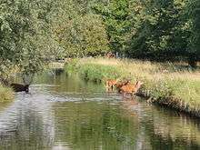
- Bushy Park – a Grade I listed park[12]
The oldest of the listed structures lie within the part of Bushy Park in the area; the Old Brew House may be late 17th century.[11]
In the First World War, No 15 High Street was the drill hall of the 8th Battalion of the Middlesex Regiment. The regiment's insignia can still be seen in stone over the door.[13]
Hampton Hill was bombed a number of times during the Blitz, the first major incident was in November 1940 when 63 Park Road was gutted when an abandoned Wellington bomber crashed on it. On the next night much of Alpha Road was destroyed and five people died after a Luftwaffe bomber dropped a landmine on it. Subsequently Hampton Hill had a number of lucky escapes with bombs and incendiaries either failing to explode or landing in Bushy Park, Fulwell Golf Course, and other open land, with the next major incident being in June 1944 when a doodlebug exploded near Longford Close and killed one person.[14]
Geography
The small town is in the southwestern suburbs of London, in the London Borough of Richmond upon Thames. The geology of south-west London north of the river is a flat alluvial plain rich in clay and humus and thus useful for market gardening; with little floodplain on either side of the river and though downhill, Hampton's riverside is only 7 metres (23 ft) beneath the maximum elevation in Hampton Hill.[15] A comparison can be made with Strawberry Hill which is smaller and has a small noticeable incline to the east.
Aside from the residential areas of the town, the High Street is filled with shops, restaurants, several cafes, a few public houses, and a traditional 75-year-old bakery.[16] The High Street also stages a yearly parade before Christmas when the street is closed and a procession takes place.
The Hampton Hill Association (HHA) launched their Hampton Hill Community website on 30 November 2007, with local links & telephone numbers, a What's On Guide, Gallery, History and Young Residents pages as well as information about the mission of the HHA and its committee members.
The High Street in Hampton Hill has an active Traders' Association. They have been organising the annual Christmas Lighting Up parade for over 40 years. In 2010 the inaugural Hampton Hill Summer Festival was organised. The Hampton Hill Traders' Association together with Richmond Council co-fund the town centre manager, Jayne Jackson. The wide range of commerce, theatre and restaurants in the High Street is documented by an annually updated Hampton Hill Guide.[17]
Hampton Hill is also home to the Hampton Hill Theatre,[18] a small community theatre
 |
Hanworth | Whitton Fulwell |
Fulwell Strawberry Hill |
|
| Hanworth | |
Teddington | ||
| ||||
| | ||||
| Hampton | Hampton | across Bushy Park Hampton Court (hamlet by the Palace) |
Transport
Bus services
- 285 (Kingston to Heathrow Central via Teddington and Feltham) 24 Hour
- R68 (Kew Retail Park to Hampton Court via Richmond and Teddington)
- R70 (Hampton Nurserylands to Richmond 'Circular Service' via Twickenham)
Trains
- Fulwell railway station: Trains run every 30 minutes Mon-Sat
- Hampton railway station: Trains run every 30 minutes Mon-Sat
- Teddington railway station: Trains run approximately every 15 minutes Mon-Sat
Additional train services run during the weekday morning and evening peak
Education
Hampton Hill Junior School is on St James Avenue; the headteacher is Alan Went, the deputy is Amanda Appleyard.
Lady Eleanor Holles School Juniors Department is located in Hampton Hill, off Uxbridge Road (the Seniors are in Hampton, off Hanworth Road).
Religious sites
- St James' Church, Hampton Hill – Church of England, built in 1863
- Hampton Hill United Reformed Church
- Hampton Hill Spiritualist Church
- St Francis de Sales – Roman Catholic
Sports
References
- ↑ At Wellington Road, TW12 north of the Longford River 51°25′59″N 0°21′07″W / 51.433086°N 0.352014°W
- ↑ "How we came up with the area covered by the Plan". London Borough of Richmond upon Thames. Retrieved 16 December 2014.
- ↑ 167, High Street Historic England. "Details from listed building database (1065419)". National Heritage List for England.
- ↑ 127, Uxbridge Road Historic England. "Details from listed building database (1253021)". National Heritage List for England.
- ↑ Templeton Lodge Historic England. "Details from listed building database (1065420)". National Heritage List for England.
- ↑ Brick Boundary Walls Historic England. "Details from listed building database (1080875)". National Heritage List for England.
- ↑ Stables And Garden Wall To Upper Lodge Historic England. "Details from listed building database (1191599)". National Heritage List for England.
- ↑ Church Of St James Historic England. "Details from listed building database (1255505)". National Heritage List for England.
- ↑ Monument At South-Eastern End Of General Roy's Survey Base Historic England. "Details from listed building database (1263302)". National Heritage List for England.
- ↑ Upper Lodge Historic England. "Details from listed building database (1358057)". National Heritage List for England.
- 1 2 Old Brew House Historic England. "Details from listed building database (1080872)". National Heritage List for England. also a Scheduled Ancient MonumentHistoric England. "Details from listed building database (1002046)". National Heritage List for England.
- ↑ Bushy Park Historic England. "Details from listed building database (1000281)". National Heritage List for England.
- ↑ "Great War Centenary - Drill Halls". geograph.co.uk. Retrieved 23 July 2014.
- ↑ Barnfield, P. (2001). When the Bombs Fell: Twickenham, Teddington and The Hamptons Under Aerial Bombardment During the Second World War. Twickenham: Twickenham Local History Society. pp. 15 & 29. ISBN 0-903341-73-5.
- ↑ "Elevation Tools". maximum above sea level 18m
- ↑ "The Cavan Bakery".
- ↑ Hampton Hill Guide
- ↑ Hampton Hill Playhouse
External links
- The Hampton Hill Guide with the Hampton Hill Traders' Association
- Notes on Hampton Hill (Twickenham museum)
- Hampton Hill Association Community Website
- Burials in St James's churchyard
- 1st Hampton Hill Sea Scout Group
- 3rd Hampton Hill Scout Group