River Waring
| River Waring | |
| River | |
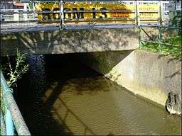 The River Waring as it flows through Horncastle, viewed from Wharf Road | |
| Country | England |
|---|---|
| Counties | Lincolnshire |
| Tributaries | |
| - left | Thunker Drain |
| Source | |
| - location | Belchford |
| - elevation | 328 ft (100 m) |
| Mouth | |
| - location | Horncastle |
| - elevation | 95 ft (29 m) |
The River Waring is a small river in Lincolnshire, England, and a tributary of the River Bain. The Waring rises in the parish of Belchford and runs through Belchford village, passing between the villages of Fulletby, West Ashby and Low Toynton before arriving at Horncastle,[1] where it divides Horncastle market place from the part of the town known as Cagthorpe. After the Horncastle floods of the 1960s, the river channel was straightened and its banks built up through the town.[2] It joins the River Bain along with the Thunker Drain or Scrafield Beck at the confluence by the town's swimming pool, which was built on the site of the old dry dock of the Horncastle Canal.[3]
Bibliography
- Clarke, J. N. (1990). The Horncastle and Tattershall Canal. Oakwood Press. ISBN 0-85361-398-2.
References
- ↑ Ordnance Survey, 1:50,000 map
- ↑ Robinson, David N. "Horncastle and the Problem of Floods". Welcome to Horncastle. Retrieved 18 February 2016.
- ↑ Clarke 1990, pp. 85–86
53°12′24″N 0°07′21″W / 53.2068°N 0.1224°W
| Rivers | |
|---|---|
This article is issued from Wikipedia - version of the 2/18/2016. The text is available under the Creative Commons Attribution/Share Alike but additional terms may apply for the media files.