Roe Highway
| Roe Highway Western Australia | |
|---|---|
 | |
| Map of Perth's central suburbs with Roe Highway highlighted in red | |
| General information | |
| Type | Highway |
| Length | 35 km (22 mi) |
| Opened | 1980s |
| Route number(s) |
|
| Major junctions | |
| Northeast end |
|
| |
| Southwest end |
|
| Location(s) | |
| Major suburbs | Midvale, Hazelmere, Forrestfield, Kewdale, Welshpool, Canning Vale, Leeming, Jandakot |
| Highway system | |
|
Highways in Australia National Highway • Freeways in Australia Highways in Western Australia | |
| |
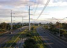
Roe Highway is a 35 km (22 mi) limited access highway and partial freeway in the south-eastern suburbs of Perth, Western Australia, linking Middle Swan in the north-east with Bibra Lake in the south-west. It is primarily allocated State Route 3 and forms half of Perth's outer ring road along with Reid Highway, which it joins onto at its northern terminus.
The highway is one of the key heavy vehicle routes in the Perth metropolitan area. Aside from intersections, the speed limit is 100 km/h (62 mph) for most of its length. Twenty kilometres (12 mi) of the highway, between Kwinana Freeway and Tonkin Highway, is a continuous freeway, with grade-separated interchanges and free traffic flow. The rest of the highway is the standard of Perth's major highways; limited access, with few grade separations and traffic lights.
Roe Highway is multiplexed with National Highway 94 from Great Eastern Highway Bypass to Great Eastern Highway, and also National Highway 95 from Great Eastern Highway to Great Northern Highway.
Route description

Most junctions on the highway are grade separated diamond interchanges south-west of Tonkin Highway, and at-grade traffic light controlled intersections to the north-east of Tonkin Highway. The exceptions are at: Great Eastern Highway, a modified diamond interchange with a northbound to eastbound loop ramp; Clayton Street and Maida Vale Road, which are grade separated, but with only northbound exit and southbound entry ramps; and the terminus at Kwinana Freeway, a trumpet interchange. There is a diamond interchange at Tonkin Highway, with the free flowing traffic on Tonkin Highway, and traffic light controlled intersections on Roe Highway at the entry and exit ramps.
History
Roe Highway was first proposed in 1955 by Gordon Stephenson as part of what was to become the Metropolitan Region Planning Scheme. The highway was intended to form the southern and eastern sections of a ring route around the Perth metropolitan area.[1] It is named in honour of John Septimus Roe, who arrived in Western Australia in 1829 and served at the first state Surveyor General of Western Australia for 41 years.[2]
Work began in 1981, with the first section between the Beechboro-Gosnells Highway and Bushmead Road opening in 1983. The next section, from Bushmead Road to Great Eastern Highway was opened in 1984. The third stage, linking Great Eastern Highway and Great Northern Highway opened on 14 December 1988, at the same time as the Great Eastern Highway Bypass opened. The state Minister for Transport, Bob Pearce was assisted in the opening ceremony by Jason and Rachael Roe, two of the sixth generation of the Roe family to live in Australia and descendants of John Septimus Roe.[2] The new roads provided a limited access dual carriageway bypass of the historical Guildford and Midland districts that was much needed at the time.
In 1994, the highway was extended 2 km (1.2 mi) further southwards from Tonkin Highway to Welshpool Road. Following 7 years in hiatus, work recommenced, and in 2001 a new 4 km (2 mi) southwestern extension known as stage 4 was completed from Welshpool Road to the purpose-built Kenwick Link (an Albany Highway bypass built in 1998) – most of which replaced the overtaxed William Street in Beckenham. Work on the 3 km (1.9 mi) long stage 5 was undertaken simultaneously with stage 4, bringing the highway to Nicholson Road in 2002.
Stage 6, a 5 km (3 mi) extension from Nicholson Road to South Street was completed in 2004, with stage 7 being announced shortly afterwards. The 4.5 km (3 mi) stage 7 extension from South Street to Kwinana Freeway was completed in March 2006, at a cost of A$75m, and represents the highway's current southwestern terminus.[3]
The 19 km (12 mi) of road built since 1994 between Tonkin Highway and Kwinana Freeway, is to a freeway standard. It may in the future be upgraded to a freeway classification.
In June 2012, the new grade separated interchange opened at the Great Eastern Highway intersection, allowing free flowing traffic on Roe Highway over Great Eastern Highway. The design includes a northbound to eastbound loop ramp to cater for heavy vehicles, and three pedestrian underpasses.[4]
Stage 8 / Fremantle Eastern Bypass
Roe Highway was first proposed in 1955 by Gordon Stephenson as part of what was to become the Metropolitan Region Planning Scheme. The highway was intended to form the southern and eastern sections of a ring route around the Perth metropolitan area.[5] In the 1950s, Stephenson planned for Roe Highway to continue westwards towards Fremantle, through South Fremantle along Marine Terrace and then north to connect with Stirling Highway and the Port of Fremantle. As part of the plan, in 1974 Stirling Highway was extended from its then terminus north of the Swan River southwards to Canning Highway. Over a period of approximately 20 years, Main Roads Western Australia procured land, and in 1985, Stirling Highway was extended southwards from Canning Highway to High Street (the western continuation of Leach Highway). The remaining 3 km (1.9 mi) strip of land south of High Street then became known as the Fremantle Eastern Bypass.
At the southern end of the proposed Fremantle Eastern Bypass, an 8 km (5 mi) east-west road reservation was proclaimed, and became known as Roe Highway stage 8. With a change of state governments in 2001, the planned Fremantle Eastern Bypass / Roe Highway stage 8 was cancelled, with a commitment by the government to sell the land reserved for the Fremantle Eastern Bypass. As part of the funding arrangement for Roe Highway stages 6 and 7, the federal government stipulated that the Roe Highway stage 8 reservation was to be retained.
Following a change in state governments in September 2008, planning work has now commenced on an extension of Roe Highway from Kwinana Freeway to Stock Road.[6] Parliamentary debate[7] was continuing in 2012 as the state government continued its intention to implement the plan.
Future
Gateway WA
Gateway WA is a $1 billion project that will upgrade the road network around Perth Airport. It is the largest project Main Roads Western Australia has ever undertaken, covering the upgrade of Tonkin, Leach, and Roe Highways, and the construction of four new interchanges. The project is jointly funded by state and federal governments, which are providing $317.5 million and $686.4 million respectively.[8]
As part of the project, Roe Highway's interchange with Tonkin Highway will be upgraded, noise walls will be erected along Roe Highway in High Wycombe, and a new interchange between Roe Highway and Berkshire Road will be constructed.[8]
Perth Freight Link

The Perth Freight Link is a $1.6 billion project to improve the road freight link between Kewdale and Fremantle Harbour. The project includes a 5 km (3.1 mi) extension to Roe Highway (known as Roe 8), as well as upgrading Stock Road, Leach Highway, and High Street to provide a grade-separated route, bypassing fourteen sets of traffic signals.[9] The links plan includes mandatory GPS tracking of all vehicles over an as yet undisclosed size or weight with a charge per kilometre being applied for vehicles travelling in the area between Muchea and North Fremantle.[10] The extension will take the highway from its current terminus at Kwinana Freeway approximately 5 km (3.1 mi) further west to Stock Road, near Forrest Road in Coolbellup. The proposed route is along or within the vicinity of an existing road reserve in the Perth Metropolitan Region Scheme.[11]
In September 2015 the group Save the Beeliar Wetlands took legal action against the Environmental Protection Agency (EPA), arguing that the EPA did not follow its own policies.[12] Preliminary works began on the project during November 2015, which drew protests with many people being given move-on orders preventing them from being in the area. On 16 December 2015 the Supreme Court handed down its findings: that because the EPA did not follow its published policies as it was legally obliged to, the approval of Roe 8 and the subsequent approval given by the environment minister Albert Jacobs were invalid.[12]
Noongar custodian Corina Abraham, on behalf of the local Whadjuk Noongar people filed writs against members of the Department of Aboriginal Affairs cultural committee and the current WA Minister for Aboriginal Affairs Peter Collier in the WA Supreme Court on 30 March 2016. The writs allege that they did not receive procedural fairness as both Abraham and her now deceased father were part of the group consulted in the original group consulted in the report which the committee later overturned to enable the project's approval. Abraham's lawyer Greg McIntyre QC (who had also been Eddie Mabo's lawyer) also sought an injunction to prevent the minister making any decisions based on the new recommendation until the matter is heard by the court.[13]
Interchanges and intersections
| LGA | Location | km | mi | Destinations | Notes |
|---|---|---|---|---|---|
| Swan | Middle Swan | 0 | 0.0 | Highway terminus: continues west as Reid Highway (State Route 3). National Highway 95 concurrency terminus: continues north. Traffic light controlled intersection | |
| Middle Swan, Stratton | 1.4 | 0.87 | Traffic light controlled intersection | ||
| Swan, Mundaring | Midvale | 3.4 | 2.1 | Morrison Road – Midland, Swan View | Traffic light controlled intersection |
| 4.3 | 2.7 | Modified diamond interchange with northbound to eastbound loop ramp. National Highway 95 terminus. National Highway 94 concurrency terminus: continues east. | |||
| Swan | Bellevue | 5.1 | 3.2 | Clayton Street – Bellevue, Midland | Northbound exit and southbound entry only |
| Hazelmere | 7.1 | 4.4 | National Highway 94 concurrency terminus: continues west; Traffic light controlled T junction | ||
| Kalamunda | High Wycombe, Maida Vale | 9.9 | 6.2 | Traffic light controlled intersection | |
| 11.2 | 7.0 | Maida Vale Road – High Wycombe, Maida Vale | Northbound exit and southbound entry only | ||
| Forrestfield | 13.6– 13.7 | 8.5– 8.5 | Berkshire Road – Forrestfield | Diamond interchange | |
| Kewdale, Forrestfield, Wattle Grove | 16.0– 16.2 | 9.9– 10.1 | Diamond interchange (Tonkin Highway free flowing), with traffic lights at each intersection | ||
| Kewdale | 16.8 | 10.4 | Chisholm Crescent – Kewdale | Closed in January 2016, previously a LILO T junction (north-eastbound access only)[14] | |
| Gosnells | East Cannington, Welshpool | 18.1 | 11.2 | ||
| Beckenham | 22.3 | 13.9 | |||
| Beckenham, Kenwick, Langford, Thornlie | 22.9– 23.0 | 14.2– 14.3 | Djarlgarra Bridge (over Canning River) | ||
| Gosnells, Canning | Lynwood, Langford, Thornlie, Canning Vale | 25.6 | 15.9 | ||
| Canning | Lynwood, Willetton | 28.2 | 17.5 | Willeri Drive – Canning Vale, Riverton | |
| Leeming | 30.2 | 18.8 | |||
| Cockburn | Jandakot | 33.3 | 20.7 | Dogbone interchange | |
| Bibra Lake, Jandakot, North Lake | 34.2– 34.8 | 21.3– 21.6 | Highway terminus: trumpet interchange | ||
1.000 mi = 1.609 km; 1.000 km = 0.621 mi
| |||||
See also
- Highways in Australia
- Highways in Western Australia
- Freeways in Australia
- Freeways in Western Australia
Notes
- ↑ New Roe Highway link to open (April 1998). Western Roads: official journal of Main Roads Western Australia, 21(1), p.4. Perth: Main Roads Western Australia.
- 1 2 History and a highway (March 1989). Western Roads: official journal of the Main Roads Department, Western Australia, 14(1), p.5. Perth: Main Roads Department.
- ↑ Main Roads, Western Australia, Annual Report 2006. Perth: Main Roads, Western Australia, 2006, p. 51-52
- ↑ "Roe/Great Eastern interchange improves safety, traffic flow and transport efficiency". Ministerial Media Statements. Government of Western Australia. Retrieved 2012-06-11.
- ↑ New Roe Highway link to open (April 1998). Western Roads: official journal of Main Roads Western Australia, 21(1), p.4. Perth: Main Roads Western Australia.
- ↑ http://www.mainroads.wa.gov.au/BuildingRoads/Projects/UrbanProjects/Roe/Pages/roe.aspx
- ↑ http://www.parliament.wa.gov.au/Hansard/hansard.nsf/0/d813b0c9e04bb55b482579f4002a00bd/$FILE/C38%20S1%2020120502%20p2027b-2042a.pdf
- 1 2 "Gateway WA". Main Roads Western Australia. 27 March 2013. Archived from the original on 10 May 2013. Retrieved 29 April 2013.
- ↑ Main Roads Western Australia (5 January 2015). "Perth Freight Link". Government of Western Australia. Retrieved 8 February 2015.
- ↑ Parker, Gareth (17 Dec 2014). "Truck toll to pay for Roe Highway extension". The West Australian. Retrieved 2 January 2016.
- ↑ Main Roads Western Australia (17 December 2014). "Roe Highway Extension – Kwinana Freeway to Stock Road". Government of Western Australia. Retrieved 8 February 2015.
- 1 2 Young, Emma (16 Dec 2016). "Supreme Court rules EPA approval of Roe 8 'invalid'". WA Today. Retrieved 2 January 2016.
- ↑ Grant, Steve (1 April 2016). "ROE 8 The fight of my life". Fremantle Herald. Retrieved 2 April 2016.
- ↑ "Permanent Closure: Roe Highway / Chisholm Crescent Intersection, Kewdale" (PDF). Traffic Notice. Gateway WA. 4 December 2015. Archived (PDF) from the original on 19 January 2016. Retrieved 19 January 2016. Additional archives: 19 January 2016.
References
- Hepburn, J.A. & Stephenson, G. 1955, Plan for the metropolitan region, Perth and Fremantle, Western Australia, 1955: a report prepared for the Government of Western Australia, Government Printing Office, Perth.
- Edmonds, Leigh (1997). The vital link: a history of Main Roads Western Australia 1926–1996. Nedlands, Western Australia: University of Western Australia Press. ISBN 1-875560-87-4.
- Main Roads WA
- The Roe7 Project
- Skyview WA – Department of Land Information, Western Australia
Road infrastructure in Western Australia | ||
|---|---|---|
| Freeways | ||
| Metropolitan highways | ||
| Highways and major roads |
| |
| Outback tracks | ||
| National Highways | ||||||||
|---|---|---|---|---|---|---|---|---|
| National Routes | ||||||||
| State Routes | ||||||||
| Tourist Drives | ||||||||