Roeser
| Roeser Réiser | ||
|---|---|---|
| Commune | ||
|
Town hall | ||
| ||
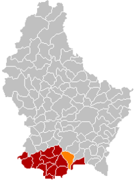 Map of Luxembourg with Roeser highlighted in orange, and the canton in dark red | ||
| Coordinates: 49°32′10″N 6°08′45″E / 49.5361°N 6.1458°ECoordinates: 49°32′10″N 6°08′45″E / 49.5361°N 6.1458°E | ||
| Country |
| |
| Canton | Esch-sur-Alzette | |
| Government | ||
| • Mayor | Tom Jungen | |
| Area | ||
| • Total | 23.8 km2 (9.2 sq mi) | |
| Area rank | 37 of 105 | |
| Highest elevation | 311 m (1,020 ft) | |
| • Rank | 100th of 105 | |
| Lowest elevation | 256 m (840 ft) | |
| • Rank | 63rd of 105 | |
| Population (2014) | ||
| • Total | 5,502 | |
| • Rank | 23rd of 105 | |
| • Density | 230/km2 (600/sq mi) | |
| • Density rank | 29th of 105 | |
| Time zone | CET (UTC+1) | |
| • Summer (DST) | CEST (UTC+2) | |
| LAU 2 | LU00010011 | |
| Website | roeser.lu | |


Roeser (Luxembourgish: Réiser) is a commune and small town in southern Luxembourg. It is part of the canton of Esch-sur-Alzette, which is part of the district of Luxembourg. As of the February 1, 2011 census, the commune had a population of 5,302.
As of 2005, the town of Roeser, which lies in the north of the commune, has a population of 682. Other towns within the commune include Berchem, Bivange, Crauthem, Kockelscheuer, Livange, and Peppange.
External links
-
 Media related to Roeser at Wikimedia Commons
 |
Leudelange | Luxembourg City, Hesperange | | |
| Bettembourg | |
Weiler-la-Tour | ||
| ||||
| | ||||
| Zoufftgen (FR-57) | Frisange |
 | ||
This article is issued from Wikipedia - version of the 12/1/2016. The text is available under the Creative Commons Attribution/Share Alike but additional terms may apply for the media files.