Rooma
| Rooma(रूमा) Kanpur Nagar | |
|---|---|
| town | |
| Nickname(s): Textile City of Uttar Pradesh | |
 Rooma(रूमा)  Rooma(रूमा) Location in Uttar Pradesh, India | |
| Coordinates: 26°28′N 80°19′E / 26.46°N 80.32°ECoordinates: 26°28′N 80°19′E / 26.46°N 80.32°E | |
| Country |
|
| State | Uttar Pradesh |
| District | Kanpur Nagar |
| Government | |
| • Body | Rooma/Chakeri Municipality |
| Area | |
| • Total | 7.21 km2 (2.78 sq mi) |
| Elevation | 123 m (404 ft) |
| Population (2011) | |
| • Total | 9,868 |
| • Density | 1,647/km2 (4,270/sq mi) |
| Languages | |
| • Official | Hindi |
| Time zone | IST (UTC+5:30) |
| PIN | 208 010 |
| Vehicle registration | UP-78 |
| Nearest city | Kanpur |
| Literacy | 85% |
| Lok Sabha constituency | Akbarpur (Lok Sabha constituency) |
| Vidhan Sabha constituency | Maharajpur |
| Civic agency | Rooma/Chakeri Municipality/ward-10/Zone-2 |
| Website |
up |
Rooma(Hindi:रूमा)(Urdu:روما) is a developing town near Kanpur, India and a major industrial centre on Kanpur-Allahabad Highway of National Highway 2.[1]
Economy
There are many industries situated in the U.P.S.I.D.C. developing area. Many automotive showrooms are located on NH-2 National Highway 2.TECHNO INDIA is Service centre of Makita and Bosch power tools. Rooma has immense potential to be developed as major industrial city in Uttar Pradesh as the Dedicated Freight Corridor proposed by Government of India passes from here and Rooma has its own railway station on the corridor.
Textile Park
The Project has been set up on 173 acres of land on National Highway No.2 (Kanpur-Allahabad Section). Facilities like Training Centre, Fashion Design Centre, CETP, etc. for textile units in the area has been set up in the project.[2]
Leather Complex
UPSIDC has developed a leather goods complex along with township at Rooma.[3]
New Rooma Industrial Estate
UPSIDC has planned to develop a new industrial estate named as New Rooma Industrial Estate to give fuel to small scale industries.[4]
Banks :
- Bank of Baroda
- State Bank of India
- Allahabad Bank
Education
Rooma is one of the educational hubs in Kanpur, having a number of Engg. Institutes like Kanpur Institute of Technology, AXIS Colleges, Allenhouse Group, Vision Institute of Technology etc.
Demography
Tourist Attractions
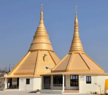
- Radha-Swami Asram
- Habiba Masjid, Jajmau
- Jajmau Tila
- Rooma Dhori Ghat
- Beramh Dev Temple
- Balaji Mandir, Salempur Mod
Transport
Road
National Highway 2 which connects Delhi with Dankuni near Kolkata passes from Rooma. Rooma has a bus stop near the highway and buses for major cities like Kanpur, Allahabad, Agra, Mathura, Faridabad, Jaipur etc are easily available here.
Railways
Rooma (RXM) has a railway station on Delhi-Howrah main line but only passenger trains have halt here. There is a proposal to convert Rooma into terminal station as it is developing at very fast rate.[5]Sarsaul Railway Station which has express/mail trains stoppage is 5 km from here and Kanpur Central Railway Station is 18 km from here.
Airways
Kanpur Airport is the nearest airport but has no flights at present. The airport is under renovation and is expected to have air services in late 2017. Lucknow Airport is the nearest international airport with flights to major cities of India and Middle East.
References
- ↑ https://books.google.co.in/books?id=wNVYAAAAYAAJ&q=Rooma+Kanpur&dq=Rooma+Kanpur&hl=en&sa=X&ved=0ahUKEwit1Oe2v7jNAhVJqI8KHRCbCzkQ6AEIDzAB
- ↑ http://www.upsidc.com/textilepark.htm
- ↑ https://books.google.co.in/books?id=WllPAQAAMAAJ&q=Rooma+Kanpur&dq=Rooma+Kanpur&hl=en&sa=X&ved=0ahUKEwit1Oe2v7jNAhVJqI8KHRCbCzkQ6AEIGzAE
- ↑ http://inextepaper.jagran.com/854865/INext-Kanpur/28-06-16?show=touch#page/1/2
- ↑ http://indiarailinfo.com/station/map/rooma-rxm/5278
Bank Bank of Baroda Allahabad bank