Ruggs, Oregon
| Ruggs, Oregon | |
|---|---|
| Unincorporated community | |
|
Grain elevator along Oregon Route 206 in Ruggs | |
 Ruggs, Oregon  Ruggs, Oregon | |
| Coordinates: 45°15′48″N 119°41′12″W / 45.26333°N 119.68667°WCoordinates: 45°15′48″N 119°41′12″W / 45.26333°N 119.68667°W | |
| Country | United States |
| State | Oregon |
| County | Morrow |
| Elevation | 2,136 ft (651 m) |
| Time zone | Pacific (PST) (UTC-8) |
| • Summer (DST) | PDT (UTC-7) |
| ZIP code | 97843 |
| Area code(s) | 458 and 541 |
| Coordinates and elevation from the Geographic Names Information System (GNIS)[1] | |

Ruggs is an unincorporated community in Morrow County, Oregon, United States. Ruggs lies at the intersection of Oregon Route 206 and Oregon Route 207, at an elevation of 2,136 feet (651 m).[1] Ruggs is east of Eightmile and southwest of Heppner.[2] The community is part of the Pendleton–Hermiston Micropolitan Statistical Area.
Ruggs lies along Rhea Creek, a tributary of Willow Creek, which flows north into the Columbia River at Heppner Junction.[2] The community was named for Ed Rugg, a local rancher who operated a store and service station here after World War I.[3]
References
- 1 2 "Ruggs". Geographic Names Information System. United States Geological Survey. November 28, 1980. Retrieved May 23, 2015.
- 1 2 Oregon Atlas & Gazetteer (7th ed.). Yarmouth, Maine: DeLorme. 2008. p. 73. ISBN 978-0-89933-347-2.
- ↑ McArthur, Lewis A.; Lewis L. McArthur (2003) [1928]. Oregon Geographic Names (7th ed.). Portland, Oregon: Oregon Historical Society Press. p. 831. ISBN 0-87595-277-1.
Municipalities and communities of Morrow County, Oregon, United States | ||
|---|---|---|
| Cities | 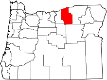 | |
| Unincorporated communities | ||
| Ghost town | ||
This article is issued from Wikipedia - version of the 9/30/2016. The text is available under the Creative Commons Attribution/Share Alike but additional terms may apply for the media files.