Rukungiri
| Rukungiri | |
|---|---|
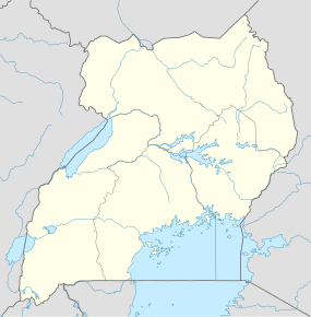 Rukungiri Location in Uganda | |
| Coordinates: 00°47′24″S 29°55′30″E / 0.79000°S 29.92500°ECoordinates: 00°47′24″S 29°55′30″E / 0.79000°S 29.92500°E | |
| Country |
|
| Region | Western Region of Uganda |
| Sub-region | Kigezi sub-region |
| District | Rukungiri District |
| Elevation | 5,380 ft (1,640 m) |
| Population (2014 Census) | |
| • Total | 36,509[1] |
Rukungiri is a town in Rukungiri District of the Western Region of Uganda. It is the site of the district headquarters.
Location
Rukungiri is approximately 68 kilometres (42 mi), by road, north of Kabale, the largest town in the Kigezi sub-region.[2] This is approximately 400 kilometres (250 mi), by road, southwest of Kampala, the capital and largest city of Uganda.[3] The coordinates of the town are 0°47'24.0"S, 29°55'30.0"E (Latitude:-0.7900; Longitude:29.9250).[4]
Overview
Rukungiri is a two-street town surrounded by numerous hills and valleys. Most of the surrounding hills, however, have lost their natural shapes because of human activity, most notably agriculture. The town itself is located on a hilltop. In some places, the agricultural terraces on the hills cover them from the foot to peak.[5]
Population
According to the 2002 national population census, Rukungiri had 12,765 inhabitants. In 2010, the Uganda Bureau of Statistics (UBOS) estimated the population at 14,400. In 2011, UBOS estimated the mid-year population at 14,700.[6] In 2014, the national population census put the population at 36,509.[1]
Points of interest
The following additional points of interest are located in Rukungiri or near the town limits:
- offices of Rukungiri Town Council
- Rukungiri central market
See also
References
- 1 2 UBOS (27 August 2014). "The Population of The Regions of the Republic of Uganda And All Cities And Towns of More Than 15,000 Inhabitants". Citypopulation.de Quoting Uganda Bureau of Statistics (UBOS). Retrieved 26 February 2015.
- ↑ "Map Showing Kabale And Rukungiri With Distance Marker". Globefeed.com. Retrieved 8 June 2014.
- ↑ "Distance Between Kampala And Rukungiri With Map". Globefeed.com. Retrieved 8 June 2014.
- ↑ Google (19 July 2015). "Location of Rukungiri Town At Google Maps" (Map). Google Maps. Google. Retrieved 19 July 2015.
- ↑ Mutabaazi, Enoch (16 April 2007). "Rukungiri Town: A Town Weary of Political Battles". Ugpulse.com. Retrieved 8 June 2014.
- ↑ UBOS. "Estimated Population of Rukungiri In 2002, 2010 And 2011" (PDF). Uganda Bureau of Statistics (UBOS). Retrieved 8 June 2014.
External links
Capital: Rukungiri | ||
| Towns and villages | ||
| Economy | ||
| Transport | ||
| Notable landmarks | ||
| Health | ||
| Notable people | ||