Russellville Regional Airport
| Russellville Regional Airport | |||||||||||
|---|---|---|---|---|---|---|---|---|---|---|---|
 | |||||||||||
| IATA: none – ICAO: KRUE – FAA LID: RUE | |||||||||||
| Summary | |||||||||||
| Airport type | Public | ||||||||||
| Owner | City of Russellville | ||||||||||
| Serves | Russellville, Arkansas | ||||||||||
| Elevation AMSL | 404 ft / 123 m | ||||||||||
| Coordinates | 35°15′33″N 093°05′36″W / 35.25917°N 93.09333°W | ||||||||||
| Runways | |||||||||||
| |||||||||||
| Statistics (2007) | |||||||||||
| |||||||||||
Russellville Regional Airport (ICAO: KRUE, FAA LID: RUE) is a city-owned public-use airport located two nautical miles (3.7 km) southeast of the central business district of Russellville, a city in Pope County, Arkansas, United States.[1] According to the FAA's National Plan of Integrated Airport Systems for 2009–2013, it is categorized as a general aviation facility.[2] It was formerly known as Russellville Municipal Airport.
Although many U.S. airports use the same three-letter location identifier for the FAA and IATA, this facility is assigned RUE by the FAA but has no designation from the IATA[3]
Facilities and aircraft
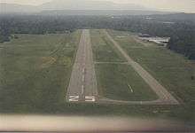
Russellville Regional Airport covers an area of 307 acres (124 ha) at an elevation of 404 feet (123 m) above mean sea level. It has one runway designated 7/25 with an asphalt surface measuring 5,094 by 75 feet (1,553 x 23 m).[1]
For the 12-month period ending October 31, 2007, the airport had 25,100 aircraft operations, an average of 68 per day: 80% general aviation, 18% air taxi, and 2% military. At that time there were 51 aircraft based at this airport: 90% single-engine, 8% multi-engine and 2% helicopter.[1]
References
- 1 2 3 4 FAA Airport Master Record for RUE (Form 5010 PDF). Federal Aviation Administration. Effective 3 June 2010.
- ↑ National Plan of Integrated Airport Systems for 2009–2013: Appendix A: Part 1 (PDF, 1.33 MB). Federal Aviation Administration. Updated 15 October 2008.
- ↑ "Russellville, Arkansas (ICAO: KRUE, FAA: RUE)". Great Circle Mapper. Retrieved 19 June 2010.
External links
- Airport page at City of Russellville website
- Aerial image as of 25 February 1994 from USGS The National Map
- FAA Terminal Procedures for RUE, effective December 8, 2016
- Resources for this airport:
- FAA airport information for RUE
- AirNav airport information for KRUE
- FlightAware airport information and live flight tracker
- NOAA/NWS latest weather observations
- SkyVector aeronautical chart, Terminal Procedures