Saaj
| Saaj | |
|---|---|
| Village | |
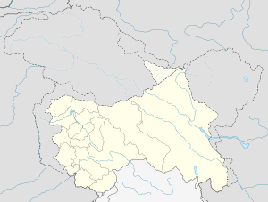
 Saaj  Saaj Location in Jammu and Kashmir, India | |
| Coordinates: 33°25′39.5″N 74°22′06.6″E / 33.427639°N 74.368500°E | |
| Country |
|
| State | Jammu and Kashmir |
| District | Rajouri |
| Population (2011) | |
| • Total | 4,112 |
| Time zone | IST (UTC+5:30) |
Saaj or Saj[1] (33°28'0"N 74°20'28"E) is a village located in the ThanaMandi tehsil of the Rajouri district in the Indian State of Jammu and Kashmir. Saaj lies off India 144A [2] approximately equidistant from both Rajouri and Thanamandi.
Population and Agriculture
Lohar (Blacksmith), Kamhars (Potters), and Tarkhan (Carpenters) are among some of the most prominent professions. The major part of the population of Saaj depends on farming for their livelihood. Others are government workers or jobs less focused on manual labor. Some animals like buffalo, goats, and sheep are commonly relied on for food and clothing.
According to 2011 census data, Saaj has 946 households and a population of 4,112[3] (2,148 males and 1,964 females)
The climate of Saaj is moderate and is suitable for various crops and vegetation. The main crops of Saaj are maize (مکی), wheat (گندم), and paddy (دھان).
Maize is cultivated in the middle and upper portion of the village, while Paddy is cultivated in the lower portion of the village, along with wheat cultivated all over the village. Vegetables are also grown in Saaj on a small scale. Saaj is also full of natural vegetation. It has grasslands, meadows, trees, herbs, bushes, and common land for cattle.
2011 Census Detail of Village Saaj
| Total Number of HouseHold : 946 | |||
|---|---|---|---|
| Population | Persons | Males | Females |
| Total | 4,112 | 2,148 | 1,964 |
| In the age group 0–6 years | 693 | 376 | 317 |
| Scheduled Castes (SC) | 0 | 0 | 0 |
| Scheduled Tribes (ST) | 891 | 471 | 420 |
| Literates | 2,586 | 1,548 | 1,038 |
| Illiterate | 1,526 | 600 | 926 |
| Total Worker | 1,979 | 988 | 991 |
| Main Worker | 1,962 | 972 | 990 |
| Main Worker - Cultivator | 1,655 | 706 | 949 |
| Main Worker - Agricultural Labourers | 0 | 0 | 0 |
| Main Worker - Household Industries | 2 | 2 | 0 |
| Main Worker - Other | 305 | 264 | 41 |
| Marginal Worker | 17 | 16 | 1 |
| Marginal Worker - Cultivator | 5 | 5 | 0 |
| Marginal Worker - Agriculture Labourers | 1 | 1 | 0 |
| Marginal Worker - Household Industries | 1 | 1 | 0 |
| Marginal Workers - Other | 10 | 9 | 1 |
| Marginal Worker (3-6 Months) | 17 | 16 | 1 |
| Marginal Worker - Cultivator (3-6 Months) | 5 | 5 | 0 |
| Marginal Worker - Agriculture Labourers (3-6 Months) | 1 | 1 | 0 |
| Marginal Worker - Household Industries (3-6 Months) | 1 | 1 | 0 |
| Marginal Worker - Other (3-6 Months) | 10 | 9 | 1 |
| Marginal Worker (0-3 Months) | 0 | 0 | 0 |
| Marginal Worker - Cultivator (0-3 Months) | 0 | 0 | 0 |
| Marginal Worker - Agriculture Labourers (0-3 Months) | 0 | 0 | 0 |
| Marginal Worker - Household Industries (0-3 Months) | 0 | 0 | 0 |
| Marginal Worker - Other Workers (0-3 Months) | 0 | 0 | 0 |
| Non Worker | 2,133 | 1,160 | 973 |
Religion in Saaj
The whole population of the village is Muslim, which is based on several castes, including the Bhatti, Khokhar, Gujjar, Thaker, Kashmiri and Janjua caste. The caste of "Bhatti" is widely spread throughout the village.
Local Landmarks
- Historical Fort (مغل سراۓ )
- Historical Pond (تالاب )
- Holy Tomb of Baba Jallian Wali Sarkar (زیارت بابا جلیانوالی سرکار) [4]
- Leeran Wali Bawli
References
- ↑ "Saj 185132". Google Maps. Google. Retrieved 10 February 2016.
- ↑ "India NH144A". OpenStreetMap. Retrieved 10 February 2016.
- ↑ "2001 Census Data for Saj". Census of India. Government of India, Ministry of Home Affairs. Retrieved 12 February 2016.
- ↑ "Hazrat Baba Jaliyan Wale Saaj". Google Maps. Google. Retrieved 10 February 2016.