Saint-André Parish, New Brunswick
| Saint-André St. André | |
|---|---|
| Parish | |
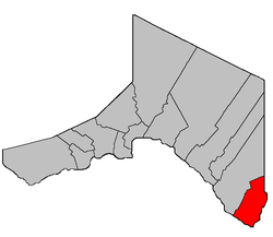 Location within Madawaska County, New Brunswick. | |
| Coordinates: 47°08′37″N 67°45′18″W / 47.14361°N 67.755°W | |
| Country |
|
| Province |
|
| County | Madawaska |
| Established | 1913 |
| Area[1] | |
| • Land | 128.08 km2 (49.45 sq mi) |
| Population (2011)[1] | |
| • Total | 1,134 |
| • Density | 8.9/km2 (23/sq mi) |
| • Pop 2006-2011 |
|
| • Dwellings | 418 |
| Time zone | AST (UTC-4) |
| • Summer (DST) | ADT (UTC-3) |
Saint-André is a Canadian parish in Madawaska County, New Brunswick.[2]
Delineation
Saint-André Parish is defined in the Territorial Division Act[3] as being bounded:
- All that part of the former Parish of Saint-Léonard in the County of Madawaska, lying southeasterly of the following described lines, namely: Beginning on the eastern bank or shore of the Saint John River, at the most western angle of lot No. 147, granted to Peter C. Martin, above Powers Creek, thence northeasterly along the northwest line of said lot to the most northern angle thereof, thence southeasterly along the northeastern line of said lot and its southeastern prolongation to the southwest angle of lot No. 1, granted to R. Poitras in the second tier, thence northerly along the western line of said lot to the most northern angle thereof, thence southeasterly along the northeastern line of said lot to the most southern angle of lot number two hundred and eleven granted to O. Bellefleur, junior, in Block R., thence northeasterly along the southeastern line of said lot and its northeastern prolongation to the most eastern angle of lot No. 314 in Block R. aforesaid, thence northwesterly along the northeastern line of said lot to the most western angle of lot No. 12 in the first tract, Saint-Amand,[lower-alpha 1] thence northeasterly along the northwestern line of said lot and its northeastern prolongation to the southern line of lot No. 3, on the southern side of Coombes Road [Settlement], thence easterly along the southern base line of lots fronting on the southern side of Coombes Road to the southeastern angle of lot No. 13 granted to Juliene John, thence northerly along the eastern line of said lot to the northeast angle thereof, thence easterly along the southern line of lot No. 15 granted to Alexander Michaud, to the southeast angle thereof, thence north along the eastern line of said lot to the northeast angle of the same, and thence easterly along the eastern prolongation of the northern line of last mentioned lot to the line dividing the Counties of Madawaska and Victoria.
Communities
Parish population total does not include incorporated municipalities (in bold):
|
|
Demographics
PopulationPopulation trend[4]
|
LanguageMother tongue language (2006)[5]
|
See also
Footnotes
- ↑ Actually Cyr Settlement; the confusion is caused by the community of Saint-Amand within the Settlement.
References
- 1 2 2011 Statistics Canada Census Profile: Saint-André Parish, New Brunswick
- ↑ New Brunswick Provincial Archives - Saint-André Parish
- ↑ "Territorial Division Act (R.S.N.B. 1973, c. T-3)". Government of New Brunswick website. Retrieved 24 August 2016.
- ↑ Statistics Canada: 1996, 2001, 2006 census
- ↑ 2006 Statistics Canada Community Profile: Saint-André Parish, New Brunswick
 |
Saint-Léonard Parish | | ||
| Saint-Léonard Parish | |
Drummond Parish (Victoria County) | ||
| ||||
| | ||||
| Aroostook County, Maine |
Grand Falls Parish (Victoria County) |
| Subdivisions | |
|---|---|
| Cities | |
| Counties | |
| |
Coordinates: 47°08′37″N 67°45′18″W / 47.14361°N 67.75500°W
This article is issued from Wikipedia - version of the 8/26/2016. The text is available under the Creative Commons Attribution/Share Alike but additional terms may apply for the media files.