Saint-Elphège, Quebec
| Saint-Elphège | |
|---|---|
| Parish municipality | |
 Location within Nicolet-Yamaska RCM. | |
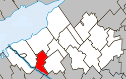
 Saint-Elphège Location in southern Quebec. | |
| Coordinates: 46°03′N 72°42′W / 46.050°N 72.700°WCoordinates: 46°03′N 72°42′W / 46.050°N 72.700°W[1] | |
| Country |
|
| Province |
|
| Region | Centre-du-Québec |
| RCM | Nicolet-Yamaska |
| Constituted | March 12, 1886 |
| Government[2][3] | |
| • Mayor | Claude Précourt |
| • Federal riding |
Bas-Richelieu— Nicolet—Bécancour |
| • Prov. riding | Nicolet-Bécancour |
| Area[2][4] | |
| • Total | 42.20 km2 (16.29 sq mi) |
| • Land | 40.53 km2 (15.65 sq mi) |
| Population (2011)[4] | |
| • Total | 292 |
| • Density | 7.2/km2 (19/sq mi) |
| • Pop 2006-2011 |
|
| • Dwellings | 108 |
| Time zone | EST (UTC−5) |
| • Summer (DST) | EDT (UTC−4) |
| Postal code(s) | J0G 1J0 |
| Area code(s) | 450 and 579 |
| Highways |
|
Saint-Elphège is a parish municipality located on the east bank of the Saint-François River in the Nicolet-Yamaska Regional County Municipality of Quebec. The population as of the Canada 2011 Census was 292.
Demographics
Population
Population trend:[5]
| Census | Population | Change (%) |
|---|---|---|
| 2011 | 292 | |
| 2006 | 271 | |
| 2001 | 294 | |
| 1996 | 321 | |
| 1991 | 320 | N/A |
Language
Mother tongue language (2006)[6]
| Language | Population | Pct (%) |
|---|---|---|
| French only | 225 | 93.75% |
| English only | 15 | 6.25% |
| Both English and French | 0 | 0.00% |
| Other languages | 0 | 0.00% |
See also
References
- ↑ Reference number 56245 of the Commission de toponymie du Québec (French)
- 1 2 Ministère des Affaires municipales, des Régions et de l'Occupation du territoire: Saint-Elphège
- ↑ Parliament of Canada Federal Riding History: BAS-RICHELIEU--NICOLET--BÉCANCOUR (Quebec)
- 1 2 2011 Statistics Canada Census Profile: Saint-Elphège, Quebec
- ↑ Statistics Canada: 1996, 2001, 2006, 2011 census
- ↑ 2006 Statistics Canada Community Profile: Saint-Elphège, Quebec
 |
Baie-du-Febvre | La Visitation-de-Yamaska | | |
| Pierreville | |
Saint-Zéphirin-de-Courval | ||
| ||||
| | ||||
| Saint-François River / Saint-Pie-de-Guire | Saint-François River / Saint-Bonaventure | Drummondville |
| Cities | |
|---|---|
| Municipalities | |
| Parishes | |
| Villages | |
| |
This article is issued from Wikipedia - version of the 5/8/2013. The text is available under the Creative Commons Attribution/Share Alike but additional terms may apply for the media files.