Wôlinak, Quebec
| Wôlinak | |
|---|---|
| First Nations reserve | |
|
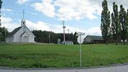
Wôlinak village | |
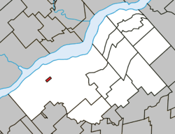 Location within Bécancour RCM. | |
 Wôlinak Location in southern Quebec. | |
| Coordinates: 46°19′N 72°25′W / 46.317°N 72.417°WCoordinates: 46°19′N 72°25′W / 46.317°N 72.417°W[1] | |
| Country |
|
| Province |
|
| Region | Centre-du-Québec |
| RCM | None |
| Constituted | unspecified |
| Government[2] | |
| • Type | Band council |
| • Federal riding |
Bas-Richelieu— Nicolet—Bécancour |
| • Prov. riding | Nicolet-Bécancour |
| Area[2][3] | |
| • Total | 0.80 km2 (0.31 sq mi) |
| • Land | 0.75 km2 (0.29 sq mi) |
| Population (2011)[3] | |
| • Total | 180 |
| • Density | 239.9/km2 (621/sq mi) |
| • Pop 2006-2011 |
|
| • Dwellings | 89 |
| Time zone | EST (UTC−5) |
| • Summer (DST) | EDT (UTC−4) |
| Area code(s) | 450 |
| Highways | No major routes |
Wôlinak is an Abenaki First Nations reserve in the Centre-du-Québec region, Quebec, Canada. An enclave within the city of Bécancour, it was one of the Seven Nations of Canada.
History
Around 1600, a few Abenaki families and Solokis familles established themselves on the Puante river (name given after a battle with the English colonists against the French colonists) which later, was given the name of Bécancour from the name of M. de Bécancour, Baron de Portneuf, who was also established there.
From 600 inhabitants in the beginning, their numbers diminished after wars and epidemics.
See also
References
External links
 |
Bécancour | | ||
| Bécancour | |
Bécancour | ||
| ||||
| | ||||
| Bécancour |
| Cities | |
|---|---|
| Municipalities | |
| Parishes | |
| |
This article is issued from Wikipedia - version of the 11/10/2016. The text is available under the Creative Commons Attribution/Share Alike but additional terms may apply for the media files.