Saint-Patrice-de-Beaurivage, Quebec
| Saint-Patrice-de-Beaurivage | |
|---|---|
| Municipality | |
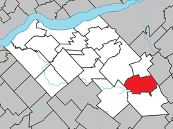 Location within Lotbinière RCM. | |
 Saint-Patrice-de-Beaurivage Location in southern Quebec. | |
| Coordinates: 46°25′N 71°14′W / 46.417°N 71.233°WCoordinates: 46°25′N 71°14′W / 46.417°N 71.233°W[1] | |
| Country |
|
| Province |
|
| Region | Chaudière-Appalaches |
| RCM | Lotbinière |
| Constituted | September 29, 1984 |
| Government[2] | |
| • Mayor | Claude Fortin |
| • Federal riding |
Lotbinière— Chutes-de-la-Chaudière |
| • Prov. riding | Lotbinière-Frontenac |
| Area[2][3] | |
| • Total | 85.50 km2 (33.01 sq mi) |
| • Land | 85.91 km2 (33.17 sq mi) |
|
There is an apparent contradiction between two authoritative sources | |
| Population (2011)[3] | |
| • Total | 1,080 |
| • Density | 12.6/km2 (33/sq mi) |
| • Pop 2006-2011 |
|
| • Dwellings | 444 |
| Time zone | EST (UTC−5) |
| • Summer (DST) | EDT (UTC−4) |
| Postal code(s) | G0S 1B0 |
| Area code(s) | 418 and 581 |
| Highways |
|
| Website |
www -de-beaurivage |
Saint-Patrice-de-Beaurivage is a municipality in the Municipalité régionale de comté de Lotbinière in Quebec, Canada. It is part of the Chaudière-Appalaches region and the population is 1,054 as of 2009. It is named after Saint Patrick, as the first settlers were Irish. Beaurivage is associated to the seigneurie of Beaurivage, also known as Saint-Gilles.
References
- Commission de toponymie du Québec
- Ministère des Affaires municipales, des Régions et de l'Occupation du territoire
 |
Saint-Gilles | Saint-Narcisse-de-Beaurivage | Saint-Bernard | |
| Sainte-Agathe-de-Lotbinière | |
|||
| ||||
| | ||||
| Saint-Sylvestre |
| Municipalities | |
|---|---|
| Parishes | |
| Villages | |
| |
This article is issued from Wikipedia - version of the 11/12/2013. The text is available under the Creative Commons Attribution/Share Alike but additional terms may apply for the media files.