Sainte-Croix, Quebec
| Sainte-Croix | |
|---|---|
| Municipality | |
 Location within Lotbinière RCM. | |
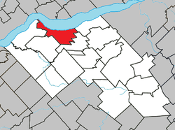
 Sainte-Croix Location in southern Quebec. | |
| Coordinates: 46°37′N 71°44′W / 46.617°N 71.733°WCoordinates: 46°37′N 71°44′W / 46.617°N 71.733°W[1] | |
| Country |
|
| Province |
|
| Region | Chaudière-Appalaches |
| RCM | Lotbinière |
| Constituted | October 5, 2001 |
| Government[2] | |
| • Mayor | Jacques Gauthier |
| • Federal riding | Lévis—Lotbinière |
| • Prov. riding | Lotbinière-Frontenac |
| Area[2][3] | |
| • Total | 72.40 km2 (27.95 sq mi) |
| • Land | 69.54 km2 (26.85 sq mi) |
| Population (2011)[3] | |
| • Total | 2,352 |
| • Density | 33.8/km2 (88/sq mi) |
| • Pop 2006-2011 |
|
| • Dwellings | 1,148 |
| Time zone | EST (UTC−5) |
| • Summer (DST) | EDT (UTC−4) |
| Postal code(s) | G0S 2H0 |
| Area code(s) | 418 and 581 |
| Highways |
|
| Website |
www sainte-croix |
Sainte-Croix is a municipality in and the seat of the Municipalité régionale de comté de Lotbinière in Quebec, Canada. It is part of the Chaudière-Appalaches region and the population is 2,433 as of 2009. The new constitution dates from 2001, after the amalgamation of the parish and the village of Sainte-Croix.
Name
Sainte-Croix name refers to the True Cross, but was in use well before its foundation in 1713. In fact, the seigneurie of Sainte-Croix was granted in 1637 to the Company of One Hundred Associates at a point named Platon Sainte-Croix (Holy Cross Flats in English), at the mouth of the Jacques-Cartier River. It had been named as such by Jacques Cartier, who had spent the winter of 1535-36 there. Samuel de Champlain explained in 1613 that there had been a mistake and this was not the place where Jacques Cartier had wintered. The point is now called Pointe Platon ("Plato (or Flat) Point").
References
- Commission de toponymie du Québec
- Ministère des Affaires municipales, des Régions et de l'Occupation du territoire
 |
Portneuf Saint Lawrence River |
Cap-Santé / Donnacona Saint Lawrence River |
| |
| Lotbinière | |
Saint-Antoine-de-Tilly | ||
| ||||
| | ||||
| Saint-Édouard-de-Lotbinière | Notre-Dame-du-Sacré-Cœur-d'Issoudun |
| Municipalities | |
|---|---|
| Parishes | |
| Villages | |
| |