Saint Andrews Parish, New Brunswick
This article is about the parish. For the town, see Saint Andrews, New Brunswick.
| Saint Andrews St. Andrews | |
|---|---|
| Parish | |
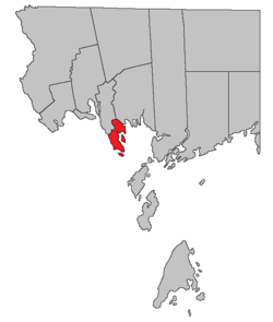 Location within Charlotte County. | |
| Country |
|
| Province |
|
| County | Charlotte County |
| Established | 1786 |
| Area[1] | |
| • Land | 24.38 km2 (9.41 sq mi) |
| Population (2011)[1] | |
| • Total | 593 |
| • Density | 24.3/km2 (63/sq mi) |
| • Pop (2006-2011) |
|
| • Dwellings | 306 |
| Time zone | AST (UTC-4) |
| • Summer (DST) | ADT (UTC-3) |
Saint Andrews is a Canadian parish in Charlotte County, New Brunswick.[2]
History
Saint Andrews Parish established in 1786: included Saint Croix Parish until 1874.
Delineation
Saint Andrews Parish is defined in the Territorial Division Act[3] as being bounded:
- North by Saint Croix Parish and a direct line from the Southeast angle of Lot Number 11 granted to James Greenlaw to the most Western angle of Lot Number 20 granted to Francis Welsh; west by the St. Croix River south by Passamaquoddy Bay, and east by the west line of lot number twenty, granted to F. Welsh, including Ministers and Navy Islands.
Communities
Parish population total does not include incorporated municipalities (in bold).
- Bar Road
- Chamcook
- Chamcook Lake
- Saint Andrews
Bodies of water & Islands
This is a list of rivers, lakes, streams, creeks, marshes and Islands that are at least partially in this parish
|
|
|
Demographics
Population
| Canada census – Saint Andrews Parish, New Brunswick community profile | |||
|---|---|---|---|
| 2011 | 2006 | 2001 | |
| Population: | 593 (+0.2% from 2006) | 592 (+7.2% from 2001) | 547 (+21.0% from 1996) |
| Land area: | 24.38 km2 (9.41 sq mi) | 24.38 km2 (9.41 sq mi) | 24.33 km2 (9.39 sq mi) |
| Population density: | 24.3/km2 (63/sq mi) | 24.3/km2 (63/sq mi) | 22.5/km2 (58/sq mi) |
| Median age: | 47.6 (M: 47.2, F: 47.9) | 42.8 (M: 42.9, F: 42.6) | 38.9 (M: 38.2, F: 40.2) |
| Total private dwellings: | 311 | 306 | 296 |
| Median household income: | $.N/A | $53,136 | $35,975 |
| Notes: 2011 income data for this area has been suppressed for data quality or confidentiality reasons. – References: 2011[1] 2006[4] 2001[5] | |||
| Historical Census Data - Saint Andrews Parish, New Brunswick[6] | |||||||||||||||||||||||||||||
|---|---|---|---|---|---|---|---|---|---|---|---|---|---|---|---|---|---|---|---|---|---|---|---|---|---|---|---|---|---|
|
|
| |||||||||||||||||||||||||||
(A) adjustment due to boundary change. | |||||||||||||||||||||||||||||
Language
| Canada Census Mother Tongue - Saint Andrews Parish, New Brunswick[6] | ||||||||||||||||||
|---|---|---|---|---|---|---|---|---|---|---|---|---|---|---|---|---|---|---|
| Census | Total | English |
French |
English & French |
Other | |||||||||||||
| Year | Responses | Count | Trend | Pop % | Count | Trend | Pop % | Count | Trend | Pop % | Count | Trend | Pop % | |||||
| 2011 |
590 |
555 | |
94.07% | 25 | |
4.24% | 0 | |
0.00% | 10 | |
1.69% | |||||
| 2006 |
0 |
545 | |
0.00% | 20 | |
0.00% | 0 | |
0.00% | 20 | |
0.00% | |||||
| 2001 |
545 |
525 | |
96.33% | 20 | |
3.67% | 0 | |
0.00% | 0 | |
0.00% | |||||
| 1996 |
460 |
450 | n/a | 97.83% | 0 | n/a | 0.00% | 0 | n/a | 0.00% | 10 | n/a | 2.17% | |||||
Access Routes
Highways and numbered routes that run through the parish, including external routes that start or finish at the parish limits:[7]
|
|
|
|
See also
References
- 1 2 3 2011 Statistics Canada Census Profile: Saint Andrews Parish, New Brunswick
- ↑ New Brunswick Provincial Archives - Saint Andrews Parish
- ↑ "Territorial Division Act (R.S.N.B. 1973, c. T-3)". Government of New Brunswick website. Retrieved 24 August 2016.
- ↑ "2006 Community Profiles". Canada 2006 Census. Statistics Canada. March 30, 2011. Retrieved 2014-03-15.
- ↑ "2001 Community Profiles". Canada 2001 Census. Statistics Canada. February 17, 2012. Retrieved 2014-03-15.
- 1 2 Statistics Canada: 1996, 2001, 2006, 2011 census
- ↑ Atlantic Canada Back Road Atlas ISBN 978-1-55368-618-7 Pages 4, 12
 |
Saint Croix Parish | Saint Patrick Parish | | |
| Bay of Fundy | |
Bay of Fundy Saint George Parish | ||
| ||||
| | ||||
| Bay of Fundy West Isles Parish |
| Subdivisions | |
|---|---|
| Cities | |
| Counties | |
| |
Coordinates: 45°07′55″N 67°04′09″W / 45.132043°N 67.069302°W
This article is issued from Wikipedia - version of the 8/26/2016. The text is available under the Creative Commons Attribution/Share Alike but additional terms may apply for the media files.