Sainte-Élisabeth, Quebec
Not to be confused with Sainte-Élizabeth-de-Warwick, Quebec (formerly spelled "Élisabeth").
| Sainte-Élisabeth | |
|---|---|
| Parish municipality | |
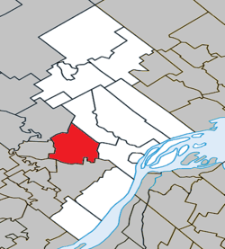 Location within D'Autray RCM. | |
 Sainte-Élisabeth Location in central Quebec. | |
| Coordinates: 46°05′N 73°21′W / 46.083°N 73.350°WCoordinates: 46°05′N 73°21′W / 46.083°N 73.350°W[1] | |
| Country |
|
| Province |
|
| Region | Lanaudière |
| RCM | D'Autray |
| Constituted | July 1, 1855 |
| Government[2] | |
| • Mayor | Mario Houle |
| • Federal riding | Berthier—Maskinongé |
| • Prov. riding | Berthier |
| Area[2][3] | |
| • Total | 83.20 km2 (32.12 sq mi) |
| • Land | 82.77 km2 (31.96 sq mi) |
| Population (2011)[3] | |
| • Total | 1,559 |
| • Density | 18.8/km2 (49/sq mi) |
| • Pop 2006-2011 |
|
| • Dwellings | 628 |
| Time zone | EST (UTC−5) |
| • Summer (DST) | EDT (UTC−4) |
| Postal code(s) | J0K 2J0 |
| Area code(s) | 450 and 579 |
| Highways |
|
| Website |
www |
Sainte-Élisabeth is a parish municipality in the Lanaudière region of Quebec, Canada, part of the D'Autray Regional County Municipality.
Demographics
Population trend:[4]
- Population in 2011: 1559 (2006 to 2011 population change: 8.3%)
- Population in 2006: 1440
- Population in 2001: 1474
- Population in 1996: 1559 (or 1564 when adjusted for 2001 boundaries)
- Population in 1991: 1508
Private dwellings occupied by usual residents: 601 (total dwellings: 628)
Mother tongue:
- English as first language: 0.75%
- French as first language: 98.5%
- English and French as first language: 0%
- Other as first language: 0.75%
See also
References
- ↑ Reference number 418078 of the Commission de toponymie du Québec (French)
- 1 2 Geographic code 52030 in the official Répertoire des municipalités (French)
- 1 2 Statistics Canada 2011 Census - Sainte-Élisabeth census profile
- ↑ Statistics Canada: 1996, 2001, 2006, 2011 census
External links
 |
Saint-Félix-de-Valois | Saint-Norbert | | |
| Notre-Dame-de-Lourdes | |
Sainte-Geneviève-de-Berthier | ||
| ||||
| | ||||
| Notre-Dame-des-Prairies | Saint-Thomas |
| Cities & Towns | |
|---|---|
| Municipalities | |
| Parishes | |
| |
This article is issued from Wikipedia - version of the 4/8/2014. The text is available under the Creative Commons Attribution/Share Alike but additional terms may apply for the media files.