Salur mandal
| Salur mandal సాలూరు మండలం | |
|---|---|
| Mandal | |
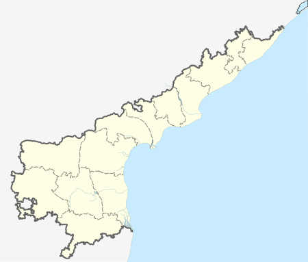
 Salur mandal Location in Andhra Pradesh, India | |
| Coordinates: 18°32′00″N 83°13′00″E / 18.5333°N 83.2167°ECoordinates: 18°32′00″N 83°13′00″E / 18.5333°N 83.2167°E | |
| Country | India |
| State | Andhra Pradesh |
| District | Vizianagaram |
| Headquarters | Salur |
| Government | |
| • Body | Mandal Parishad |
| Population (2011) | |
| • Total | 101,386 |
| Languages | |
| • Official | Telugu |
| Time zone | IST (UTC+5:30) |
Salur mandal is one of the 34 mandals in Vizianagaram district of the Indian state of Andhra Pradesh. It is administration under Parvathipuram revenue division and headquartered at Salur.[1] The mandal is bounded by Makkuva, Ramabhadrapuram, Pachipenta and Bobbili mandals. A portion of it also borders the state of Odisha.[2]
Demographics
As of 2011 census, the mandal had a population of 101,386. The total population constitute, 49,731 males and 51,655 females.[3]
Government and politics
Salur mandal is one of the four mandals in Salur (Assembly constituency), which in turn is a part of Araku (Lok Sabha constituency), one of the 25 Lok Sabha constituencies representing Andhra Pradesh.[4] The present MLA is Rajanna Dora Peedika, who won the Andhra Pradesh Legislative Assembly election, 2014 representing YSR Congress Party.[5]
Towns and villages
As of 2011 2011 census of India, the mandal has 89 settlements. It includes 1 town and 88 villages.[6]
The settlements in the mandal are listed below:
- Annamrajuvalasa
- Antivalasa
- Baguvalasa
- Bandapai
- Barnaguda
- Bhavanipuram
- Borabanda
- Butalakarrivalasa
- Chandrappavalasa
- Chemidipatipolam
- Chinavootagedda
- Chintamala
- Chora
- Dagaravalasa
- Dattivalasa
- Devubutchamma Peta
- Diguvamendangi
- Diguvasembi
- Doliyamba
- Donkalavelaga Valasa
- Dugdasagaram
- Dulibhadra
- Eduladandigam
- Gadilavalasa
- Ganjaibhadra
- Gunjari
- Gurrapuvalasa
- Guruvinayuni
- Jaggudoravalasa
- Jeegiram
- Jilleduvalasa
- Kanapalabanda
- Kandulapadam
- Karadavalasa
- Karasuvalasa
- Keerapadu
- Kodama
- Kodukarakavalasa
- Kondakaraka Valasa @ Janavarivalasa
- Kothavalasa
- Kotiya
- Kottuparuvu
- Kudakaru
- Kuddadivalasa
- Kurmarajupeta
- Kurukutti
- Laxmipuram
- Lolingabhadra
- Maipalle -
- Maripalle
- Masikachintala Valasa
- Mavudi
- Mirtivalasa
- Mokhasadandigam
- Mokhasamamidi Palle
- Mucherlavalasa
- Mudakaru
- Mudangi
- Mugadavalasa
- Mulakkayavalasa
- Narlavalasa
- Neliparti
- Nimmalapadu
- Pagulachennuru
- Panasalavalasa
- Pandirimamidi Valasa
- Parannavalasa
- Pattuchennuru
- Pedapadam
- Pedapadammutta
- Pedavalasa
- Poyimala
- Purohitunivalasa
- Salur (M)
- Sariki
- Sikhaparuva
- Sirivara
- Sivarampuram
- Solipiguda
- Surapadu @ Kanjupaka
- Teenusamantha Valasa
- Tentuboddavalasa
- Thonam
- Thunda
- Tupakivalasa
- Vallapuram
- Yeguvamendangi
- Yeguvasembi
Note: M-Municipality[7]
References
- ↑ "District Census Handbook, Vizianagaram" (PDF). Census of India. Government of India. p. 18,44,230. Retrieved 8 February 2016.
- ↑ "Mandals in Vizianagaram district". aponline.gov.in. Retrieved 8 February 2016.
- ↑ "Sub-district details". Census of India. Government of India. Retrieved 9 February 2016.
- ↑ "Delimitation of Parliamentary and Assembly Constituencies Order, 2008" (pdf). Election Commission of India. p. 22. Retrieved 20 October 2014.
- ↑ "MLA". AP State Portal. Retrieved 20 October 2014.
- ↑ "Sub-District Details of Guntur District". The Registrar General & Census Commissioner, India. Retrieved 24 May 2014.
- ↑ "Abbreviations used". censusindia.gov.in. Retrieved 26 May 2014.
 |
Narayanapatna block, Koraput district, Odisha | Makkuva mandal | Makkuva mandal |  |
| Pottangi block, Koraput district, Odisha | |
Bobbili mandal | ||
| ||||
| | ||||
| Pottangi Block, Koraput district Pachipenta mandal |
Pachipenta mandal | Ramabhadrapuram mandal |