Koraput district
| Koraput କୋରାପୁଟ | |
|---|---|
| District | |
|
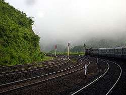
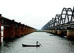
View at Laxmipur Road railway station, Koraput district | |
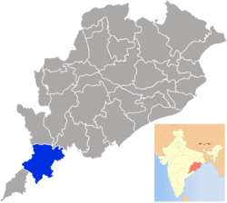 Location in Odisha, India | |
| Coordinates: 18°48′30″N 82°42′30″E / 18.8083°N 82.7083°ECoordinates: 18°48′30″N 82°42′30″E / 18.8083°N 82.7083°E | |
| Country |
|
| State | Odisha |
| Headquarters | Koraput |
| Government | |
| • Collector | Shri Jayakumar V, IAS |
| • Member of Lok Sabha | Jhina Hikaka, BJD |
| Area | |
| • Total | 8,379 km2 (3,235 sq mi) |
| Population (2011) | |
| • Total | 1,376,934 |
| • Density | 140.58/km2 (364.1/sq mi) |
| Languages | |
| • Official | Odia, English |
| Time zone | IST (UTC+5:30) |
| PIN | 764 020 |
| Vehicle registration | OD-10 |
| Sex ratio | 1.038 ♂/♀ |
| Literacy | 49.21% |
| Lok Sabha constituency | Koraput |
| Vidhan Sabha constituency | 5 |
| Climate | Aw (Köppen) |
| Precipitation | 1,522 millimetres (59.9 in) |
| Avg. summer temperature | 38 °C (100 °F) |
| Avg. winter temperature | 12 °C (54 °F) |
| Website |
www |
Koraput is a district of Odisha, India, and known for rich and diverse types of mineral deposits. It is located along the Eastern Ghats.
History
Koraput district was ruled by several dynasties such as Satavahanas, Ikshvakus, Nalas, Ganga kings and kings of Surya vansha. In ancient times when the Nalas ruled this tract with Pushkari near modern Umarkote was their capital city. In the medieval period[1][2][3] Nandapur developed as the capital under the Silavamsi kings and after them under the kings of the solar dynasty.[2] Viravikrama Deo of the solar dynasty shifted his capital to Jeypore about the middle of the 17th century and developed into a prospered town.[2]
Koraput came under the French possession in 1753 A.D. At that time the French General was Bussy, who obtained it from Nizam. Anand Raju, the Raja of Vijayanagarm invited the English to expel the French from the Sarkar. On 1st Dec, 1758 A.D., at Rajahmundry a decisive battle took place where the French were defeated. The Raja of Jeypore Ramachandra Deo (1781-1825 A.D.)was granted a permanent Sanand by the British. With the march of time, Jeypore Estate was administered directly by the British under the Act XXVI of 1839.[1][3]
It was a part of the erstwhile Madras Presidency and became a district of Odisha state on 1 April 1936 . In October, 1992, erstwhile Koraput district was divided, resulting in the creation of Malkangiri, Rayagada and Nabarangpur district along with present Koraput district.
It is currently a part of the Red Corridor.[4]
Etymology
The district of Koraput derives its name from its headquarters, the present town of Koraput. According to Mr. R.C.S. Bell, the name of the town is ‘Kora-Putti’ or “the hamlet of the “Nux-vomica” and it is derived presumably from Kora that must at one time have been prominent near the site.[1]
Some opine that the word is derived from KHORA a sect of people who still inhabit nearby villages. According to the second theory, Koraput is a corrupted form of ‘Karaka-Pentho’. Karaka literally means ‘hail-stone’.
Another opinion is often found that the term Kora that means the Sun God who was worshipped by the local tribals in ancient times. Hence the town was so named.
It is also believed that one ‘Khora Naiko’ laid foundation of the village during the time of Nandapur kings. He hailed probably from Ranpur and served under the Nandapur kings in the Militia, and for his faithful and meritorious services he was permitted to establish this village which was named after him as Khora Putu, and later on the name has been abbreviated to ‘Koraput[1]’.
Geography
The erstwhile undivided district of Koraput has been divided into four districts – Koraput, Rayagada, Malkangiri and Nowrangapur in 1992. So the present Koraput district is located between 18 degree 13’ and 19 degree 10’ North Latitudes and 82 degree 5’ and 83 degree 23’ East Longitudes. On the extreme North it is bounded by Nabarangpur district, on the West by Bastar district of Chhattisgarh State, on the South by the district of Malkangiri and on the East by the districts of Vizianagaram and Srikakulam of Andhra Pradesh State. Its area is 8,807 km2.
Koraput comes under Eastern Ghat Highland Agro climatic Zone. Most part of the Koraput district is undulated and many parts of Jeypore Sub-Division are plain lands. Climatic condition of the district is warm and humid. Average annual rainfall of the district is 1567 mm. Mean Maximum summer temperature is 34.1 C and Mean Minimum Winter temperature is 10.4 C.
1672 m high Deomali, the tallest mountain in Odisha, is located in Koraput district.[5]
Major Towns
Administration
Koraput district is divided into 2 sub-divisions and 14 blocks. The 2 sub-divisions are Koraput and Jeypore Blocks in Koraput sub-division 1. Koraput 2. Semiliguda 3. Nandapur 4. Pottangi 5. Dasmanthpur 6. Lamtaput 7. Laxmipur 8. Narayanapatna 9. Bandugaon Blocks in Jeypore sub-division 1. Jeypore 2. Boipariguda 3. Kotpad 4. Kundra 5. Boriguma
Culture
PARAB(tribal culture and dance festival)
Places Of Interest
People
Koraput is an Adivasi district, known for high concentration of Adivasi communities (tribes). As many as 51 are found in undivided Koraput district. These tribals have been grouped into three major classes[3]
- Dravidian race represented by Kondh. Poraja, Gond and Koya, forming the major part of the population.
- Munda or Kolarian race Which includes Savara and Gadaba
- Austro-Asian race: the Bondas,one of the most primitive tribes.
Apart from these three, there are many others like Omanatya and Bhumia, whose origin is not clearly known.Each community has its own language, hailed as a great repository of ecological knowledge. These communities have been practicing their own indigenous religions, but are termed as 'Hindus' by the constitution of India. This paves the way for their assimilation into the 'Hindu Mainstream'. Adivasi religion thus faces an onslaught from both Hinduism as well as evangelical Christianity.
Economy
In 2006 the Ministry of Panchayati Raj named Koraput one of the country's 250 most backward districts (out of a total of 640).[6] It is one of the 19 districts in Odisha currently receiving funds from the Backward Regions Grant Fund Programme (BRGF).[6]
Agriculture
The district economy mainly depends on agriculture and which mainly depends on rainfall. The rainfall depends on South-West monsoon. Out of total cropping area of 296000ha in Koraput, irrigation potential in Kharif is 30.71% and in Rabi is 21.51%. Generally crops grown during Rabi like Paddy, Wheat, Maize, Ragi, Mung, Biri, Groundnut, Mustard, Field Pea, Sunflower etc. needs assured irrigation.[1]
Jeypore tract of the Koraput district is known as one of the centres of origin of rice. The people of Koraput district, notably the adivasis have generated and conserved many indigenous cultivars of rice that are suitable for both dryland and wetland cultivation. The Food and Agricultural Organisation (FAO) in 2012 recognised the service of the communities of Koraput in ensuring food security by declaring the Koraput district as a Global Agricultural Heritage Site
Major Industries
There are only five Large Scale industries located in the district manufacturing & Processing Alumina, Paper, Cement, Aeronautical Engine & hydro electricity. The general pattern of non-agricultural employment, however, leans heavily towards small-scale and household industries
- Hindustan Aeronautics Limited(HAL) - Sunabeda
- NALCO-Damanjodi
- BILT PAPERMILL-Jeypore
- Kolab Hydroelectric Power Station
- Macha kunda Hydroelectric power station-Under Lamptaput Block
Minerals
The principal economic mineral deposits of Koraput district are Limestone & Bauxite, besides this, occurrence of China clay, Nepheline Synite, Gold, Black & Multi colored rocks named as Decorative Stone are also found in this district.[1] The principal mines in the district are
- Panchpatmali Bauxite Mines of M/s. National Aluminum & Co. Ltd.
- Maliparbat Bauxite Mines of M/s. Hindalco Industries Ltd.,
- Ampavally Limestone Mines of M/s. Odisha Mining Corporation Ltd. and M/s. Industrial Development Corporation of Odisha Ltd.
Demographics
According to the 2011 census Koraput district has a population of 1,376,934,[7] roughly equal to the nation of Swaziland[8] or the US state of Hawaii.[9] This gives it a ranking of 356th in India (out of a total of 640).[7] The district has a population density of 156 inhabitants per square kilometre (400/sq mi) .[7] Its population growth rate over the decade 2001-2011 was 16.63%.[7] Koraput has a sex ratio of 1031 females for every 1000 males,[7] and a literacy rate of 49.21%.[7]
Languages
As regards the tribal dialects of Koraput district in Orissa it may be noted that no proper survey has ever been made. But attempts have been made by different individuals to make a study of the various tribal language of the district.
The percentage of people speaking tribal language in Koraput district has reduced from 37 percent in 1931 census to 22.86 percent in 1971 census. Thus, a large number of tribals of the district have adopted non-tribal languages during the past four decades. Most of the people speak Desia Oriya, but the manner and the accent with which tills is spoken in Koraput is very different from other parts of Orissa. Most aborigine tribals have their own dialects. The intermixing of Telugu and Oriya is spoken in Jeypore sub division. Since some Telugu speaking people from Srikakulum and Vijayanagar areas have migrated to these areas centauries back and other come for business. Languages include Bhatri, which falls within the Odia language group but only shares about 60% lexical similarity with Oriya, spoken by about 600 000;[10] and Bhunjia, spoken by approximately 7000 Bhunjia Adivasis.[11]
Naxalism
Naxalism is a serious matter of concern in south Odisha, including Koraput district, since around 2000. Earlier, the naxalite activities were confined to districts such as Malkangiri, which share its borders with the neighboring states. With time, the naxal activities has spread to Koraput as well as other districts like Rayagada or Nabarangpur. The inaccessible hilly terrain, dense forests, lack of development, grievances of the tribals and poor, and the absence of administration have been conducive to the spread of left-wing extremism in Odisha. The seriousness of the problem was underlined by a co-ordinated Naxalite attack on the District Headquarters and armoury at Koraput on February 6, 2004.[12]
Naxal group, namely People's War Group (PWG), has carried out numerous operations (attacks on rich farmers, police, bureaucrats and politicians, loots from godowns) within last few years in Koraput as well as in its neighboring districts.[13]
Transport
Koraput railway station is a junction station on Kirandul-Visakhapatnam railway line that branches towards Rayagada railway station on the other side. many trains like Kirandul Vskp passenger, Jagdalpur-Howrah, Jagdalpur-Bhubaneswar Hirakhand Exp halt for 10–25 minutes at Koraput. Other main railheads include Jeypore, Kotpad Road Station, Damanjodi, and Lakshmipur Road. Koraput District is served by NH-26, from Raipur to Visakhapatnam. One can go to nearby Malkangiri through Jeypore Road.
Politics
Vidhan sabha constituencies
The following is the 5 Vidhan sabha constituencies[14][15] of Koraput district and the elected members[16] of that area
| No. | Constituency | Reservation | Extent of the Assembly Constituency (Blocks) | Member of 14th Assembly | Party |
|---|---|---|---|---|---|
| 141 | Lakshmipur | ST | Lakshmipur, Dasamanthapur, Bandhugaon, Narayanpatana | Mr. Kailash Chandra Kulesika | INC |
| 142 | Kotpad | ST | Kotpad (NAC), Kotpad, Kundra, Borigumma (part), Boipariguda (part) | INC | |
| 143 | Jeypore | None | Jeypore (M), Jeypore, Borigumma (part) | Mr. Tara Prasad Bahinipati | INC |
| 144 | Koraput | SC | Koraput (NAC), Sunabeda (NAC), Lamptaput, Koraput(PART), Boipariguda (part) | Mr. Krushna Chandra Sagaria | INC |
| 145 | Pottangi | ST | Pottangi, Semiliguda, Nandapur, Koraput (part) | Mr. Prafulla Kumar Pangi | BJD |
References
- 1 2 3 4 5 6 "Home: District Portal of , Odisha, India". www.ordistricts.nic.in. Retrieved 2016-09-11.
- 1 2 3 "Gazetteer | Odisha State Archive". www.odishaarchives.nic.in. Retrieved 2016-09-11.
- 1 2 3 "Gazetteer | Gopabandhu Academy Of Administration". gopabandhuacademy.gov.in. Retrieved 2016-09-11.
- ↑ "83 districts under the Security Related Expenditure Scheme". IntelliBriefs. 2009-12-11. Retrieved 2011-09-17.
- ↑ The Imperial Gazetteer of India, v. 17, p. 74
- 1 2 Ministry of Panchayati Raj (September 8, 2009). "A Note on the Backward Regions Grant Fund Programme" (PDF). National Institute of Rural Development. Retrieved September 27, 2011.
- 1 2 3 4 5 6 "District Census 2011". Census2011.co.in. 2011. Retrieved 2011-09-30.
- ↑ US Directorate of Intelligence. "Country Comparison:Population". Retrieved 2011-10-01.
Swaziland 1,370,424
- ↑ "2010 Resident Population Data". U. S. Census Bureau. Archived from the original on October 19, 2013. Retrieved 2011-09-30.
Hawaii 1,360,301
- ↑ M. Paul Lewis, ed. (2009). "Bhatri: A language of India". Ethnologue: Languages of the World (16th ed.). Dallas, Texas: SIL International. Retrieved 2011-09-28.
- ↑ M. Paul Lewis, ed. (2009). "Bhunjia: A language of India". Ethnologue: Languages of the World (16th ed.). Dallas, Texas: SIL International. Retrieved 2011-09-30.
- ↑ "Maoists in Orissa Growing Tentacles and a Dormant State".
- ↑ "Naxalite Consolidation In Orissa".
- ↑ Assembly Constituencies and their EXtent
- ↑ Seats of Odisha
- ↑ "List of Member in Fourteenth Assembly". ws.ori.nic.in. Retrieved 19 February 2013.
MEMBER NAME
Bibliography
Berger, Peter (2002). The Gadaba and the 'non-ST' Desia of Koraput, Orissa. Article
Burrow, T. and S. Bhattacharya (1961). Some notes on the Kui dialect as spoken by the Kuttia Kandhas of North-east Koraput. Indo-Iranian Journal. 5 (2): 118-135
Franco, Merlin F. and D. Narasimhan (2012). Ethnobotany of Kondh, Poraja, Gadaba and Bonda of the Koraput region of Orissa, India. D.K. Printworld. ISBN 978-81-246-0619-3
Franco, Merlin F and D. Narasimhan (2009). Plant names and uses as indicators of knowledge patterns. Indian Journal of Traditional Knowledge. 8: 645-648 Article
Franco, Merlin F., D. Narasimhan and W. Stanley (2009). Relationship between Four Tribal Communities and their Natural Resources in the Koraput Region. Ethnobotany Research & Applications 6: 481-485
Franco, Merlin F and D. Narasimhan (2008). Ecological elements in the songs of the Poraja and the ancient Tamils. Indian Journal of Eco-criticism 1, 49-54
Thusu, Kidar Nath and Jha, Makhan (1972). Ollar Gadba of Koraput. Anthropological Survey of India, Kolkata
Thusu, Kidar Nath (1977). Pengo Parajas of Koraput. Anthropological Survey of India, Kolkata
External links
-
 Koraput travel guide from Wikivoyage
 - Road Map of Koraput District
- Official website

| Governance |
|  |
|---|---|---|
| Topics | ||
| GI Products | ||
| Districts | ||
| Cities | ||
| Rivers |
|    | |||||||||||||||||||||||||
|---|---|---|---|---|---|---|---|---|---|---|---|---|---|---|---|---|---|---|---|---|---|---|---|---|---|---|---|
| Dams, barrages | |||||||||||||||||||||||||||
| Geographical features / regions | |||||||||||||||||||||||||||
| Riparian districts |
| ||||||||||||||||||||||||||
| Cities | |||||||||||||||||||||||||||
| Languages / people | |||||||||||||||||||||||||||
| Coalfields | |||||||||||||||||||||||||||
| Oil / gas fields | |||||||||||||||||||||||||||
| Industries |
| ||||||||||||||||||||||||||
| Transport | |||||||||||||||||||||||||||
| Related topics | |||||||||||||||||||||||||||
| Other basins | |||||||||||||||||||||||||||