San Francisco de los Romo
| San Francisco de los Romo | |
|---|---|
| City | |
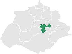 Municipality location in Aguascalientes | |
|
San Francisco de los Romo Location in Mexico | |
| Coordinates: 22°05′N 102°16′W / 22.083°N 102.267°WCoordinates: 22°05′N 102°16′W / 22.083°N 102.267°W | |
| Country |
|
| State | Aguascalientes |
| Municipality | San Francisco de los Romo |
| Population (2005) | |
| • Total | 16,124 |
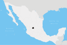
San Francisco de los Romo is a city in the Mexican state of Aguascalientes. It serves as the municipal seat for the surrounding municipality of San Francisco de los Romo.
San Francisco de los Romo stands at 22°05′N 102°16′W / 22.083°N 102.267°W in the central part of the state. The town, which is the state's sixth-largest community, is located at the northwest corner of the municipality.
Demographics
As of 2010, the city had a total population of 16,124.[1]
Climate
| Climate data for San Francisco de los Romo (1951–2010) | |||||||||||||
|---|---|---|---|---|---|---|---|---|---|---|---|---|---|
| Month | Jan | Feb | Mar | Apr | May | Jun | Jul | Aug | Sep | Oct | Nov | Dec | Year |
| Record high °C (°F) | 35.0 (95) |
37.0 (98.6) |
39.0 (102.2) |
43.0 (109.4) |
44.0 (111.2) |
42.0 (107.6) |
40.0 (104) |
39.0 (102.2) |
38.0 (100.4) |
39.0 (102.2) |
34.0 (93.2) |
38.0 (100.4) |
44.0 (111.2) |
| Average high °C (°F) | 22.9 (73.2) |
24.7 (76.5) |
28.2 (82.8) |
30.9 (87.6) |
32.6 (90.7) |
31.4 (88.5) |
28.9 (84) |
29.0 (84.2) |
27.7 (81.9) |
26.4 (79.5) |
24.7 (76.5) |
22.5 (72.5) |
27.5 (81.5) |
| Daily mean °C (°F) | 12.7 (54.9) |
13.9 (57) |
16.8 (62.2) |
19.6 (67.3) |
21.8 (71.2) |
22.5 (72.5) |
21.1 (70) |
20.9 (69.6) |
19.9 (67.8) |
17.5 (63.5) |
14.8 (58.6) |
13.1 (55.6) |
17.9 (64.2) |
| Average low °C (°F) | 2.5 (36.5) |
3.1 (37.6) |
5.3 (41.5) |
8.2 (46.8) |
11.1 (52) |
13.6 (56.5) |
13.2 (55.8) |
12.9 (55.2) |
12.1 (53.8) |
8.5 (47.3) |
4.8 (40.6) |
3.7 (38.7) |
8.3 (46.9) |
| Record low °C (°F) | −8.0 (17.6) |
−6.2 (20.8) |
−6.2 (20.8) |
−0.8 (30.6) |
0.0 (32) |
5.0 (41) |
5.0 (41) |
5.4 (41.7) |
2.0 (35.6) |
−4.1 (24.6) |
−4.2 (24.4) |
−6.0 (21.2) |
−8.0 (17.6) |
| Average precipitation mm (inches) | 15.5 (0.61) |
8.6 (0.339) |
7.3 (0.287) |
10.7 (0.421) |
19.5 (0.768) |
72.5 (2.854) |
94.5 (3.72) |
98.0 (3.858) |
87.1 (3.429) |
31.5 (1.24) |
12.6 (0.496) |
15.2 (0.598) |
473.0 (18.622) |
| Average precipitation days (≥ 0.1 mm) | 2.2 | 1.3 | 0.8 | 1.5 | 3.0 | 7.8 | 10.2 | 10.5 | 8.9 | 4.9 | 1.6 | 2.2 | 54.9 |
| Source: Servicio Meteorologico Nacional[2][3] | |||||||||||||
References
- Link to tables of population data from Census of 2005 Instituto Nacional de Estadística, Geografía e Informática (INEGI)
- Aguascalientes Enciclopedia de los Municipios de México
- ↑ "San Francisco de los Romo". Catálogo de Localidades. Secretaría de Desarrollo Social (SEDESOL). Retrieved 23 April 2014.
- ↑ "Estado de Aguascalientes-Estacion: San Francisco de los Romo (SMN)". Normales Climatologicas 1951–2010 (in Spanish). Servicio Meteorologico Nacional. Retrieved 8 May 2015.
- ↑ "Extreme Temperatures and Precipitation for San Francisco de los Romo (SMN) 1927–1983" (in Spanish). Servicio Meteorológico Nacional. Retrieved 8 May 2015.
External links
- Ayuntamiento de San Francisco de los Romo Official website
- Gobierno del Estado de Aguascalientes Official website of State of Aguascalientes
This article is issued from Wikipedia - version of the 3/5/2016. The text is available under the Creative Commons Attribution/Share Alike but additional terms may apply for the media files.