Sand Creek Township, Bartholomew County, Indiana
| Sand Creek Township | |
|---|---|
| Township | |
|
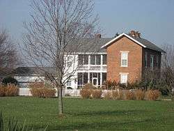
The William R. Gant Farmhouse, a historic site in the township | |
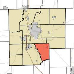 Location in Bartholomew County | |
| Coordinates: 39°07′17″N 85°50′28″W / 39.12139°N 85.84111°WCoordinates: 39°07′17″N 85°50′28″W / 39.12139°N 85.84111°W | |
| Country | United States |
| State | Indiana |
| County | Bartholomew |
| Government | |
| • Type | Indiana township |
| Area | |
| • Total | 26.49 sq mi (68.6 km2) |
| • Land | 26.21 sq mi (67.9 km2) |
| • Water | 0.27 sq mi (0.7 km2) 1.02% |
| Elevation | 630 ft (192 m) |
| Population (2010) | |
| • Total | 2,390 |
| • Density | 91.2/sq mi (35.2/km2) |
| ZIP codes | 47201, 47203, 47232 |
| GNIS feature ID | 0453831 |
Sand Creek Township is one of twelve townships in Bartholomew County, Indiana, United States. As of the 2010 census, its population was 2,390 and it contained 919 housing units.[1]
History
The Elnora Daugherty Farm, William R. Gant Farm, and Newsom-Marr Farm are listed on the National Register of Historic Places.[2]
Geography
According to the 2010 census, the township has a total area of 26.49 square miles (68.6 km2), of which 26.21 square miles (67.9 km2) (or 98.94%) is land and 0.27 square miles (0.70 km2) (or 1.02%) is water.[1]
Cities, towns, villages
Unincorporated towns
Adjacent townships
- Rock Creek Township (northeast)
- Geneva Township, Jennings County (east)
- Redding Township, Jackson County (south)
- Wayne Township (west)
- Columbus Township (northwest)
Cemeteries
The township contains these three cemeteries: New Harmony, Sandcreek and Springer.
Major highways
School districts
- Bartholomew County School Corporation
Political districts
- Indiana's 9th congressional district
- State House District 57
- State House District 65
- State Senate District 41
References
- United States Census Bureau 2007 TIGER/Line Shapefiles
- United States Board on Geographic Names (GNIS)
- United States National Atlas
- 1 2 "Population, Housing Units, Area, and Density: 2010 - County -- County Subdivision and Place -- 2010 Census Summary File 1". United States Census. Retrieved 2013-05-10.
- ↑ National Park Service (2010-07-09). "National Register Information System". National Register of Historic Places. National Park Service.
External links
Municipalities and communities of Bartholomew County, Indiana, United States | ||
|---|---|---|
| City | ||
| Towns | ||
| Townships | ||
| CDP | ||
| Other unincorporated communities |
| |
| Footnotes | ‡This populated place also has portions in an adjacent county or counties | |
This article is issued from Wikipedia - version of the 7/23/2016. The text is available under the Creative Commons Attribution/Share Alike but additional terms may apply for the media files.