Sant'Ambrogio sul Garigliano
| Sant'Ambrogio sul Garigliano | ||
|---|---|---|
| Comune | ||
| Comune di Sant'Ambrogio sul Garigliano | ||
 | ||
| ||
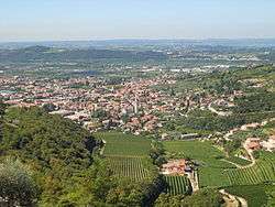
 Sant'Ambrogio sul Garigliano Location of Sant'Ambrogio sul Garigliano in Italy | ||
| Coordinates: 41°23′N 13°52′E / 41.383°N 13.867°E | ||
| Country | Italy | |
| Region | Lazio | |
| Province / Metropolitan city | Frosinone (FR) | |
| Government | ||
| • Mayor | Sergio Messore | |
| Area | ||
| • Total | 9.0 km2 (3.5 sq mi) | |
| Elevation | 137 m (449 ft) | |
| Population (31 December 2010[1]) | ||
| • Total | 976 | |
| • Density | 110/km2 (280/sq mi) | |
| Demonym(s) | Ambrosiani | |
| Time zone | CET (UTC+1) | |
| • Summer (DST) | CEST (UTC+2) | |
| Postal code | 03040 | |
| Dialing code | 0776 | |
| Website | Official website | |

Sant'Ambrogio sul Garigliano is a comune (municipality) in the Province of Frosinone in the Italian region Lazio, located about 130 kilometres (81 miles) southeast of Rome and about 50 km (31 mi) southeast of Frosinone.
Sant'Ambrogio sul Garigliano borders the following municipalities: Rocca d'Evandro, Sant'Andrea del Garigliano, Sant'Apollinare. During World War II, due to its position across the Gustav Line, it was mostly destroyed.
Twin towns
 Sant'Ambrogio di Torino, since 2004
- Sant'Ambrogio di Valpolicella, since 2004
References
External links
This article is issued from Wikipedia - version of the 1/29/2016. The text is available under the Creative Commons Attribution/Share Alike but additional terms may apply for the media files.