Santoña
| Santoña | |||
|---|---|---|---|
| Municipality | |||
|
Santoña | |||
| |||
_Mapa.svg.png) Location of Santoña | |||
 Santoña Location in Spain | |||
| Coordinates: 43°26′29″N 3°27′27″W / 43.44139°N 3.45750°WCoordinates: 43°26′29″N 3°27′27″W / 43.44139°N 3.45750°W | |||
| Country |
| ||
| Autonomous community |
| ||
| Province | Cantabria | ||
| Comarca | Trasmiera | ||
| Judicial district | Santoña | ||
| Capital | Santoña | ||
| Government | |||
| • Alcaldesa | María Puerto Gallego Arriola (2007) (PSC-PSOE) | ||
| Area | |||
| • Total | 11.53 km2 (4.45 sq mi) | ||
| Elevation | 7 m (23 ft) | ||
| Highest elevation | 315 m (1,033 ft) | ||
| Lowest elevation | 0 m (0 ft) | ||
| Population (2008) | |||
| • Total | 11,601 | ||
| • Density | 1,000/km2 (2,600/sq mi) | ||
| Demonym(s) | santoñés/a | ||
| Time zone | CET (UTC+1) | ||
| • Summer (DST) | CEST (UTC+2) | ||
| Postal code | 39740 | ||
| Official language(s) | Spanish | ||
| Website | Official website | ||
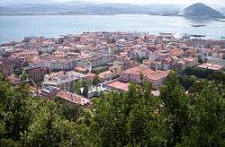
Santoña is a town in the eastern coast of the autonomous community of Cantabria, on the north coast of Spain. It is situated by the bay of the same name. It is 45 kilometres (28 mi) from the capital Santander. Santoña is divided into two zones, an urban plain, and a mountainous area, with Mount Buciero at its eastern limit, and Brusco and the beach of Berria to the north. The beach of San Martin comprises its south limit and the fishing harbor and marsh area its western limit.
Population centres
- Santoña, the main town, where most of the population lives.
- Dueso, 174 inhabitants in 2008.[1] Location of the Penal de El Dueso prison.
- Piedrahíta, 173 inhabitants in 2008.[1]
Notable People
- Juan de la Cosa (1460-1509), cartographer, conquistador, and explorer
Trivia
The song "Santonian shores" of the band Eluveitie is about this region. [2]
References
- 1 2 Instituto Nacional de Estadística
- ↑ It has to be for it is about Celts sailing 'off to the Santonian shores' and the region is named that way since celtic times (https://es.wikipedia.org/wiki/Santo%C3%B1a#El_top.C3.B3nimo).
External links
- Ayuntamiento de Santoña
- Santoña - Cantabria 102 Municipios
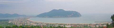
View of Laredo and Santoña bay from San Miguel de Seña.
Gallery
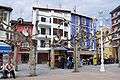 Plaza de San Antonio
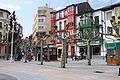 San Felipe street
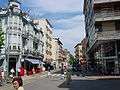 Manzanedo street
 Santa María del Puerto, 13th century.
 Manzanedo Secondary School
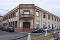 Former Albo cannery
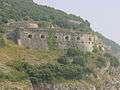 Fort San Carlos
 Fort San Martín
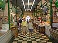 Plaza de abastos (food market)
 Marina
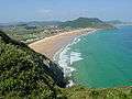 Berria beach
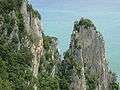 El Fraile peak
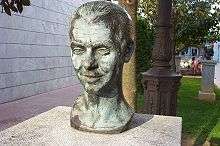 Bust of Federico García Lorca
This article is issued from Wikipedia - version of the 11/26/2016. The text is available under the Creative Commons Attribution/Share Alike but additional terms may apply for the media files.