Sarmera
| Sarmera सरमेरा | |
|---|---|
| town | |
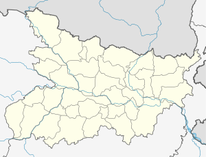 Sarmera Location in Bihar, India | |
| Coordinates: 25°17′49″N 85°48′39″E / 25.29682°N 85.81082°ECoordinates: 25°17′49″N 85°48′39″E / 25.29682°N 85.81082°E | |
| Country |
|
| State | Bihar |
| Region | Magadh |
| District | Nalanda |
| Government | |
| • Shri. | Kaushlendra kumar (MP), Jitendra Kumar (MLA, Asthawan (171)) |
| Elevation | 42 m (138 ft) |
| Population (2001) | |
| • Total | 96,441 |
| Languages | |
| • Official | Hindi, Magadhi, English |
| Time zone | IST (UTC+5:30) |
| PIN | 811104 |
| Telephone code | 916132 |
| Vehicle registration | BR |
| Sex ratio | 1000/892 ♂/♀ |
| Literacy | 53.64% |
| Lok Sabha constituency | Nalanda |
| Vidhan Sabha constituency | Ashthama(171) |
| Climate | ETh (Köppen) |
| Precipitation | 1,020 millimetres (40 in) |
| Website |
nalanda |
Sarmera is a town and a block in Nalanda district in the Indian state of Bihar. It is located 110 KM east of Patna and is on the National Highway NH82 (linking Gaya to Mokameh and passes through Bihar Sharif) and State Highway SH78 (Bihta - Sarmera) connecting it to major cities in Bihar. Sarmera is a block in Nalanda district of Bihar, India and has nine panchayats namely Malawan, Kenar, Dhanuki, Mirnagar, Husaina, Sarmera, Chero, Sasaur and Isua. Major habitated villages in Sarmera are Gopalbad, Pojh, Chero, Parnawa, Isua, Bari Malawan, Choti Malawan, Kenar, Rupaspur, Sasaur, Husiana.
Geography
Sarmera is situated on 10 km from the southern banks of the Ganges. The landscape is predominately plain and the land strip along the north of Ganges is called Tal, which is the flood plain of river Ganges and submerges during monsoons.
History
The recorded history of Sarmera dates back to Akbar's reign when the area was known as Gayaspur Pargana and was assigned as a mansab by him to the dhaulani brahmins from kannauj. Those people migrated to the region and reigned till independence when the estate was annexed by the Indian Union.
Economy
The main occupation is agriculture and agriculture related commercial activities. However there are significant numbers of brick kilns along the road passing to this town. Main crops are lentils, chickpeas, mustard, rice and vegetables. Recently Sarmera is developing as a market and a trading place, however Barbigha still remains the major market of this region.
Transport
Sarmera is connected to all the major cities of Bihar by road. However the neighbouring areas lacked any kind of road until recently.
Demographics
As of 2001 India census,[1] Sarmera had a population of 16,441. Males constitute 53% of the population and females 47%. Sarmera block which constitutues 9 panchayats has a 'population' of 78610.[2] Sarmera has a literacy rate of 53.64%, lower than the national average of 69.5%: male literacy is 69%, and female literacy is '39%'.[3]
People and Culture
Most people speak Magadhi here, a dialect called Magahi locally. However, it changes considerably across a couple of Kilometres. Families are very traditional, and often large. However, as people are getting education, they are becoming liberal. Marriages are generally arranged and they involve a large sum of dowry, although illegal. Bride and groom meet only after marriage. Caste system is ingrained in the social fabric of the place in the same way as it exists in other parts of Bihar. Consequently caste based politics plays an important role in the life of the people here. The continuously diminishing infrastructure and unemployment have forced the people to migrate to other parts of India for better opportunities. The common attire of the people includes dhoti, kurta and gamchha, a large rectangular cotton cloth on their shoulders or tied round heads. Women dress in sarees. The most awaited and widely celebrated festival is Chhath, a festival where people worship the setting and the rising Sun in the month of October/November.
References
- ↑ "Census of India 2001: Data from the 2001 Census, including cities, villages and towns (Provisional)". Census Commission of India. Archived from the original on 2004-06-16. Retrieved 2008-11-01.
- ↑ , Vision of Nalanda.
- ↑ , Bihar Statistics.