Scotland Neck, North Carolina
| Scotland Neck, North Carolina | ||
|---|---|---|
| Town | ||
| ||
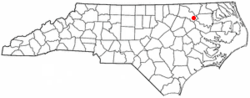 Location of Scotland Neck, North Carolina | ||
| Coordinates: 36°7′50″N 77°25′15″W / 36.13056°N 77.42083°WCoordinates: 36°7′50″N 77°25′15″W / 36.13056°N 77.42083°W | ||
| Country | United States | |
| State | North Carolina | |
| County | Halifax | |
| Area | ||
| • Total | 1.2 sq mi (3.2 km2) | |
| • Land | 1.2 sq mi (3.2 km2) | |
| • Water | 0.0 sq mi (0.0 km2) | |
| Elevation | 98 ft (30 m) | |
| Population (2010) | ||
| • Total | 2,059 | |
| • Density | 1,935.1/sq mi (747.1/km2) | |
| Time zone | Eastern (EST) (UTC-5) | |
| • Summer (DST) | EDT (UTC-4) | |
| ZIP code | 27874 | |
| Area code(s) | 252 | |
| FIPS code | 37-59780[1] | |
| GNIS feature ID | 0994423[2] | |
| Website | www.townofscotlandneck.com | |
Scotland Neck is a town in Halifax County, North Carolina, in the United States. At the 2010 census, the town population was 2,059. It is part of the Roanoke Rapids, North Carolina Micropolitan Statistical Area.
History
The Hoffman-Bowers-Josey-Riddick House, Kehukee Primitive Baptist Church, Magnolia, Scotland Neck Historic District, Trinity Church, and Woodstock are listed on the National Register of Historic Places.[3]
Geography

Scotland Neck is located at 36°7′50″N 77°25′15″W / 36.13056°N 77.42083°W (36.130441, -77.420963).[4]
According to the United States Census Bureau, the town has a total area of 1.2 square miles (3.1 km2), all of it land.
Demographics
| Historical population | |||
|---|---|---|---|
| Census | Pop. | %± | |
| 1880 | 482 | — | |
| 1890 | 778 | 61.4% | |
| 1900 | 1,348 | 73.3% | |
| 1910 | 1,726 | 28.0% | |
| 1920 | 2,061 | 19.4% | |
| 1930 | 2,339 | 13.5% | |
| 1940 | 2,559 | 9.4% | |
| 1950 | 2,730 | 6.7% | |
| 1960 | 2,974 | 8.9% | |
| 1970 | 2,869 | −3.5% | |
| 1980 | 2,834 | −1.2% | |
| 1990 | 2,575 | −9.1% | |
| 2000 | 2,362 | −8.3% | |
| 2010 | 2,059 | −12.8% | |
| Est. 2015 | 1,965 | [5] | −4.6% |
At the census[1] of 2000, there were 2,362 people, 987 households, and 611 families residing in the town. The population density was 1,935.1 people per square mile (747.5/km²). There were 1,097 housing units at an average density of 898.7 per square mile (347.2/km²). The racial makeup of the town was 29.85% White, 68.04% African American, 0.17% Native American, 1.10% from other races, and 0.85% from two or more races. Hispanic or Latino of any race were 2.07% of the population.
There were 987 households out of which 24.7% had children under the age of 18 living with them, 31.4% were married couples living together, 24.4% had a female householder with no husband present, and 38.0% were non-families. 35.9% of all households were made up of individuals and 17.9% had someone living alone who was 65 years of age or older. The average household size was 2.39 and the average family size was 3.11.
In the town the population was spread out with 27.1% under the age of 18, 8.1% from 18 to 24, 23.3% from 25 to 44, 21.7% from 45 to 64, and 19.8% who were 65 years of age or older. The median age was 39 years. For every 100 females there were 81.1 males. For every 100 females age 18 and over, there were 71.6 males.
The median income for a household in the town was $21,094, and the median income for a family was $27,115. Males had a median income of $24,519 versus $17,328 for females. The per capita income for the town was $12,982. About 24.4% of families and 31.9% of the population were below the poverty line, including 42.8% of those under age 18 and 28.2% of those age 65 or over.
Scotland Neck recruited and self supplied an independent volunteer company, 'the Scotland Neck Mounted Riflemen' in 1859. At the opening of the Civil War in 1861, the company was mustered into the Army of the Confederate States, as Company G, 3rd North Carolina Cavalry, 41st Regiment. A brief pamphlet of the unit's experience during the war was written by the son of one of the officers serving in the Company (http://en.geneanet.org/archives/livres/741978/7).
Notable people
- John Eaton, politician and diplomat.
- John D. Hall, politician and radio station owner.
- Claude Kitchin, politician.
- Tom Umphlett, Major League baseball player, was born in Scotland Neck.
References
- 1 2 "American FactFinder". United States Census Bureau. Retrieved 2008-01-31.
- ↑ "US Board on Geographic Names". United States Geological Survey. 2007-10-25. Retrieved 2008-01-31.
- ↑ National Park Service (2010-07-09). "National Register Information System". National Register of Historic Places. National Park Service.
- ↑ "US Gazetteer files: 2010, 2000, and 1990". United States Census Bureau. 2011-02-12. Retrieved 2011-04-23.
- ↑ "Annual Estimates of the Resident Population for Incorporated Places: April 1, 2010 to July 1, 2015". Retrieved July 2, 2016.
- ↑ "Census of Population and Housing". Census.gov. Retrieved June 4, 2015.
External links
Municipalities and communities of Halifax County, North Carolina, United States | ||
|---|---|---|
| City | 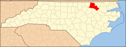 | |
| Towns | ||
| CDPs | ||
| Unincorporated communities | ||