Severn, North Carolina
| Severn, North Carolina | |
|---|---|
| Town | |
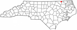 Location of Severn, North Carolina | |
| Coordinates: 36°30′47″N 77°11′20″W / 36.51306°N 77.18889°WCoordinates: 36°30′47″N 77°11′20″W / 36.51306°N 77.18889°W | |
| Country | United States |
| State | North Carolina |
| County | Northampton |
| Area | |
| • Total | 1.0 sq mi (2.6 km2) |
| • Land | 1.0 sq mi (2.6 km2) |
| • Water | 0.0 sq mi (0.0 km2) |
| Elevation | 69 ft (21 m) |
| Population (2010) | |
| • Total | 276 |
| • Density | 261.1/sq mi (100.8/km2) |
| Time zone | Eastern (EST) (UTC-5) |
| • Summer (DST) | EDT (UTC-4) |
| ZIP code | 27877 |
| Area code(s) | 252 |
| FIPS code | 37-60560[1] |
| GNIS feature ID | 1022551[2] |
Severn is a town in Northampton County, North Carolina, United States. The population was 276 at the 2010 census. It is part of the Roanoke Rapids, North Carolina Micropolitan Statistical Area.
Geography
Severn is located at 36°30′47″N 77°11′20″W / 36.51306°N 77.18889°W (36.513173, -77.188783).[3]
According to the United States Census Bureau, the town has a total area of 1.0 square mile (2.6 km2), all of it land.
Demographics
| Historical population | |||
|---|---|---|---|
| Census | Pop. | %± | |
| 1920 | 284 | — | |
| 1930 | 354 | 24.6% | |
| 1940 | 323 | −8.8% | |
| 1950 | 340 | 5.3% | |
| 1960 | 310 | −8.8% | |
| 1970 | 356 | 14.8% | |
| 1980 | 309 | −13.2% | |
| 1990 | 260 | −15.9% | |
| 2000 | 263 | 1.2% | |
| 2010 | 276 | 4.9% | |
| Est. 2015 | 258 | [4] | −6.5% |
As of the census[1] of 2000, there were 263 people, 103 households, and 70 families residing in the town. The population density was 261.1 people per square mile (100.5/km²). There were 117 housing units at an average density of 116.2 per square mile (44.7/km²). The racial makeup of the town was 59.32% White, 35.74% African American, 1.90% Native American, 2.28% from other races, and 0.76% from two or more races. Hispanic or Latino of any race were 2.28% of the population.
There were 103 households out of which 20.4% had children under the age of 18 living with them, 51.5% were married couples living together, 13.6% had a female householder with no husband present, and 32.0% were non-families. 30.1% of all households were made up of individuals and 16.5% had someone living alone who was 65 years of age or older. The average household size was 2.55 and the average family size was 3.19.
In the town the population was spread out with 20.9% under the age of 18, 6.8% from 18 to 24, 27.8% from 25 to 44, 24.7% from 45 to 64, and 19.8% who were 65 years of age or older. The median age was 41 years. For every 100 females there were 92.0 males. For every 100 females age 18 and over, there were 98.1 males.
The median income for a household in the town was $32,969, and the median income for a family was $41,458. Males had a median income of $26,607 versus $15,000 for females. The per capita income for the town was $16,227. About 11.6% of families and 13.5% of the population were below the poverty line, including 4.3% of those under the age of eighteen and 30.0% of those sixty five or over.
Notable residents
- Stu Martin - He played Major League Baseball from 1936 to 1943 and was born in nearby Rich Square.
References
- 1 2 "American FactFinder". United States Census Bureau. Retrieved 2008-01-31.
- ↑ "US Board on Geographic Names". United States Geological Survey. 2007-10-25. Retrieved 2008-01-31.
- ↑ "US Gazetteer files: 2010, 2000, and 1990". United States Census Bureau. 2011-02-12. Retrieved 2011-04-23.
- ↑ "Annual Estimates of the Resident Population for Incorporated Places: April 1, 2010 to July 1, 2015". Retrieved July 2, 2016.
- ↑ "Census of Population and Housing". Census.gov. Retrieved June 4, 2015.
Municipalities and communities of Northampton County, North Carolina, United States | ||
|---|---|---|
| Towns | 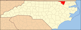 | |
| Unincorporated communities | ||