Mason County, Washington
| Mason County, Washington | ||
|---|---|---|
 Mason County Courthouse | ||
| ||
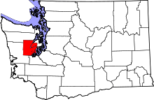 Location in the U.S. state of Washington | ||
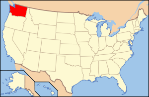 Washington's location in the U.S. | ||
| Founded | March 13, 1854 | |
| Named for | Charles H. Mason | |
| Seat | Shelton | |
| Largest city | Shelton | |
| Area | ||
| • Total | 1,051 sq mi (2,722 km2) | |
| • Land | 959 sq mi (2,484 km2) | |
| • Water | 92 sq mi (238 km2), 8.7% | |
| Population (est.) | ||
| • (2015) | 61,023 | |
| • Density | 63/sq mi (24/km²) | |
| Congressional districts | 6th, 10th | |
| Time zone | Pacific: UTC-8/-7 | |
| Website |
www | |

Mason County is a county located in the U.S. state of Washington. As of the 2010 census, the population was 60,699.[1] The county seat and only incorporated city is Shelton.[2] The county was formed out of King County on March 13, 1854. Originally named Sawamish County, it took its present name in 1864 in honor of Charles H. Mason, the first Secretary of Washington Territory.[3][4][5]
Mason County comprises the Shelton, WA Micropolitan Statistical Area and is included in the Seattle-Tacoma, WA Combined Statistical Area.
Geography
According to the U.S. Census Bureau, the county has a total area of 1,051 square miles (2,720 km2), of which 959 square miles (2,480 km2) is land and 92 square miles (240 km2) (8.7%) is water.[6]
Geographic features
Major highways
Adjacent counties
- Jefferson County - northwest
- Kitsap County - northeast
- Pierce County - east/southeast
- Thurston County - southeast
- Grays Harbor County - southwest
National protected areas
- Olympic National Forest (part)
- Olympic National Park (part)
Demographics
| Historical population | |||
|---|---|---|---|
| Census | Pop. | %± | |
| 1860 | 162 | — | |
| 1870 | 289 | 78.4% | |
| 1880 | 639 | 121.1% | |
| 1890 | 2,826 | 342.3% | |
| 1900 | 3,810 | 34.8% | |
| 1910 | 5,156 | 35.3% | |
| 1920 | 4,919 | −4.6% | |
| 1930 | 10,060 | 104.5% | |
| 1940 | 11,603 | 15.3% | |
| 1950 | 15,022 | 29.5% | |
| 1960 | 16,251 | 8.2% | |
| 1970 | 20,918 | 28.7% | |
| 1980 | 31,184 | 49.1% | |
| 1990 | 38,341 | 23.0% | |
| 2000 | 49,405 | 28.9% | |
| 2010 | 60,699 | 22.9% | |
| Est. 2015 | 61,023 | [7] | 0.5% |
| U.S. Decennial Census[8] 1790–1960[9] 1900–1990[10] 1990–2000[11] 2010–2015[1] | |||
2000 census
As of the census[12] of 2000, there were 49,405 people, 18,912 households, and 13,389 families residing in the county. The population density was 51 people per square mile (20/km²). There were 25,515 housing units at an average density of 26 per square mile (10/km²). The racial makeup of the county was 88.46% White, 1.19% Black or African American, 3.72% Native American, 1.05% Asian, 0.45% Pacific Islander, 2.10% from other races, and 3.03% from two or more races. 4.78% of the population were Hispanic or Latino of any race. 16.7% were of German, 9.9% Irish, 9.8% English, 8.6% United States or American and 6.8% Norwegian ancestry.
There were 18,912 households out of which 28.90% had children under the age of 18 living with them, 56.90% were married couples living together, 9.20% had a female householder with no husband present, and 29.20% were non-families. 23.30% of all households were made up of individuals and 9.90% had someone living alone who was 65 years of age or older. The average household size was 2.49 and the average family size was 2.89.
In the county, the population was spread out with 23.50% under the age of 18, 7.70% from 18 to 24, 26.50% from 25 to 44, 25.80% from 45 to 64, and 16.50% who were 65 years of age or older. The median age was 40 years. For every 100 females there were 107.00 males. For every 100 females age 18 and over, there were 107.30 males.
The median income for a household in the county was $39,586, and the median income for a family was $44,246. Males had a median income of $37,007 versus $25,817 for females. The per capita income for the county was $18,056. About 8.80% of families and 12.20% of the population were below the poverty line, including 17.30% of those under age 18 and 4.90% of those age 65 or over.
2010 census
As of the 2010 United States Census, there were 60,699 people, 23,832 households, and 16,057 families residing in the county.[13] The population density was 63.3 inhabitants per square mile (24.4/km2). There were 32,518 housing units at an average density of 33.9 per square mile (13.1/km2).[14] The racial makeup of the county was 86.1% white, 3.7% American Indian, 1.2% Asian, 1.1% black or African American, 0.4% Pacific islander, 3.4% from other races, and 4.1% from two or more races. Those of Hispanic or Latino origin made up 8.0% of the population.[13] In terms of ancestry, 19.7% were German, 13.8% were English, 13.5% were Irish, 6.7% were Norwegian, and 4.9% were American.[15]
Of the 23,832 households, 27.0% had children under the age of 18 living with them, 52.5% were married couples living together, 9.5% had a female householder with no husband present, 32.6% were non-families, and 25.3% of all households were made up of individuals. The average household size was 2.45 and the average family size was 2.87. The median age was 44.4 years.[13]
The median income for a household in the county was $48,104 and the median income for a family was $56,809. Males had a median income of $44,992 versus $33,982 for females. The per capita income for the county was $22,530. About 11.1% of families and 15.6% of the population were below the poverty line, including 21.0% of those under age 18 and 9.0% of those age 65 or over.[16]
Communities
City
- Shelton (county seat)
Census-designated places
Unincorporated communities
See also
References
- 1 2 "State & County QuickFacts". United States Census Bureau. Retrieved January 7, 2014.
- ↑ "Find a County". National Association of Counties. Retrieved 2011-06-07.
- ↑ "Milestones for Washington State History -- Part 2: 1851 to 1900", HistoryLink.org
- ↑ Washington Agricultural Statistics Service, US Department of Agriculture, as archived at the Internet Archive
- ↑ Wilma, David (2006-04-30). "Mason County -- Thumbnail History". HistoryLink.org.
- ↑ "2010 Census Gazetteer Files". United States Census Bureau. August 22, 2012. Retrieved July 7, 2015.
- ↑ "County Totals Dataset: Population, Population Change and Estimated Components of Population Change: April 1, 2010 to July 1, 2015". Retrieved July 2, 2016.
- ↑ "U.S. Decennial Census". United States Census Bureau. Retrieved January 7, 2014.
- ↑ "Historical Census Browser". University of Virginia Library. Retrieved January 7, 2014.
- ↑ "Population of Counties by Decennial Census: 1900 to 1990". United States Census Bureau. Retrieved January 7, 2014.
- ↑ "Census 2000 PHC-T-4. Ranking Tables for Counties: 1990 and 2000" (PDF). United States Census Bureau. Retrieved January 7, 2014.
- ↑ "American FactFinder". United States Census Bureau. Retrieved 2011-05-14.
- 1 2 3 "DP-1 Profile of General Population and Housing Characteristics: 2010 Demographic Profile Data". United States Census Bureau. Retrieved 2016-03-13.
- ↑ "Population, Housing Units, Area, and Density: 2010 - County". United States Census Bureau. Retrieved 2016-03-13.
- ↑ "DP02 SELECTED SOCIAL CHARACTERISTICS IN THE UNITED STATES – 2006-2010 American Community Survey 5-Year Estimates". United States Census Bureau. Retrieved 2016-03-13.
- ↑ "DP03 SELECTED ECONOMIC CHARACTERISTICS – 2006-2010 American Community Survey 5-Year Estimates". United States Census Bureau. Retrieved 2016-03-13.
External links
| Wikimedia Commons has media related to Mason County, Washington. |
- Official Tourism Web Site for Mason County
- Mason county government
- Mason County profile by the Shelton-Mason County Journal
- Mason County Daily News
 |
Jefferson County | Kitsap County | | |
| |
Pierce County | |||
| ||||
| | ||||
| Grays Harbor County | Thurston County |
Municipalities and communities of Mason County, Washington, United States | ||
|---|---|---|
| City | | |
| CDPs | ||
| Other unincorporated communities | ||
| Ghost town | ||
| Indian reservations | ||
Coordinates: 47°21′N 123°11′W / 47.35°N 123.18°W