Shenandoah Junction, West Virginia
| Shenandoah Junction | |
|---|---|
| Census-designated place (CDP) | |
|
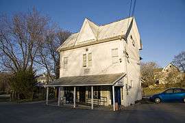
Shenandoah Junction Post Office | |
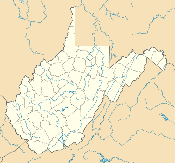 Shenandoah Junction Location within the state of West Virginia | |
| Coordinates: 39°21′31″N 77°50′35″W / 39.35861°N 77.84306°WCoordinates: 39°21′31″N 77°50′35″W / 39.35861°N 77.84306°W | |
| Country | United States |
| State | West Virginia |
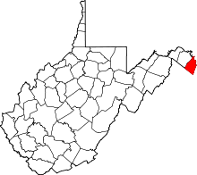
| County | Jefferson |
| Area[1] | |
| • Total | 1.013 sq mi (2.62 km2) |
| • Land | 1.013 sq mi (2.62 km2) |
| • Water | 0 sq mi (0 km2) |
| Population (2010)[2] | |
| • Total | 703 |
| • Density | 690/sq mi (270/km2) |
| Time zone | Eastern (EST) (UTC-5) |
| • Summer (DST) | EDT (UTC-4) |
| ZIP codes | 25442 |
Shenandoah Junction is a census-designated place (CDP) in Jefferson County in the U.S. state of West Virginia's Eastern Panhandle. As of the 2010 census, Shenandoah Junction had a population of 703.[2] It is located between Kearneysville and Charles Town off WV 9. Shenandoah Junction is home to Jefferson High School and West Virginia's oldest surviving wood frame structure, the Peter Burr House, built around 1751. The land where Shenandoah Junction was built was part of the 392 acres (1.59 km2) granted by Lord Fairfax to Lewis Neil. The town was originally called Neil's, but the name was changed to Shenandoah Junction in 1881. The town owes much of its early growth to the coming of the Baltimore and Ohio Railroad in the 1830s, and the name refers to the junction of the B&O and Norfolk and Western Railway at the center of the community.[3]
Climate
The climate in this area is characterized by hot, humid summers and generally mild to cool winters. According to the Köppen Climate Classification system, Shenandoah Junction has a humid subtropical climate, abbreviated "Cfa" on climate maps.[4]
References
- ↑ "US Gazetteer files: 2010, 2000, and 1990". United States Census Bureau. 2011-02-12. Retrieved 2011-04-23.
- 1 2 "American FactFinder". United States Census Bureau. Retrieved 2011-05-14.
- ↑ Kenny, Hamill (1945). West Virginia Place Names: Their Origin and Meaning, Including the Nomenclature of the Streams and Mountains. Piedmont, WV: The Place Name Press. p. 570.
- ↑ Climate Summary for Shenandoah Junction, West Virginia