Simonds Parish, Saint John County, New Brunswick
Not to be confused with Simonds Parish, Carleton County, New Brunswick.
| Simonds | |
|---|---|
| Parish | |
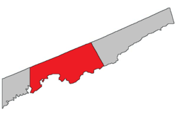 Location within Saint John County | |
| Coordinates: 45°20′N 65°47′W / 45.33°N 65.78°WCoordinates: 45°20′N 65°47′W / 45.33°N 65.78°W | |
| Country |
|
| Province |
|
| County | Saint John County |
| Established | 1839 |
| Population (2006)[1] | |
| • Total | 3,759 |
| • Change 2006-11 |
|
| • Dwellings | 1,483 |
| Time zone | AST (UTC-4) |
| • Summer (DST) | ADT (UTC-3) |
| Median Income* | $51,323 CDN |
| |
Simonds is a Canadian parish in Saint John County, New Brunswick.[2]
History
Simonds Parish established in 1839 from Portland Parish: named for James Simonds (1735-1831), the first English settler at Saint John in 1761, and for his son Charles Simonds (1783-1859), the speaker of the New Brunswick house of assembly.
Delineation
Simonds Parish is defined in the Territorial Division Act[3] as being bounded:
- All that part of the County bounded south by the Bay of Fundy, west by The City of Saint John, north by the Kings County line, and east by the eastern line of lot number one, granted to Samuel Hugh, at Tynemouth Creek, and the northern prolongation thereof.
Communities
Parish population total does not include incorporated municipalities (in bold):
|
|
|
Geography
The following water bodies are located within or adjacent to this parish.
- McBrien Lake
- Loch Lomond
- Balls Lake
- Haynes Lake
- Taylor Lake
- Otter Lake
- Mackins Lake
- Millican Lake
- Grassy Lake
- Browns Lake
- Black River
- Bay of Fundy (adjacent)
- Partridge Island
Demographics
PopulationPopulation trend[4]
|
LanguageMother tongue language (2006)[1]
|
Access Routes
Highways and numbered routes that run through the parish, including external routes that start or finish at the parish limits:[5]
|
|
|
See also
References
- 1 2 Community Profile: Saint Martins Parish, New Brunswick
- ↑ New Brunswick Provincial Archives - St John Parish
- ↑ "Territorial Division Act (R.S.N.B. 1973, c. T-3)". Government of New Brunswick website. Retrieved 25 August 2016.
- ↑ Statistics Canada: 2001, 2006 census
- ↑ Atlantic Canada Back Road Atlas ISBN 978-1-55368-618-7

| Subdivisions | |
|---|---|
| Cities | |
| Counties | |
| |
This article is issued from Wikipedia - version of the 8/26/2016. The text is available under the Creative Commons Attribution/Share Alike but additional terms may apply for the media files.