Sjuøyane

Sjuøyane (English: Seven Islands) is the northernmost part of the Svalbard archipelago north of Norway, and some 20 km north of Nordaustlandet.
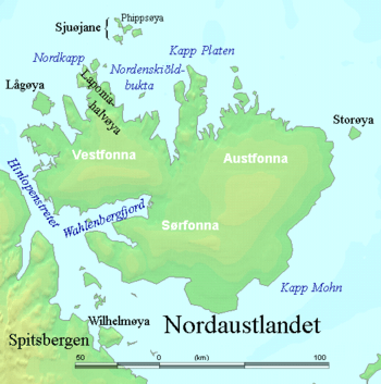
Geography
As the name implies, this is a group of seven islands (as well as several islets and skerries), of which the three larger ones are:
And the four smaller:
Rossøya, more a skerry than an island, is at 80°49’44" the northernmost land of Svalbard and thus of Norway. Ice conditions are often difficult, but they are often earlier accessible than other parts of Svalbard further southeast because of the influence of the last drops of the Gulf Stream. Sjuøyane belong to the Nordaust-Svalbard Nature Reserve.
History
Sjuøyane were first marked on a map by the Dutchman Hendrick Doncker (1663). Pieter Goos (1666) and other cartographers soon followed. Cornelis Giles and Outger Rep (c. 1710) were the first to put the islands in their correct position. The islands may have been sighted as early as 1618, as an Enkhuizen whaler is said to have seen the islands this year. As map-makers often lagged years behind the actual discoveries of the archipelago, this claim may very well be true, although evidence is lacking.
See also
References
- Conway, W. M. 1906. No Man’s Land: A History of Spitsbergen from Its Discovery in 1596 to the Beginning of the Scientific Exploration of the Country. Cambridge: At the University Press.
- Norwegian Polar Institute: Place names in Norwegian polar areas
- Norwegian Polar Institute Sjuøyane website page: http://cruise-handbook.npolar.no/en/northeast_reserve/sjuoyane.html
Coordinates: 80°41′N 20°57′E / 80.683°N 20.950°E