Songdalen
| Songdalen kommune | |||
|---|---|---|---|
| Municipality | |||
|
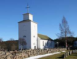
Greipstad Church in Songdalen municipality | |||
| |||
 Songdalen within Vest-Agder | |||
| Coordinates: 58°11′19″N 7°48′6″E / 58.18861°N 7.80167°ECoordinates: 58°11′19″N 7°48′6″E / 58.18861°N 7.80167°E | |||
| Country | Norway | ||
| County | Vest-Agder | ||
| District | Sørlandet | ||
| Administrative centre | Nodeland | ||
| Government | |||
| • Mayor (2003) | Johnny Greibesland (Sp) | ||
| Area | |||
| • Total | 216 km2 (83 sq mi) | ||
| • Land | 206 km2 (80 sq mi) | ||
| Area rank | 323 in Norway | ||
| Population (2004) | |||
| • Total | 5,483 | ||
| • Rank | 178 in Norway | ||
| • Density | 27/km2 (70/sq mi) | ||
| • Change (10 years) | 5.2 % | ||
| Demonym(s) | Songdøl[1] | ||
| Time zone | CET (UTC+1) | ||
| • Summer (DST) | CEST (UTC+2) | ||
| ISO 3166 code | NO-1017 | ||
| Official language form | Neutral | ||
| Website |
www | ||
|
| |||


Songdalen is a municipality in Vest-Agder county, Norway. Songdalen was created as a new municipality on 1 January 1964 through the merger of the former municipalities of Finsland, Greipstad and a small part of Øvrebø. The administrative center is the village of Nodeland. The central market area is located at Brennåsen.
General information
Name
The Old Norse form of the name is uncertain. The first element is related to the river name Sygna (see Søgne), but the exact form and meaning is unknown. The last element is the finite form of dal which means "valley" or "dale".
Coat-of-arms
The coat-of-arms is from modern times. They were granted on 20 December 1985. The arms show three oak leaves, each for one of the three former municipalities of Greipstad, Finsland, and Øvrebø, which now form the municipality of Songdalen. The oak was chosen, as the area is heavily forested.
(See also coat-of-arms of Eigersund, Nedre Eiker, Tingvoll and Øvre Eiker)
Geography
Songdalen is an inland municipality, bordering on the municipalities of Kristiansand and Vennesla in the east, Marnardal in the west, and Søgne in the south. A suburb of Kristiansand, Songdalen's administrative centre Nodeland is a short 10-minute drive from the city centre.
The landscape of the municipality is heavily shaped by the last ice age. The Songdalselva is a river flowing through the valley of the southern part of the municipality. The river passes through a 1 kilometre (0.62 mi) long, 100 metres (330 ft) deep scenic narrow gorge (Juve) at Underåsen. It is recognized for fishing, canoeing and other recreation opportunities.
In the southern part Songdalen's altitude is close to sea level, but increases up to a maximum of 414 meters above sea level in the northern part. The climate changes correspondingly, from coastal in the southern part to a more inland type climate in the northern part.
The forests are mixed deciduous and evergreen (heavily forested with oak and pine), with the ratio of pine woods increasing towards the north of the municipality. Elk and beaver are common in the area.[2]
History
In 1964, Finsland and Greipstad municipalities, along with Eikeland in Øvrebø, were merged into Songdalen municipality.
Greipstad is mentioned in written sources as early as 1344. Through the Middle Ages records indicate that Greipstad, a small farm community with 34 farms, was continuously inhabited. Greipstad became an independent municipality in 1913; split off from the municipality of Søgne.
Finsland, which lies further from the coast, has few preserved written records, but records have indications of farms there in the year 1000.
An eight-kilometers long section of the old Vestlandske Hovedvei (Westland Highway) passes through the municipality from Farvannet to Kvislevann. The highway was built in the 1790s and the section exists today in much the same way as it did for ordinary traffic in 1881.[3]
The fortifications at Rossevann were built in 1916/17 for the Stavanger Battalion. The municipality also has visible evidence of World War II fortifications.
References
- ↑ "Navn på steder og personer: Innbyggjarnamn" (in Norwegian). Språkrådet. Retrieved 2015-12-01.
- ↑ Stagg, Frank Noel (1958). South Norway. George Allen & Unwin, Ltd.
- ↑ Welle-Strand, Erling (1996). Adventure Roads in Norway. Nortrabooks. ISBN 82-90103-71-9.
External links
 Media related to Songdalen at Wikimedia Commons
 The dictionary definition of Songdalen at Wiktionary
- Municipal fact sheet from Statistics Norway
 Vest-Agder travel guide from Wikivoyage
- Welcome to Songdalen - Tourist information