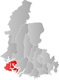
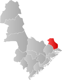
Southern Norway
| Southern Norway Sørlandet | ||||||||||||
|---|---|---|---|---|---|---|---|---|---|---|---|---|
| Region (landsdel) | ||||||||||||
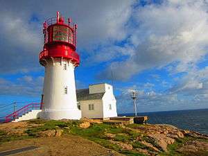
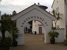
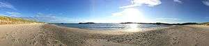
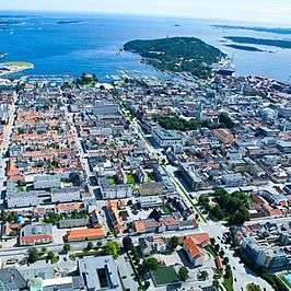
Descending, from top: Lindesnes fyr, Bystranda in Kristiansand, Kardemommeby in Kristiansand Zoo, The Lista beaches, Downtown Kristiansand, Flekkerøy outside Kristiansand, Arendal, Risør, Brekkestø in Lillesand, Mandal. Collage of Sørlandet | ||||||||||||
.svg.png) | ||||||||||||
| Coordinates: NO 58°36′N 7°48′E / 58.6°N 7.8°ECoordinates: NO 58°36′N 7°48′E / 58.6°N 7.8°E | ||||||||||||
| Country | Norway | |||||||||||
| Capital | Kristiansand, Arendal | |||||||||||
| Counties (fylker) |
Aust-Agder Vest-Agder | |||||||||||
| Area | ||||||||||||
| • Total | 16,434 km2 (6,345 sq mi) | |||||||||||
| Population (2009) | ||||||||||||
| • Total | 277,250 | |||||||||||
| • Density | 17/km2 (44/sq mi) | |||||||||||
| Demonym(s) |
Sørlending Egde | |||||||||||

Southern Norway (Norwegian: Sørlandet) (lit. "The Southland") is the geographical region (landsdel) of the Skagerrak coast of southern Norway consisting of the two counties of Vest-Agder and Aust-Agder. The total combined area of Vest-Agder and Aust-Agder is 16,493 square kilometres (6,368 sq mi).[1] The highest point in the region is Sæbyggjenuten, in Setesdalsheiene, at 1,507 m (4,944 ft).[2]
Sørlandet should not be confused with the Norwegian term Sør-Norge (see South Norway).
Etymology
The name Agder was known in Old Norse as "Agðir", and is assumed to be connected to the word ǫgd (sharp).[3]
History
Southern Norway is the youngest region of Norway, it was established shortly after Northern Norway. The first village builder was Vilhelm Krag who thought Southern Norway should have been bigger than it is today, from Egersund to Grenland, but even today it isn't entirely sure where the border goes. All the way back in 1865, it was talked about "the southern Norway boats". These boats were built in Lista and the invention was from a man from Lofoten, Northern Norway. So the expression "Sørlandet" first appeared in 1902.
The name and modern concept of this part of the country being considered as a separate region was introduced as late as 1902 by the local author Vilhelm Krag. Prior to this, the area was considered part of Western Norway. Southern Norway coincides roughly with the historic petty kingdom of Agder, which lends its name to the two constituent counties: Vest-Agder and Aust-Agder, as well as the University of Agder.
Occasionally, adjacent parts of the county of Rogaland and Telemark might be considered part of this region, as well.
If defined as an informal region, Southern Norway is perhaps more properly defined as the Skagerrak coastal belt, thus excluding the inland valleys to the north.
Traditionally, the easternmost border of Agder was Rygjarbit, which was thought to be Gjernestangen in Risør. Today, Rygjarbit is thought to be the strait between Askerøya and Lyngør in Tvedestrand.[6]
Transportation
| Historical population | ||
|---|---|---|
| Year | Pop. | ±% |
| 1951 | 172,753 | — |
| 1960 | 185,302 | +7.3% |
| 1970 | 215,874 | +16.5% |
| 1980 | 225,429 | +4.4% |
| 1990 | 240,906 | +6.9% |
| 2000 | 257,869 | +7.0% |
| 2010 | 279,024 | +8.2% |
| Source: Statistics Norway . | ||
Air
Arendal Airport, Gullknapp is a general aviation airport located outside of Arendal city. The airport was founded in 1984 with a 500 meters long runway.
Arendal Airport, Rådhuskaien is a former water airport in the cove of downtown Arendal.
Farsund Airport, Lista is a former public airport located with Lista. It opened in 1941 and closed in 1999. The airport is located at Lista.
Kristiansand Airport, Kjevik is the only public airport in Southern Norway, in 2014 there were over 1 million travelers from the airport. Kjevik Airport has destinations to charter places, European cities and some of the largest Norwegian cities. The Airport opened in 1918 and is located at Tveit, 16 kilometers from downtown Kristiansand, Kvadraturen. The IATA code is KRS and ICAO is ENCN. It is owned by Avinor.
Kristiansand Airport, Kongsgårdbukta is a former water-airport located at Lund from 1934 to 1939.
Kristiansand Naval Air Station is also a former water-airport located at Tangen from 1919 to 1949.
Mandal Airfield is a former military owned airport.
Bus
All bus lines and buses in Southern Norway is owned by AKT (Agder Kollektiv Transport).
Nettbuss serves the Kristiansand Region with local blue buses. In Kristiansand, the city buses goes all days from 04 AM to 01 AM, extra night buses during the weekend and direct/extra buses during the rush hours. The lines are A1, A2, A3, A24, D2, D3, M1, M2, M3, 01, 05, 07, 08, 09, 12, 13, 15, 17, 18, 19, 22, 23, 29, 30, 31, 32, 34, 35, 36, 37, 40, 42, 45, 46, 47, 49 and other less notable lines.
Setesdal Bilruter serves Setesdal, Østre Agder and Lillesand. Line 100 goes from Arendal - Grimstad - Lillesand to Kristiansand. Bus lines from Setesdal goes to both Arendal and Kristiansand. Line 150 goes from Arendal to Tvedestrand and Risør.
Sørlandsruta serves the coastal cities and towns of Vest-Agder. Line 900 is the main serving line from Kristiansand to Mandal, Vigeland, Lyngdal and Farsund (- Lista). Some of the bus collaborate with local bus from Lyngdal to Flekkefjord and Kvinesdal.
Roads
European Route E18 goes through Aust-Agder and Kristiansand east. E18 goes with the shore and coastal cities. European Route E39 starts in Kristiansand west from Denmark, and through Vest-Agder E39 also goes with the shore and coastal cities. Norwegian National Road 9 starts in Kristiansand and up to Evje and through Setesdal. Norwegian National Road 41 starts in Tveit in Kristiansand, and goes past the Airport, it continues to Birkenes and Åmli in Aust-Agder and continues to Telemark. Norwegian County Road 43 goes from Farsund and Lista to Lyngdal and Eiken in Hægebostad.
Sea
From Kristiansand Harbour, there are daily ferries from Kristiansand to Hirtshals, Denmark three times in the day. In Arendal, there are local ferries to the island Tromøy.
Train
Trains from Oslo to Stavanger goes through the entire Southern Norway. There are also trains from Oslo S - Kristiansand and Stavanger S - Kristiansand S. From Nelaug Station there is a local train going to Arendal Station, since the main railroad goes in the inland and not by the coast. In Kristiansand, the trains turn direction if they're continuing.
Tourism
Key industries in Southern Norway are forestry, agriculture and tourism. There are also popular ski resorts like Hovden in the valley of Setesdal and Bortelid in Åseral municipality.
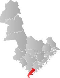
List of municipalities
About 80% of the population of the two counties live along the coast, which has the warmest climate as well as offering quick access to the rich fishing grounds and maritime roads of the Skagerrak. In Southern Norway there are also a number of smaller inland municipalities. The list of the municipalities in Southern Norway are:
| Coat of arms | City | Adm. center | Population (2015) | Region | Location | County | Photo | Map | Language |
|---|---|---|---|---|---|---|---|---|---|
 |
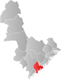
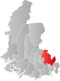
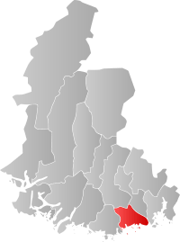
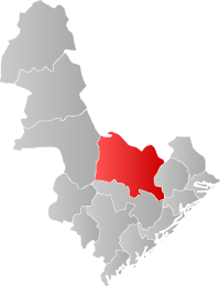
Kristiansand | Kvadraturen | 87,446 | Kristiansandregionen | Coast | Vest-Agder |  |
 |
Bokmål |
 |
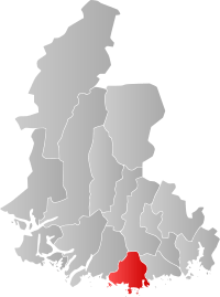
Arendal | Arendal | 44,219 | Østre Agder | Coast | Aust-Agder |  |
 |
Bokmål |
 |
Grimstad | Grimstad | 20,497 | Østre Agder | Coast | Aust-Agder |  |
 |
Bokmål |
 |
Mandal | Mandal | 15,061 | Lindesnesregionen | Coast | Vest-Agder |  |
 |
Bokmål |
 |
Vennesla | Vennesla | 14,095 | Kristiansandregionen | Inland | Vest-Agder | 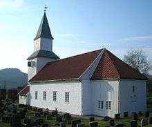 |
 |
Neutral |
 |
Søgne | Tangvall | 11,217 | Kristiansandregionen | Coast | Vest-Agder | 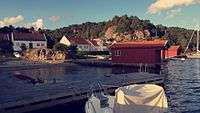 |
 |
Bokmål |
 |
Farsund | Farsund | 9,433 | Listerregionen | Coast | Vest-Agder | 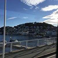 |
 |
Bokmål |
 |
Flekkefjord | Flekkefjord | 9,069 | Listerregionen | Coast | Vest-Agder | 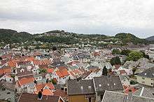 |
 |
Bokmål |
 |
Lillesand | Lillesand | 9,040 | Kristiansandregionen | Coast | Aust-Agder | 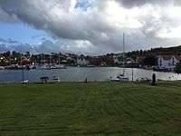 |
 |
Bokmål |
 |
Lyngdal | Alleen | 8,335 | Listaregionen | Coast | Vest-Agder |  |
 |
Bokmål |
 |
Risør | Risør | 6,894 | Østre Agder | Coast | Aust-Agder | 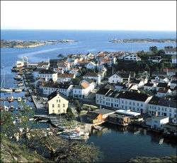 |
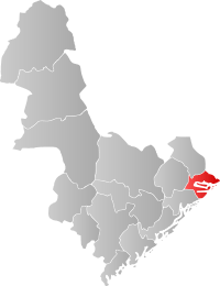 |
Neutral |
 |
Songdalen | Nodeland | 6,354 | Kristiansandregionen | Inland | Vest-Agder | 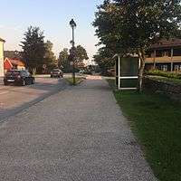 |
 |
Neutral |
 |
Kvinesdal | Liknes | 5,984 | Listerregionen | Coast | Vest-Agder |  |
 |
Neutral |
 |
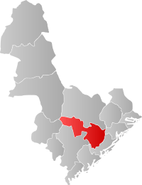
Froland | Blakstad | 5,532 | Østre Agder | Inland | Aust-Agder |  |
 |
Neutral |
 |
Lindesnes | Vigeland | 4,880 | Lindesnesregionen | Coast | Vest-Agder | 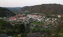 |
 |
Bokmål |
 |
Birkenes | Birkeland | 4,689 | Kristiansandregionen | Inland | Aust-Agder |  |
 |
Neutral |
 |
Evje og Hornnes | Evje | 3,567 | Setesdal | Inland | Aust-Agder |  |
 |
Neutral |
 |
Gjerstad | Gjerstad | 2,478 | Østre Agder | Inland | Aust-Agder |  |
 |
Bokmål |
 |
Marnardal | Heddeland | 2,294 | Lindesnesregionen | Inland | Vest-Agder |  |
Neutral | |
 |
Vegårshei | Myra | 2,018 | Østre Agder | Inland | Aust-Agder |  |
 |
Neutral |
 |
Sirdal | Tonstad | 1,838 | Listerregionen | Inland | Vest-Agder |  |
Neutral | |
 |
Åmli | Åmli | 1,832 | Østre Agder | Inland | Aust-Agder | 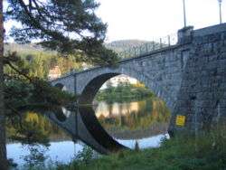 |
 |
Nynorsk |
 |
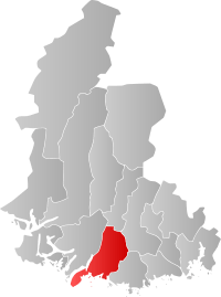
Audnedal | Konsmo | 1,750 | Lindesnesregionen | Inland | Vest-Agder | 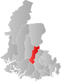 |
Neutral | |
 |
Hægebostad | Tingvatn | 1,693 | Lindesnesregionen | Inland | Vest-Agder | 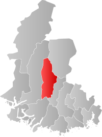 |
Nynorsk | |
 |
Iveland | Birketveit | 1,315 | Kristiansandregionen | Inland | Aust-Agder |  |
Neutral | |
 |
Valle | Valle | 1,251 | Setesdal | Inland | Aust-Agder | 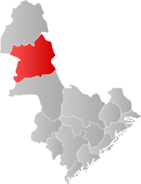 |
Nynorsk | |
 |
Bygland | Bygland | 1,189 | Setesdal | Inland | Aust-Agder |  |
Nynorsk | |
 |
Bykle | Bykle | 933 | Setesdal | Inland | Aust-Agder |  |
 |
Nynorsk |
 |
Åseral | Kyrkjebygda | 925 | Lindesnesregionen | Inland | Vest-Agder | 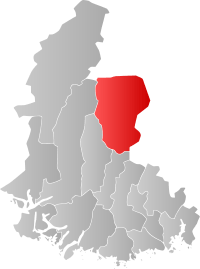 |
Nynorsk |
Image gallery
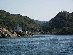 Kirkehavn on Hidra, Vest-Agder, Norway
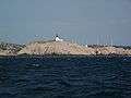
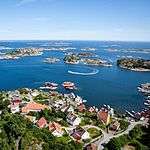
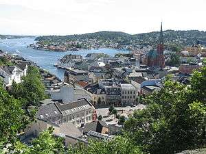
 Arendal
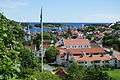 Risør
Risør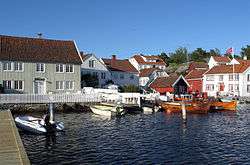
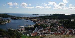
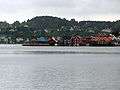
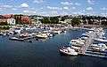 Kristiansand harbor
See also
- Demographics of Southern Norway
- Kashubian vetch - Sørlandsvikke (Kasjubiasvikke)
References
- ↑ Store norske leksikon. "Sørlandet – landsdel" (in Norwegian). Retrieved 2010-04-15.
- ↑ ut.no. "Sæbyggjenuten - Sørlandets høyeste punkt" (in Norwegian). Retrieved 2016-02-16.
- ↑ Thorsnæs, Geir. "Agder". snl.no.
- ↑ Statistics Norway - Church of Norway.
- ↑ Statistics Norway - Members of religious and life stance communities outside the Church of Norway, by religion/life stance. County. 2006-2010
- ↑ "Rygjarbit". snl.no.
External links
-
 South Norway travel guide from Wikivoyage
 - Southern Norway www.visitnorway.com
- Getting to Southern Norway and around
- Agder
- Visit Sørlandet
- University of Agder
- Tonal characteristics of some varieties of spoken South Norwegian.
| ||
| Counties | ||
|---|---|---|
| Cities | ||
| Towns | ||
| Municipalities | ||