Sonneberg (district)
| Sonneberg | |
|---|---|
| District | |
 | |
| Country |
|
| State | Thuringia |
| Capital | Sonneberg |
| Area | |
| • Total | 433 km2 (167 sq mi) |
| Population (31 December 2015)[1] | |
| • Total | 56,818 |
| • Density | 130/km2 (340/sq mi) |
| Time zone | CET (UTC+1) |
| • Summer (DST) | CEST (UTC+2) |
| Vehicle registration | SON, NH |
| Website | www.landkreis-sonneberg.de |
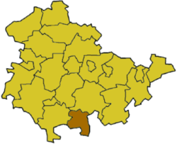
Sonneberg is a Kreis (district) in the south of Thuringia, Germany. Neighboring districts are (from the west clockwise) the districts Hildburghausen, Saalfeld-Rudolstadt, and the Bavarian districts Kronach and Coburg.
History
The district was created in 1868 when districts were introduced in Saxe-Meiningen. In 1952, parts of the district were split off into a newly created district Neuhaus am Rennweg. In 1994, Neuhaus am Rennweg was dissolved and the district Sonneberg regained its original size.
Geography
The district is located on the southern slopes of the mountains of the Thuringian Forest. The land descends from the more than 800m tall hills (the highest elevation is the 863m high Bleßberg) down to the lower plains Sonneberger Unterland and Schalkauer Platte. The Dreistromstein near Siegmundsburg near Neuhaus am Rennweg marks the intersection of three watersheds that drain into the rivers Rhine, Weser, and Elbe.
Coat of arms
 |
The coat of arms shows symbols of the historic states which make up the territory of the district. In the top left field is the lion as symbol of the county of Meißen. In the top right field is the symbol of the Lords of Sonneberg, which includes sheep shears. The bottom left field displays the symbol of the Counts of Schaumberg-Rauenstein, and the bottom right field shows the coat of arms of Saxony. |
Towns and municipalities
| Towns | Municipalities |
|---|---|
References
External links
- Official website (German)
| Urban districts | |
|---|---|
| Rural districts | |
Coordinates: 50°25′N 11°10′E / 50.42°N 11.17°E