South Carolina Highway 216
| ||||
|---|---|---|---|---|
| Battleground Road | ||||
| Route information | ||||
| Maintained by SCDOT | ||||
| Length: | 1.2 mi[1] (1.9 km) | |||
| Existed: | 1964 – present | |||
| Major junctions | ||||
| South end: | Kings Mountain National Military Park | |||
| North end: |
| |||
| Location | ||||
| Counties: | Cherokee | |||
| Highway system | ||||
| ||||

South Carolina Highway 216 (SC 216) is a primary 1.2-mile (1.9 km) state highway in the state of South Carolina. The highway runs north–south, from the Kings Mountain National Military Park to North Carolina Highway 216 at the North Carolina state line.
Route description
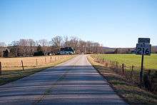
SC 216 is a short 1.2-mile (1.9 km) two-lane rural highway in the northeast corner of Cherokee County.[2] At the state line, NC 216 continues north towards Interstate 85 and US 29 south of Kings Mountain. SC 216 passes through a partly forested area with some homes along the road as wells as intersecting three minor state secondary roads during its journey.[1] At its eastern terminus at the Kings Mountain National Military Park entrance, the road continues east park-maintained towards York County and SC 161.
History
The current SC 216 was established between 1960 and 1964 as a new primary route.
The first SC 216 existed from 1939 to 1948, starting off as a 1-mile (1.6 km) spur of US 21 in Sheldon. In 1940 it was extended to a loop; but after one year, half of the loop was downgraded as secondary road. By 1948, the route was decommissioned.[3]
Junction list
The entire route is in Cherokee County.
| Location | mi[1] | km | Destinations | Notes | |
|---|---|---|---|---|---|
| | 0.0 | 0.0 | Battleground Road | Kings Mountain National Military Park entrance | |
| State line | 1.2 | 1.9 | |||
| 1.000 mi = 1.609 km; 1.000 km = 0.621 mi | |||||
References
- 1 2 3 Google (February 2, 2013). "South Carolina Highway 216" (Map). Google Maps. Google. Retrieved February 2, 2013.
- ↑ General Highway System - Cherokee County, South Carolina (PDF) (Map). South Carolina Department of Transportation. June 2005. Retrieved February 2, 2013.
- ↑ "Mapmikey's South Carolina Highways Page". Retrieved July 3, 2011.
External links
 Media related to South Carolina Highway 216 at Wikimedia Commons