South Carolina Highway 215
| ||||
|---|---|---|---|---|
| Route information | ||||
| Maintained by SCDOT | ||||
| Length: | 95.7 mi[1] (154.0 km) | |||
| Existed: | 1928 – present | |||
| Major junctions | ||||
| South end: |
| |||
|
| ||||
| North end: |
| |||
| Location | ||||
| Counties: | Richland, Fairfield, Chester, Union, Spartanburg | |||
| Highway system | ||||
| ||||

South Carolina Highway 215 (SC 215) is a primary state highway in the U.S. state of South Carolina. It serves as an alternate route to Union from either Columbia or Spartanburg.
Route description
SC 215 is a two-lane rural highway that traverses for 95.7 miles (154.0 km) from Columbia to Spartanburg; connecting Jenkinsville, Carlisle, Union, and Roebuck.
History
Established in 1928 as a renumbering of SC 121 and SC 161. It originally traveled from US 78, in Aiken, northeast through Wagener, Pelion, Edmund, and West Columbia. Through Columbia, in a concurrency with US 1/US 21/SC 2, it heads northwest through Jenkinsville, Carlisle, ending at US 176/SC 92, in Union.
In 1939, the entire route was paved. In 1948, SC 215 was rerouted to approach Union from the south, its old route through Monarch Mill being replaced by SC 92 (today SC 49-SC 215 Connector). In 1949, SC 215 was extended north to SC 56, in Pauline; a year later, it was extended north again to US 221, in Roebuck.
By 1958, SC 215 was rerouted in Columbia along Assembly Street to Blossom Street before heading west across the Saluda River in concurrency with US 21/US 176/US 321. By 1964, SC 215 was extended north from Roebuck to its current northern terminus at SC 295/SC 296, in Spartanburg; it replaced SC 295, and brought SC 215 to its longest routing.
Between 1974-77, SC 215 south of Eau Claire, in Columbia, was removed. The old alignment between Aiken to Cayce became SC 302, while in Columbia US 21/US 321 remained.
Junction list
| County | Location | mi[1] | km | Destinations | Notes |
|---|---|---|---|---|---|
| Richland | Columbia | 0.0 | 0.0 | ||
| 1.8 | 2.9 | ||||
| Cedar Creek | 12.4 | 20.0 | |||
| Fairfield | Jenkinsville | 23.6 | 38.0 | West end of SC 213 overlap | |
| | 26.3 | 42.3 | East end of SC 213 overlap | ||
| | 34.2 | 55.0 | |||
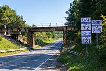
| Chester | | 48.9 | 78.7 | East end of SC 72 and north of SC 121 overlap | |
| Union | Carlisle | 52.8 | 85.0 | West end of SC 72 and south of SC 121 overlap | |
| | 61.8 | 99.5 | Monarch Highway | ||
| Union | 64.8 | 104.3 | East end of US 176 overlap | ||
| 66.4 | 106.9 | South end of SC 49 overlap | |||
| 67.2 | 108.1 | North end of SC 49 overlap | |||
| 68.0 | 109.4 | West end of US 176 overlap | |||
| Spartanburg | Glenn Springs | 83.0 | 133.6 | ||
| Pauline | 85.1 | 137.0 | West end of SC 56 overlap | ||
| | 86.1 | 138.6 | East end of SC 56 overlap | ||
| Roebuck | 91.7 | 147.6 | |||
| Spartanburg | 95.7 | 154.0 | |||
1.000 mi = 1.609 km; 1.000 km = 0.621 mi
| |||||
See also
References
- 1 2 Google (September 1, 2013). "South Carolina Highway 215" (Map). Google Maps. Google. Retrieved September 1, 2013.
External links
-
 Media related to South Carolina Highway 215 at Wikimedia Commons
 - Mapmikey's South Carolina Highways Page: SC 210-219