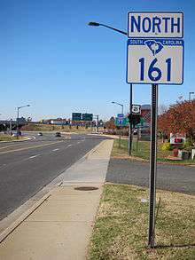
South Carolina Highway 161
| ||||
|---|---|---|---|---|
| Route information | ||||
| Maintained by SCDOT | ||||
| Length: | 28.7 mi[1] (46.2 km) | |||
| Existed: | 1930 – present | |||
| Major junctions | ||||
| South end: |
| |||
|
| ||||
| North end: |
| |||
| Location | ||||
| Counties: | York | |||
| Highway system | ||||
| ||||

South Carolina Highway 161 (SC 161) is a primary state highway in the U.S. state of South Carolina. It connects the cities of Rock Hill, York, and Kings Mountain, North Carolina.
Route description
SC 161 is a multi-lane highway, traversing from US 21 and Interstate 77, through the northern part of Rock Hill and north around York, to the back entrance area of Kings Mountain State Park and Kings Mountain National Military Park and North Carolina state line.
History
The first SC 161 appeared in 1923 as a new primary routing from SC 16, in Eau Claire, to SC 22. It was extended northwest by 1926 to SC 7, in Leeds. In 1928, the entire route was renumbered as part of SC 215.
The current SC 161 was established in 1930 as a new primary route, it originally traversed from SC 16 (today US 321) to the North Carolina state line, continuing as NC 215 (renumbered in 1937 to NC 161). In 1959, SC 161 was extended south, through York, to its current southern terminus at US 21 in Rock Hill. In 1986 or 1987, SC 161 was placed on bypass north around York, in concurrency with SC 5.[2]
Junction list
The entire route is in York County.
| Location | mi[1] | km | Destinations | Notes | |
|---|---|---|---|---|---|
| Rock Hill | 0.0 | 0.0 | |||
| 0.1 | 0.16 | ||||
| 4.2 | 6.8 | East end of SC 274 overlap | |||
| 5.7 | 9.2 | ||||
| 7.0 | 11.3 | West end of SC 274 overlap | |||
| York | 13.1 | 21.1 | South end of SC 5 overlap | ||
| 15.1 | 24.3 | ||||
| 17.3 | 27.8 | South end of US 321 overlap, north end of SC 5 overlap | |||
| | 18.8 | 30.3 | North end of US 321 overlap | ||
| Bethany | 25.2 | 40.6 | |||
| State line | 28.7 | 46.2 | |||
1.000 mi = 1.609 km; 1.000 km = 0.621 mi
| |||||
Bannered routes
Currently, there is one business loop along SC 161:
| |
|---|---|
| Location: | York, South Carolina |
York business loop
SC 161 Business follows the old alignment of SC 161 through downtown York, via Liberty Street.
See also
- Catawba River
- Crowders Mountain State Park
- Kings Mountain National Military Park
- Kings Mountain State Park
References
| Wikimedia Commons has media related to South Carolina Highway 161. |
- 1 2 Google (November 24, 2012). "South Carolina Highway 161" (Map). Google Maps. Google. Retrieved November 24, 2012.
- ↑ "Mapmikey's South Carolina Highways Page (SC 160-169)". Retrieved November 24, 2012.