Sparks, Georgia
| Sparks, Georgia | |
|---|---|
| Town | |
|
Sparks City Hall | |
 Location in Cook County and the state of Georgia | |
| Coordinates: 31°10′9″N 83°26′23″W / 31.16917°N 83.43972°WCoordinates: 31°10′9″N 83°26′23″W / 31.16917°N 83.43972°W | |
| Country | United States |
| State | Georgia |
| County | Cook |
| Area | |
| • Total | 4.1 sq mi (10.7 km2) |
| • Land | 3.9 sq mi (10.1 km2) |
| • Water | 0.2 sq mi (0.6 km2) |
| Elevation | 240 ft (73 m) |
| Population (2010) | |
| • Total | 2,052 |
| • Density | 525/sq mi (202.8/km2) |
| Time zone | Eastern (EST) (UTC-5) |
| • Summer (DST) | EDT (UTC-4) |
| ZIP code | 31647[1] |
| Area code(s) | 229 |
| FIPS code | 13-72556[2] |
| GNIS feature ID | 0333097[3] |

Sparks is a town in Cook County, Georgia, United States. The population was 2,052 at the 2010 census.[4]
Geography
Sparks is located near the center of Cook County at 31°10′09″N 83°26′23″W / 31.169210°N 83.439757°W.[5] It is bordered on the south by the city of Adel, the county seat. U.S. Route 41 passes through the center of the town as Goodman Street. Interstate 75 runs through the west side of the town, with access from Exit 41. Tifton is 20 miles (32 km) to the north, and Valdosta is 26 miles (42 km) to the south.
According to the United States Census Bureau, Sparks has a total area of 4.1 square miles (10.7 km2), of which 3.9 square miles (10.1 km2) is land and 0.23 square miles (0.6 km2), or 5.64%, is water.[4]
Demographics
| Historical population | |||
|---|---|---|---|
| Census | Pop. | %± | |
| 1890 | 307 | — | |
| 1900 | 683 | 122.5% | |
| 1910 | 842 | 23.3% | |
| 1920 | 792 | −5.9% | |
| 1930 | 635 | −19.8% | |
| 1940 | 695 | 9.4% | |
| 1950 | 887 | 27.6% | |
| 1960 | 1,158 | 30.6% | |
| 1970 | 1,337 | 15.5% | |
| 1980 | 1,353 | 1.2% | |
| 1990 | 1,205 | −10.9% | |
| 2000 | 1,755 | 45.6% | |
| 2010 | 2,052 | 16.9% | |
| Est. 2015 | 2,007 | [6] | −2.2% |
As of the census[2] of 2000, there were 1,755 people, 644 households, and 443 families residing in the town. The population density was 480.3 people per square mile (185.6/km²). There were 743 housing units at an average density of 203.3 per square mile (78.6/km²). The racial makeup of the town was 53.16% White, 43.65% African American, 0.40% Native American, 0.40% Asian, 1.60% from other races, and 0.80% from two or more races. Hispanic or Latino of any race were 3.42% of the population.
There were 644 households out of which 37.3% had children under the age of 18 living with them, 43.6% were married couples living together, 20.7% had a female householder with no husband present, and 31.2% were non-families. 27.6% of all households were made up of individuals and 10.6% had someone living alone who was 65 years of age or older. The average household size was 2.69 and the average family size was 3.25.
In the town the population was spread out with 30.8% under the age of 18, 8.9% from 18 to 24, 29.9% from 25 to 44, 18.5% from 45 to 64, and 11.9% who were 65 years of age or older. The median age was 32 years. For every 100 females there were 86.5 males. For every 100 females age 18 and over, there were 80.9 males.
The median income for a household in the town was $26,806, and the median income for a family was $29,861. Males had a median income of $22,583 versus $16,087 for females. The per capita income for the town was $10,779. About 19.6% of families and 26.7% of the population were below the poverty line, including 35.9% of those under age 18 and 28.9% of those age 65 or over.
References
- ↑ United States Postal Service (2012). "USPS - Look Up a ZIP Code". Retrieved 2012-02-15.
- 1 2 "American FactFinder". United States Census Bureau. Retrieved 2008-01-31.
- ↑ "US Board on Geographic Names". United States Geological Survey. 2007-10-25. Retrieved 2008-01-31.
- 1 2 "Geographic Identifiers: 2010 Demographic Profile Data (G001): Sparks town, Georgia". U.S. Census Bureau, American Factfinder. Retrieved July 30, 2014.
- ↑ "US Gazetteer files: 2010, 2000, and 1990". United States Census Bureau. 2011-02-12. Retrieved 2011-04-23.
- ↑ "Annual Estimates of the Resident Population for Incorporated Places: April 1, 2010 to July 1, 2015". Retrieved July 2, 2016.
- ↑ "Census of Population and Housing". Census.gov. Retrieved June 4, 2015.
Municipalities and communities of Cook County, Georgia, United States | ||
|---|---|---|
| City | 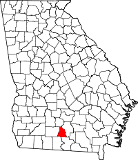 | |
| Towns | ||