Spodnji Kamenščak
| Spodnji Kamenščak | |
|---|---|
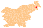
 Spodnji Kamenščak Location in Slovenia | |
| Coordinates: 46°30′47.94″N 16°10′43.94″E / 46.5133167°N 16.1788722°ECoordinates: 46°30′47.94″N 16°10′43.94″E / 46.5133167°N 16.1788722°E | |
| Country |
|
| Traditional region | Styria |
| Statistical region | Mura |
| Municipality | Ljutomer |
| Area | |
| • Total | 2.37 km2 (0.92 sq mi) |
| Elevation | 222.2 m (729.0 ft) |
| Population (2002) | |
| • Total | 418 |
| [1] | |
Spodnji Kamenščak (pronounced [ˈspoːdnji ˈkaːmɛnʃtʃak]) is a settlement in the hills southwest of Ljutomer in northeastern Slovenia. The area traditionally belonged to the Styria region and is now included in the Mura Statistical Region.[2]
References
External links
| Settlements | Administrative centre: Ljutomer
|  |
|---|---|---|
| Landmarks |
| |
| Notable people |
| |
This article is issued from Wikipedia - version of the 9/1/2014. The text is available under the Creative Commons Attribution/Share Alike but additional terms may apply for the media files.