Springfield Parish, New Brunswick
| Springfield | |
|---|---|
| Parish | |
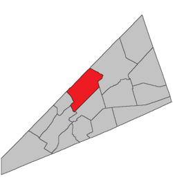 Location within Kings County, New Brunswick. | |
| Coordinates: 45°50′N 64°35′W / 45.84°N 64.59°W | |
| Country |
|
| Province |
|
| County | Kings County |
| Established | 1786 |
| Area[1] | |
| • Land | 248.22 km2 (95.84 sq mi) |
| Population (2011)[1] | |
| • Total | 1,652 |
| • Density | 6.7/km2 (17/sq mi) |
| • Pop 2006-2011 |
|
| • Dwellings | 867 |
| Time zone | AST (UTC-4) |
| • Summer (DST) | ADT (UTC-3) |
Springfield is a Canadian parish in Kings County, New Brunswick.
Its population in the 2011 Census was 1,652.
History
Brunswick Parish established in 1786: probably named for the town of Springfield in New Jersey or for the town of Springfield in Massachusetts: included parts of Studholm Parish and Havelock Parish until 1840.
Delineation
Springfield Parish is defined in the Territorial Division Act[2] as being bounded:
- North by the County line and Kars Parish; west by Kars Parish and the line dividing lots number one and number eighteen, south of Belleisle Bay, and a part of the line dividing lots number fifteen and number sixteen, in the back settlement; south by a line running north sixty degrees east or parallel to the southern base line of the Belleisle Grant, and distant sixty-five chains therefrom, and extending to its intersection with a line running north from the mouth of Halfway Brook and east by a direct line from said intersection to the southeast angle of lot number eleven, granted to Henry A. Scovil in range two of Pascobac Brook lots, thence northeasterly, or in a direct line to the northeast angle of lot letter F, granted to Samuel Foster; thence northeasterly and northerly along the southeastern and eastern line of lot letter V, granted to William S. F. Wilson, to the northeastern angle thereof; thence northeasterly along the southeastern lines of the grant to John Coy and John Good, to a point intersected by the southeastern prolongation of the northeastern line of lot number one, granted to Samuel Kierstead; thence along said prolongation and line and its northwestern prolongation to Queens county line.
Communities
Parish population total does not include incorporated municipalities (in bold):
|
|
|
Bodies of water & Islands
This is a list of rivers, lakes, streams, creeks, marshes and Islands that are at least partially in this parish
- None
Demographics
Population
Population trend[3]
| Census | Population | Change (%) |
|---|---|---|
| 2011 | N/A | |
| 2006 | 1572 | |
| 2001 | 1523 | |
| 1996 | | |
| 1991 | N/A |
Access Routes
Highways and numbered routes that run through the parish, including external routes that start or finish at the parish limits:[4]
|
|
|
See also
References
- 1 2 2011 Statistics Canada Census Profile: Springfield Parish, New Brunswick
- ↑ "Territorial Division Act (R.S.N.B. 1973, c. T-3)". Government of New Brunswick website. Retrieved 26 August 2016.
- ↑ Statistics Canada: 2001, 2006 census
- ↑ Atlantic Canada Back Road Atlas ISBN 978-1-55368-618-7
 |
Wickham Parish | Johnston Parish | | |
| Kars Parish | |
Studholm Parish | ||
| ||||
| | ||||
| Kingston Parish | Norton Parish |
| Subdivisions | |
|---|---|
| Cities | |
| Counties | |
| |
Coordinates: 47°24′57″N 65°25′17″W / 47.4157°N 65.42128°W