Horoatu Crasnei
| Horoatu Crasnei | |
|---|---|
| Commune | |
|
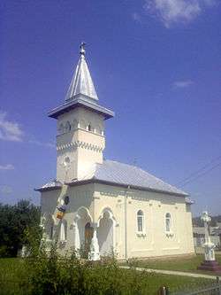
Orthodox Church in Horoatu Crasnei | |
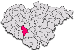
 Horoatu Crasnei in Sălaj County | |
 Horoatu Crasnei Horoatu Crasnei within Romania | |
| Coordinates: 47°07′32″N 22°53′55″E / 47.12556°N 22.89861°E | |
| Country |
|
| County |
|
| Commune | Horoatu Crasnei |
| Historic region | Transylvania |
| Government | |
| • Mayor | Iosif Şimon (Christian-Democratic National Peasants' Party) |
| Area | 84.39 km2 (32.58 sq mi) |
| Population (2002)[1] | 2,838 |
| Time zone | EET (UTC+2) |
| • Summer (DST) | EEST (UTC+3) |
| Website | www.comunahoroatucrasnei.ro |
Horoatu Crasnei (Hungarian: Krasznahorvát) is a commune located in Sălaj County, Romania.
Villages
The commune is composed of four villages: Horoatu Crasnei, Hurez (Bagolyfalu), Stârciu (Bogdánháza) and Şeredeiu (Sereden).
Stârciu
Stârciu is a village in Horoatu Crasnei commune.
In 1910, the village had 1,505 inhabitants: 1,453 Romanians and 25 Hungarians.[2] The first historical accounts of the village was in 1341. Until 1919 the village was part of the Kingdom of Hungary's Szilágy; it was again part of Hungary during World War II (1940 to 1944).
Sights
- Reformed Church in Horoatu Crasnei, built in the 15th century, historic monument[3]
- Orthodox Church in Horoatu Crasnei, built in the 18th century[4]
References
- ↑ Romanian census data, 2002; retrieved on March 1, 2010
- ↑ A történelmi Magyarország atlasza és adattára 1914. László Zentai and Pál Kósa. Pécs: Talma Kiadó. 2003. ISBN 963-85683-4-8.
- ↑ welcometoromania.ro - Reformed Church in Horoatu Crasnei, Sălaj County, retrieved on Mai 17, 2012
- ↑ welcometoromania.ro - Orthodox Church in Horoatu Crasnei, Sălaj County, retrieved on May 17, 2012
External links
Coordinates: 47°08′N 22°53′E / 47.133°N 22.883°E
This article is issued from Wikipedia - version of the 1/8/2016. The text is available under the Creative Commons Attribution/Share Alike but additional terms may apply for the media files.

