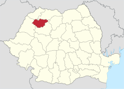
Sălaj County
| Sălaj County Județul Sălaj | ||
|---|---|---|
| County | ||
| ||
 | ||
| Coordinates: 47°12′N 23°3′E / 47.200°N 23.050°ECoordinates: 47°12′N 23°3′E / 47.200°N 23.050°E | ||
| Country | Romania | |
| Development region | Nord-Vest | |
| Historical region | Crișana, Transylvania | |
| Capital | Zalău | |
| Area | ||
| • Total | 3,864.38 km2 (1,492.05 sq mi) | |
| Area rank | 38th | |
| Population (2011) | ||
| • Total | 224,384 | |
| • Rank | 39th | |
| • Density | 58/km2 (150/sq mi) | |
| Telephone code | (+40) 260 or (+40) 360[1] | |
| ISO 3166 code | RO-SJ | |
| Website |
County Council Prefecture | |
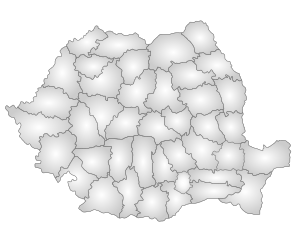
Sălaj (Romanian pronunciation: [səˈlaʒ]) (also known as Land of Silvania, silva, -ae means "forest")[2] is a county (județ) of Romania, located in the north-west of the country, in the historical regions of Crișana and Transylvania. It is bordered to the north by Satu Mare and Maramureș counties, to the west and south-west by Bihor County, and to the south-east by Cluj County. Zalău is the county seat as well as its largest city.
Etymology
In Hungarian, it is known as Szilágy megye, in Slovak as Salašská župa, and in German as Kreis Zillenmarkt. The county is named after the Sălaj River, which gets its name from Hungarian Szilágy "elm creek", composed from szil, "elm" and ágy "riverbed".[3]
History
Antiquity
On 28 July 1978, a team of speleologists discovered in the cave of Cuciulat Paleolithic paintings about 12,000 years old,[4] unique in Romania. Nicknamed the "Altamira of Romania", the cave features several red paintings of animals, including horses and felines. These are the first manifestations of this kind known in Southeastern Europe.[5]
The first villages in the current territory of Sălaj County have a length of 7,500 years. The same length have the first ceramic pots in Sălaj area. The first houses with several rooms were built in this county about 6,000 years ago. The only settlement from the Bronze Age, fully researched, in the Romanian territory is located in Sălaj County, in Recea.
From the 17th–9th centuries BC have been discovered so far 63 bronze thesauri. Bronze objects from this period, discovered in the Sălaj County, are exhibited today in renowned museums in Germany, United States, Hungary, but also Bucharest. From the first Iron Age date six defense citadels, dated to the 11th–4th centuries BC.
Daco-Roman period and early Middle Ages


Between the 2nd century BC and the 1st century AD, on the actural Sălaj territory lived Dacians. Between Crasna and Barcău rivers existed a Dacian tribal union that controlled the access roads to the north-west, to and from Transylvania and the commerce, especially the trade with salt. From the Dacian period come no less than 23 Dacian thesauri, made of silver coins and ornaments. The 3,000 coins and 70 silver ornaments weigh in total about 13 kg. The largest fortified Dacian settlement in Romania was discovered in Sălaj County, dating from the 1st century AD. In total, in Sălaj County were discovered sites of 30 Dacian villages and 15 Dacian citadels defending the tribal union in the west of current county. These citadels were located on hills and were fortified with ditches and earth walls, on which were erected wooden palisades. The center of the tribal union was on Măgura Șimleului, in a complex of settlements and fortifications.
In the western half of the county, under Roman military control, subsequently settled the Vandals, that entered into alliance with Dacians, supported by the Romans to fight other barbarians. The Vandals arrived in the area during the 1st century AD, coming from the current territory of Denmark.
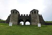
After conquering Dacia, Romans built on the place of a Dacian settlement the capital of Dacia Porolissensis, at Porolissum (current Moigrad). The capital Porolissum had about 20,000 inhabitants, defended by the militaries in the local castra.[7] As a work of art should be mentioned the amphitheater, scale replica of the one in Rome, with a capacity of 6,000 seats. In 214 AD, Roman Emperor Marcus Aurelius Antonius visited Porolissum. At Porolissum was quartered for a period Cohors III Dacorum, made of ethnic Dacians, who fought as infantry.
In the Sălaj County area were identified nine Roman castra (Certinae, Largiana, Optatiana, Porolissum, Brusturi, Buciumi, Jac, Tihău and Zalău) and the limes (fortified border) of the province. In 275 AD, Roman authorities leave the province, but indigenous people continue to live the same territories. Their presence is attested archaeologically after leaving the region by the Roman imperial authorities.
There followed the Gepids, which just passed through the area. Two Gepid gold thesauri discovered in Șimleu Silvaniei, weighing in total about 10 kg of gold and dating from the 5th century AD, are now exhibited in museums in Vienna and Budapest. In 6th–7th centuries AD arrive in the area Slavic tribes, who find here the native population.
In early Middle Ages, in the 10th century AD, boundary between the voivodeship of Menumorut and that of Gelu was on Meseș Mountains. From early medieval period come more than 100 settlements identified in the Sălaj County (7th–13th centuries). Among the first counties organized in Transylvania was Crasna County, in 1090, part of the current Sălaj County.
Byzantine chronicles and Anonymus' Gesta Hungarorum make the first mentions about Romanians in these places, about their forms of organization, as well as first documentary attestation of Zalău (1220 as villa Ziloc).[8]
Under Hungarian rule
Starting with the second half of the 11th century, Hungarians conquer systematically Transylvania which organize as autonomous Voivodate within the Kingdom of Hungary. From 1541, Transylvania becomes Principate under Ottoman suzerainty, and from 1691, Principate within the Habsburg Empire (Great Principate, starting with 1765, prince being the king). After the formation of the Austro-Hungarian Empire (1867), Transylvania disappears as state, being incorporated to Hungary. Salaj has evolved within the history of Transylvania, Romanian majority population supporting a constant process of discrimination. During the Middle Ages, Transylvania politics was monopolized by Unio Trium Nationum (political alliance of nobles, Saxon and Szekler rulers formed during the Bobâlna revolt of 1437–1438).
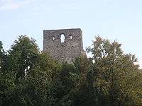
In Salaj County are medieval citadels and castles which belonged to noble families (Dragu, Jibou, Gârbou, Șimleu Silvaniei, etc.). Among them is Almașu Citadel (Romanian: Cetatea Almașului) (nowadays, in ruins), built in the 13th century, property of Transylvanian voivodes, then of Petru Rareș, Prince of Moldavia.
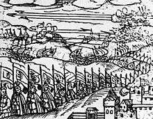
The history of Salaj County includes an important episode related to historical facts of the maker of the first political union of Wallachia, Transylvania and Moldavia, Michael the Brave. On 3 August 1601, armies led by Michael the Brave and Austrian general Giorgio Basta defeated the Hungarian noble army led by Prince Sigismund Báthory at Guruslău, near Zalău (where was erected a memorial).
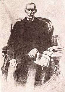
In the forefront of the struggle for national rights of Romanians have been often personalities of Sălaj County. Among Romanian revolutionaries of 1848 can be mentioned Alexandru Papiu Ilarian and Simion Bărnuțiu, who became the ideologist of the Romanian revolution in Transylvania.
Modern era
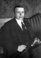
Following the establishment of the Romanian National Party in Transylvania (1869) and the adoption of "passivist" tactics (non-participation in the political life of Hungary), Sălaj leaders of the party participated in the largest protest during political passivism period, the "Memorandist Movement" (1892–1894). Was noticed the contribution of Gheorghe Pop de Băsești. The failure of political passivism determined the PNR leaders to pass to "political activism", starting with 1905. At the stage of political activism, the Transylvanian Romanians achieve representation in the Parliament in Budapest, there advocating for national rights. Was remarked the activity of Iuliu Maniu, the greatest politician in the history of Sălaj.
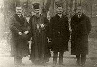
In national and international favorable conditions of 1918, leaders of Romanians in Transylvania organized the Great National Assembly in Alba Iulia (1 December 1918), with plebiscitary character, which decided the union of Transylvania with Romania. Political elites in Sălaj had a leading role in the events. Gheorghe Pop de Băsești was elected president of the Great National Council (legislative body), Iuliu Maniu became president of the Governing Council (executive body), and Victor Deleu was the leader of the Interior within the Governing Council (the two institutions have led Transilvania during its provisional autonomy until April 1920).

.tif.jpg)
In the interwar period, Sălaj evolved within the history of Greater Romania. Was remarked Iuliu Maniu's political activity, president of PNR, then president of PNȚ and prime minister of Romania. At the beginning of Greater Romania, Sălaj County had 3,815 km2 and 226,716 inhabitants, of which: 139,878 Romanians, 70,405 Hungarians, 9,322 Slovaks, 831 Jews, 6,282 other nationalities. Legislation of Greater Romania offered the possibility of functioning of schools or departments in native languages. According to documents from the State Archives, Sălaj County, in 1933 had 342,642 inhabitants, of which: 202,176 Romanians, 90,800 Hungarians, 30,840 Germans, 17,138 Jews, 1,715 other nationalities. The number of students was: 44,921 Romanians, 20,192 Hungarians, 3,287 Germans, 2,111 Jews, 396 other nationalities.
By Second Vienna Award, concluded on 30 August 1940, Nazi Germany and Fascist Italy forced Romania to cede to Hungary northwestern Transylvania. Until March 1945, when the ceded part will return to Romania (during Petru Groza government), Sălaj was part of Hungary. Between 1940 and 1944, in Sălaj County were numerous killings carried out by Horthy's troops on Romanian population, claiming the lives of 495 people,[9] of which most in the villages of Ip and Treznea. Starting with 14 October 1944, Romanian armies carried military operations in the territory of Sălaj County, gradually liberating it from the Hungarian-Horthyist occupation.
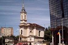
After 1947, Sălaj inhabitants have experienced the realities of the Communist totalitarian regime. Among Sălaj personalities, can be mentioned artist Ioan Sima who, in 1980, donated to the County Museum of History and Art in Zalău paintings and graphics, personal archive and his library of art.
After December 1989, in the conditions of return to a democratic political regime and Euro-Atlantic integration, Sălaj has become a model of interethnic cohabitation, also manifested in education. Politically, was remarked the activity of Corneliu Coposu, former personal secretary of Iuliu Maniu. His name links to the clotting of the Romanian Democratic Convention that succeeded the first democratic alternation in power in post-revolutionary Romania.
Geography
Sălaj County unfolds on 3,864.38 km2 (1.6% of the country area),[10] of which 239,613 ha are agricultural land, 105,833 ha forests and 41,000 ha inhabited area.[11] It is located in the north-west of the country, overlapping mostly in the area of connection between the Eastern Carpathians and Apuseni Mountains, known as "Someș Plateau".
Relief
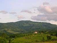
The relief is predominantly hilly, mountains occupying a small portion in the south-west. The hilly area is composed of Someș Plateau and piedmont hills of Silvania. The mountainous area is represented by two northern branches of the Apuseni Mountains: Meseș with Măgura Priei Peak (996 m) and Plopiș.[12] Depressions are widely distributed throughout the county and represent important agricultural areas of concentration of settlements.
Climate
In terms of climate, Sălaj County, by its geographical position, falls in moderate temperate continental climate, west and north-west circulation predominating.
The thermal regime of the air is conditioned by altitude, fragmentation and orientation of relief, plus local factors, the average temperature being around 8 °C. Average temperature at Zalău (calculated for the period 1961–1990) is 9.5 °C, remarking a growing trend of it. The maximum temperature recorded at the Zalău meteorological station was 38 °C on 16 August 1952, and the minimum temperature recorded is -23.5 °C, on 25 January 1954.[10]
The annual rainfall regime is generated by two factors: general atmospheric circulation, physical and geographical conditions, respectively. Advection of temperate oceanic air from west and north-west direction, especially during the summer, as well as frequent ingress of cold air masses from the north or those temperate continental from north-east and east, during the winter, plus advection of maritime tropical air from the south-west and south, explain all influences of atmospheric action centres which are felt in this area. Taking into account these elements, plus relief influences, atmospheric rainfall are unevenly spread across the county. The average amount of precipitation is 600–700 mm, in Zalău being 634.2 mm (calculated for the period 1961–1990).[10] The most abundant precipitation falls in summer, when besides frontal processes occurs the intense thermal convection, causing showers, rich in terms of quantity. During the winter, rainfall is less quantitatively, although the number of days with precipitation is not smaller. By and large, the pluviometric maximum overlaps the months of May–June, and the pluviometric minimum is registered in January–February.
| Climate data for Zalău | |||||||||||||
|---|---|---|---|---|---|---|---|---|---|---|---|---|---|
| Month | Jan | Feb | Mar | Apr | May | Jun | Jul | Aug | Sep | Oct | Nov | Dec | Year |
| Average high °C (°F) | 0.9 (33.6) |
3.8 (38.8) |
9.4 (48.9) |
15.3 (59.5) |
20.5 (68.9) |
23.2 (73.8) |
25.2 (77.4) |
25 (77) |
21.3 (70.3) |
5.8 (42.4) |
8.5 (47.3) |
2.9 (37.2) |
13.48 (56.26) |
| Average low °C (°F) | −5.1 (22.8) |
−2.8 (27) |
1.1 (34) |
5.8 (42.4) |
10.2 (50.4) |
12.9 (55.2) |
14.2 (57.6) |
13.9 (57) |
10.8 (51.4) |
6.1 (43) |
1.9 (35.4) |
−2.5 (27.5) |
5.54 (41.98) |
| Average precipitation mm (inches) | 35.4 (1.394) |
28.5 (1.122) |
34.5 (1.358) |
52.4 (2.063) |
77.3 (3.043) |
99.1 (3.902) |
72.2 (2.843) |
74.8 (2.945) |
39.7 (1.563) |
34.6 (1.362) |
42 (1.65) |
43.8 (1.724) |
634.3 (24.969) |
| Source #1: Meteo Plus | |||||||||||||
| Source #2: [13] | |||||||||||||
Hydrographic network
.JPG)
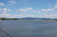
Hydrographic network of the county has a length of 1,263.7 km, of which the Someș is 95 km within the county, Almaș River 68 km, Agrij River 48 km, Crasna River 71 km, Barcău River 54 km. Water covers 57.8 km2, representing 1.5% of the county area.
Flora
Sălaj landscape presents areas with forests of oak, sessile, beech and other deciduous, pastures and agricultural land planted with vines, fruit trees, grain alternating with anthropogenic landscapes.
Demography

Ethnic composition of Sălaj County
Sălaj County has a population of 224,384 inhabitants (October 2011) and a density of 58 inhabitants/km2. Sălaj County ranks third nationally as one of the counties with the lowest number of inhabitants.[14] The degree of urbanization of the county is 39.3%. The number of people in urban areas is 88,259 and 136,125 of those in rural areas.[12]
In 2011, ethnic structure of the county includes: Romanians (148,396), Hungarians (50,177), Gypsies (15,004), Slovaks (1,118) and other nationalities (9,689). Likewise, 9,467 have not declared their ethnicity.[15]
| Census[16] | Ethnicity | ||||||||
|---|---|---|---|---|---|---|---|---|---|
| Year | Population | Romanians | Hungarians | Gypsies | Germans | Slovaks | Jews | Others | Unspecified |
| 1930 | 240,778 | 167,936 | 55,611 | 4,446 | 204 | 4,539 | 7,749 | 249 | 44 |
| 1956 | 271,989 +13% |
199,900 +19% |
66,935 +20.4% |
2,092 −52.9% |
40 −80.4% |
2,154 −52.5% |
772 −90% |
83 | 13 |
| 1966 | 263,103 −3.3% |
194,790 −2.6% |
63,850 −4.6% |
1,779 −15% |
72 +80% |
2,357 +9.4% |
88 −88.6% |
130 | 37 |
| 1977 | 264,569 +0.6% |
194,420 −0.2% |
64,017 +0.3% |
3,920 +120.3% |
122 +69.4% |
1,929 −18.2% |
40 −54.5% |
120 | 1 |
| 1992 | 266,797 +0.8% |
192,552 −1% |
63,151 −1.4% |
9,224 +135.3% |
146 +19.7% |
1,608 −16.6% |
24 −40% |
92 | – |
| 2002 | 248,015 −7% |
176,671 −8.2% |
57,167 −9.5% |
12,544 +36% |
102 −30.1% |
1,366 −15% |
12 −50% |
140 | 13 |
| 2011 | 224,384 −9.5% |
148,396 −16% |
50,177 −12.2% |
15,004 +19.6% |
57 −44.1% |
1,118 −18.2% |
5 −58.3% |
160 | 9,467 |
99.8% declared their affiliation to a religion, people who were atheists or without religion representing only 0.2%.
| Religion | People | Percentage |
|---|---|---|
| Orthodox | 138,032 | 64.4% |
| Reformed | 42,128 | 19.6% |
| Pentecostal | 10,358 | 4.8% |
| Baptist | 8,293 | 3.9% |
| Greek Catholic | 5,726 | 2.7% |
| Roman Catholic | 5,340 | 2.5% |

Economy
Industry
Sălaj County has rich natural resources of raw materials, concentrated in the following areas:
- brown coal – Cristolțel;
- lignite – Ip and Sărmășag;
- carbonaceous slate – Zimbor;
- gypsum – Treznea;
- alabaster – Gălășeni and Stâna;
- diorite – Moigrad;
- mica-schist – Marca;
- chalk – Cuciulat, Glod, Prodănești and Răstoci;
- clay – Crasna, Cuciulat, Nușfalău and Zalău;
- kaolin sand – Jac and Var;
- silica sand – Jac, Creaca, Surduc and Var;
- quartz sand – Var;
- kaolin – Ruginoasa;
- tuff – Mirșid;
- river aggregates – Benesat, Var, Rona, Almașu, Băbeni, Cuciulat, Glod, Gâlgău, Ileanda, Românași, Rus, Someș-Odorhei, Surduc and Tihău.
Education
Of the total resident population of 10 years and over 47.8% had low levels of education (primary, gymnasium or no school graduated), 41.4% intermediate levels (postgraduate and vocational, high school or professional and apprentice) and 10.8% higher levels.[17]
The number of people with higher education increased by 2.3 times in 2011 compared to 2002, and that of people with low levels of education decreased by 24.9%. On 20 October 2011, the share of illiterate persons in the total population of 10 years and over was 1.8%, 1.2% lower than in the 2002 census.
Politics
The Sălaj County Council, elected at the 2016 local government elections, is made up of 31 counselors, with the following party composition:[18]
| Party | Seats | Current County Council | ||||||||||||||
|---|---|---|---|---|---|---|---|---|---|---|---|---|---|---|---|---|
| Social Democratic Party | 12 | |||||||||||||||
| National Liberal Party | 10 | |||||||||||||||
| Democratic Alliance of Hungarians | 7 | |||||||||||||||
| National Union for the Progress of Romania | 2 | |||||||||||||||
Administrative divisions

Sălaj County has 1 municipality, 3 towns and 57 communes, subdivided into 281 villages.
Municipalities
- Zalău – capital city; population: 56,202
Towns
- Cehu Silvaniei – population: 7,214
- Jibou – population: 10,407
- Șimleu Silvaniei – population: 14,436
Communes
- Agrij
- Almașu
- Băbeni
- Bălan
- Bănișor
- Benesat
- Bobota
- Bocșa
- Boghiș
- Buciumi
- Camăr
- Carastelec
- Chieșd
- Cizer
- Coșeiu
- Crasna
- Creaca
- Crişeni
- Cristolț
- Cuzăplac
- Dobrin
- Dragu
- Fildu de Jos
- Gâlgău
- Gârbou
- Halmășd
- Hereclean
- Hida
- Horoatu Crasnei
- Ileanda
- Ip
- Letca
- Lozna
- Măeriște
- Marca
- Meseșenii de Jos
- Mirșid
- Năpradea
- Nușfalău
- Pericei
- Plopiș
- Poiana Blenchii
- Românași
- Rus
- Sălățig
- Sâg
- Sânmihaiu Almașului
- Someș-Odorhei
- Surduc
- Șamșud
- Sărmășag
- Șimișna
- Treznea
- Valcău de Jos
- Vârșolț
- Zalha
- Zimbor
Personalities


- Christopher Báthory (1530–1581), Voivode of Transylvania
- Stephen Báthory (1533–1586), Prince of Transylvania and King of Poland
- Miklós Wesselényi (1796–1850), statesman
- Simion Bărnuțiu (1808–1864), politician, historian, philosopher, professor and revolutionary
- Ioan Maniu (1833–1895), journalist and father of Iuliu Maniu
- Alimpiu Barboloviciu (1834–1914), Greek Catholic archpriest, vicar and publicist
- Iuliu Maniu (1873–1953), Prime Minister of Romania
- Béla Kun (1886–1938), revolutionary
- Joe Pasternak (1901–1991), filmmaker
- Miklós Nyiszli (1901–1956), physician and author
- Corneliu Coposu (1914–1995), politician and political prisoner
- Augustin Deac (1928–2004), historian
- Ioan Pușcaș (1932–2015), radiologist
- Florian Pop (b. 1952), mathematician
- Vasile Pușcaș (b. 1952), professor, diplomat and politician
- Codruț Șereș (b. 1969), Economy Minister
- Dacian Cioloș (b. 1969), Prime Minister of Romania
- Eduard Hellvig (b. 1974), MEP, Tourism Minister and Director of the Romanian Intelligence Service
- Cosmin Seleși (b. 1977), actor and TV star
- Ramona Farcău (b. 1979), handball player
- Talida Tolnai (b. 1979), handball player
References
- ↑ The number used depends on the numbering system employed by the phone companies on the market.
- ↑ "Sălaj - Dimensiune și Expansiune" (PDF). Sălaj County Council (in Romanian).
- ↑ Iordan, Iorgu (1963). Toponimia romînească. Bucharest: Editura Academiei Republicii Populare Romîne. p. 104. OCLC 460710897.
- ↑ Cârciumaru, Marin. "Peștera Cuciulat". Speologie.ro (in Romanian).
- ↑ Olaru, Sebastian (21 July 2013). Olteanu, Karina, ed. "Specii de lilieci unicat în Europa și picturi rupestre, în peșterile din Sălaj". Agerpres (in Romanian).
- ↑ "Sălaj: Cetatea Almașului, de la istorie la potențial turistic". The Epoch Times (in Romanian). 16 July 2009.
- ↑ Hanson, W. S.; Haynes, I. P. (2004). Roman Dacia. The Making of a Provincial Society. Journal of Roman Archaeology Supplementary Series 56. Portsmouth, RI: Journal of Roman Archaeology. ISBN 1-887829-56-3.
- ↑ "Prezentarea județului Sălaj". Sălaj Chamber of Commerce and Industry (in Romanian).
- ↑ Cristea, Irina (17 March 2014). Bădulescu, Marina, ed. "Județul Sălaj - Scurt istoric". Agerpres (in Romanian).
- 1 2 3 "Memoriu de prezentare a județului Sălaj" (PDF). Romanian Waters National Administration (in Romanian).
- ↑ "Planul local de acțiune pentru protecția mediului" (PDF). National Agency for Environmental Protection (in Romanian). 2007.
- 1 2 Mihordescu, Roxana; Lecea, Doina (17 March 2014). Bădulescu, Marina, ed. "Județul Sălaj - Prezentare". Agerpres (in Romanian).
- ↑ "Catalog – Parametri meteorologici". National Administration of Meteorology.
- ↑ "Recensământ. Populaţia Sălajului a scăzut! Află aici detalii". Adevărul (in Romanian).
- ↑ "Populația stabilă după etnie – județe, municipii, orașe, comune". National Institute of Statistics (in Romanian).
- ↑
- ↑ "Rezultate definitive ale recensământului populației și al locuințelor - 2011 (caracteristici demografice ale populației în județul Sălaj)" (PDF). National Institute of Statistics (in Romanian).
- ↑ "Mandate de CJ pe judete si competitori" (in Romanian). Biroul Electoral Central. 10 June 2016. Retrieved 16 June 2016.
External links
- (Romanian) http://www.cjsj.ro/index.php
- (Romanian) http://www.salaj.insse.ro/main.php
- (Romanian) and (English) http://www.insse.ro/cms/files/pdf/ro/cap2.pdf
- (English) http://circa.europa.eu/irc/dsis/regportraits/info/data/ro066_geo.htm
- (Romanian) http://www.flickr.com/photos/mipepitoida/2869382695/