St. John's Metropolitan Area
Not to be confused with St. John's, Newfoundland and Labrador.
| St. John's Metropolitan Area | |
|---|---|
| Metropolitan Area | |
|
| |
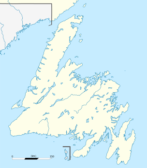
 Location of St John's in Newfoundland | |
| Coordinates: 47°34′3″N 52°42′26″W / 47.56750°N 52.70722°WCoordinates: 47°34′3″N 52°42′26″W / 47.56750°N 52.70722°W | |
| Country |
|
| Province |
|
| Census division | 1 |
| Government | |
| • MPs |
List of MPs
|
| • MHAs |
List of MHAs
|
| Area | |
| • Metro | 804.65 km2 (310.68 sq mi) |
| Population (2011[1]) | |
| • Metro | 196,966 |
| • Metro density | 244.8/km2 (634/sq mi) |
| 20th Largest metropolitan area in Canada | |
| Time zone | NST (UTC-3:30) |
| • Summer (DST) | NDT (UTC-2:30) |
| Area code(s) | 709 |
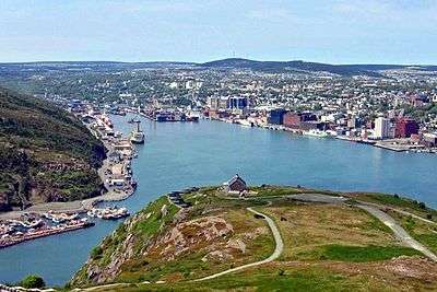
The St. John's Metropolitan Area is the most populous census metropolitan area (CMA) in the Canadian province of Newfoundland and Labrador. With a population of 196,966 in the 2011 Canadian Census, the CMA is the second largest in Atlantic Canada and the 20th largest CMA in Canada.[2]
The St. John’s CMA had a population of 214,285 as of 2015.[1][3] The CMA comprises the City of St. John's and twelve other communities, the largest of which are the town of Conception Bay South and the city of Mount Pearl.[4]
Demographics
The following information is from: Statistics Canada[4]
Population change
St. John's Metropolitan Area
| Year | Population | % change |
|---|---|---|
| 1986 | 164,593 | N/A |
| 1991 | 175,391 | 6.6 |
| 1996 | 174,051 | -0.07 |
| 2001 | 172,918 | -0.7 |
| 2006 | 181,113 | 4.7 |
| 2011 | 196,966 | 8.8 |
Municipalities
| Municipality | 2001 | 2006 | 2011 |
|---|---|---|---|
| St. John's | 99,182 | 100,646 | 106,172 |
| Conception Bay South | 19,772 | 21,966 | 24,848 |
| Mount Pearl | 24,964 | 24,671 | 24,284 |
| Paradise | 9,598 | 12,584 | 17,695 |
| Torbay | 5,474 | 6,281 | 7,397 |
| Portugal Cove – St. Philip's | 5,866 | 6,575 | 7,366 |
| Logy Bay – Middle Cove – Outer Cove | 1,872 | 1,978 | 2,098 |
| Pouch Cove | 1,669 | 1,756 | 1,866 |
| Flatrock | 1,138 | 1,214 | 1,457 |
| Bay Bulls | 1,014 | 1,078 | 1,283 |
| Witless Bay | 1,056 | 1,070 | 1,179 |
| Petty Harbour – Maddox Cove | 949 | 915 | 924 |
| Bauline | 364 | 379 | 397 |
Population density
| Rank | Municipality | Population | Land Area | Population Density | ||
|---|---|---|---|---|---|---|
| km2 | mi2 | /km2 | /mi2 | |||
| - | St. John's Metropolitan Area | 196,966 | 804.65 | 310.68 | 244.8 | 634 |
| 1 | St. John's | 106,172 | 446.04 | 172.22 | 238.0 | 616 |
| 2 | Conception Bay South | 24,848 | 59.27 | 22.88 | 419.2 | 1,086 |
| 3 | Mount Pearl | 24,284 | 15.75 | 6.08 | 1,542.1 | 3,994 |
| 4 | Paradise | 17,695 | 29.24 | 11.29 | 605.2 | 1,567 |
| 5 | Torbay | 7,397 | 34.88 | 13.47 | 212.1 | 549 |
| 6 | Portugal Cove – St. Philip's | 7,366 | 57.35 | 22.14 | 128.4 | 333 |
| 7 | Logy Bay – Middle Cove – Outer Cove | 2,098 | 16.98 | 6.56 | 123.6 | 320 |
| 8 | Pouch Cove | 1,866 | 58.34 | 22.53 | 32.0 | 83 |
| 9 | Flatrock | 1,457 | 18.12 | 7.00 | 80.4 | 208 |
| 10 | Bay Bulls | 1,283 | 30.74 | 11.87 | 41.7 | 108 |
| 11 | Witless Bay | 1,179 | 18.49 | 7.14 | 67.4 | 175 |
| 12 | Petty Harbour – Maddox Cove | 924 | 4.51 | 1.74 | 205.1 | 531 |
| 13 | Bauline | 397 | 15.95 | 6.16 | 24.9 | 64 |
References
- 1 2 "Census Profile - St. John's". Statistics Canada. Retrieved 9 February 2012.
- ↑ The City of St. John's — City Information
- ↑ "Table 1 Annual population estimates by census metropolitan area, July 1, 2014" (PDF). Statistics Canada. Retrieved 2015-02-11.
- 1 2 "Population and dwelling counts, for Canada, census metropolitan areas, census agglomerations and census subdivisions (municipalities), 2011 and 2006 censuses". Statistics Canada. Retrieved 9 February 2012.
This article is issued from Wikipedia - version of the 4/30/2016. The text is available under the Creative Commons Attribution/Share Alike but additional terms may apply for the media files.
