St. Mary's, Fore
| St. Mary's | |
|---|---|
| Civil parish | |
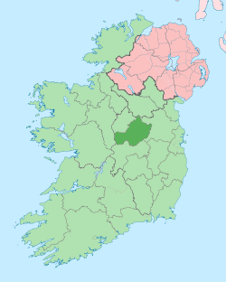
 St. Mary's Location of St. Mary's within County Westmeath in the Republic of Ireland | |
| Coordinates: 53°40′23″N 7°10′36″W / 53.67306°N 7.17667°WCoordinates: 53°40′23″N 7°10′36″W / 53.67306°N 7.17667°W | |
| Country |
|
| Province | Leinster |
| County | County Westmeath |
| Irish grid reference | N544695 |
St. Mary's is a civil parish in County Westmeath, Ireland. It is located about 19.84 kilometres (12 mi) north–north–east of Mullingar.
St. Mary's is one of 8 civil parishes in the barony of Fore in the Province of Leinster. The civil parish covers 4,290.6 acres (17.363 km2).
St. Mary's civil parish comprises 7 townlands: Aghalasty and Ankersland, Balnavine, Carrick, Christianstown, Cummerstown, Glenidan and Martinstown.
The neighbouring civil parishes are: Moylagh (County Meath) to the north, Delvin to the east, Clonarney to the east and south, Kilcumny to the south and St. Feighin's to the west.[1][2][3]
References
- ↑ St. Mary's civil parish The Placename Database of Ireland. Retrieved on 18 July 2015
- ↑ St. Mary's civil parish townlands.ie Retrieved on 18 July 2015.
- ↑ St. Mary's civil parish The IreAtlas Townland Database. Retrieved on 18 July 2015
External links
- St. Mary's civil parish at the IreAtlas Townland Data Base
- St. Mary's civil parish at townlands.ie
- St. Mary's civil parish at The Placename Database of Ireland
This article is issued from Wikipedia - version of the 7/18/2015. The text is available under the Creative Commons Attribution/Share Alike but additional terms may apply for the media files.