St. Peters Canal
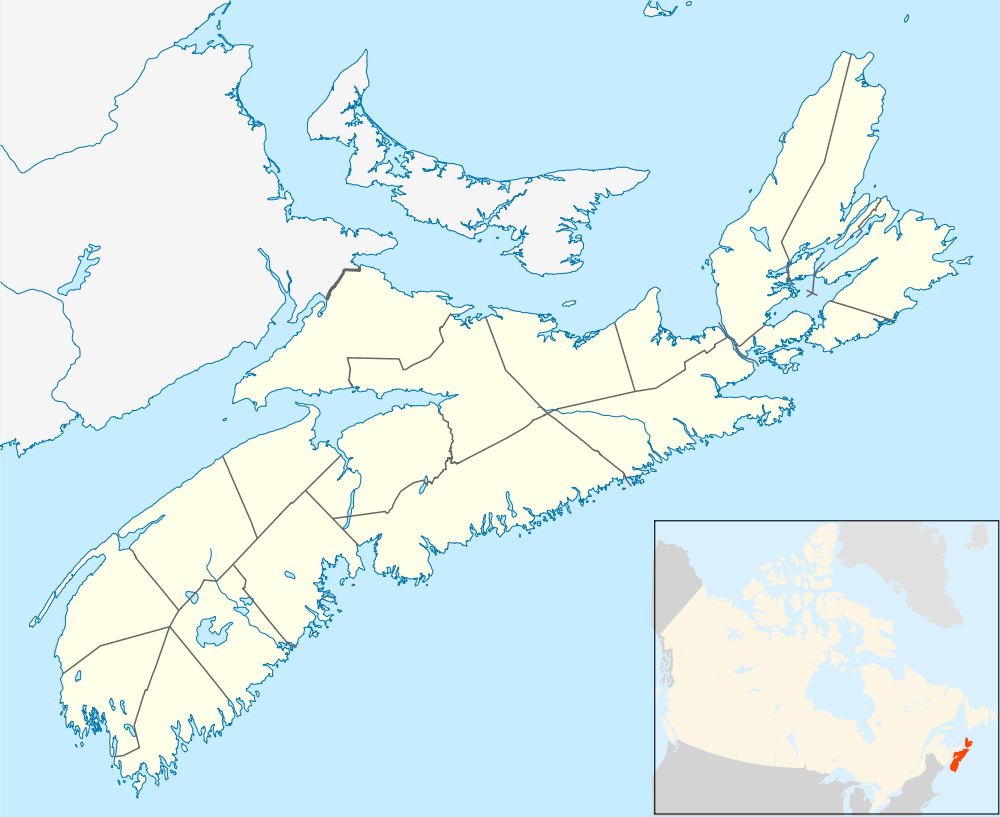
The St. Peters Canal is a small shipping canal located in eastern Canada on Cape Breton Island. It crosses an isthmus in the village of St. Peter's, Nova Scotia which connects St. Peters Inlet of Bras d'Or Lake to the north with St. Peters Bay of the Atlantic Ocean to the south.
In the vast majority of canals the flow of water is unidirectional. That is, the "high" side of the canal is always the same. St. Peter's Canal is unusual in that, due to the difference in the timing of the tides between Bras d'Or Lake and the ocean, during part of the tide cycle the Atlantic side is the higher, in other parts of the tide cycle it is the lake side. As a result, the canal requires special "double" gates, the only ones of their kind in North America. The usual canal lock has a gate at each end, each gate consisting of two swinging doors that when closed form a shallow 'V' shape, with the point of the 'V' pointing upstream. At the St. Peter's Canal lock each gate consists of four swinging doors which form a diamond shape when closed. In actual use the pair of doors which form the upstream pointing 'V' are used. No matter which side has the higher water level, either one pair or the other will be appropriate.
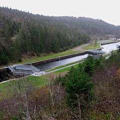
Vessels transiting the canal are limited by the size of the lock, which measures 91.44 m (301 ft) long, 14.45 m (47 ft) wide, and 4.88 m (16 ft) draught. A swing bridge over the canal has 6 m (20 ft) of clearance and is operated from the bridge house on Denys Street.
St. Peters Canal is the only working canal of national historic significance in Atlantic Canada and an important historic landmark for the Village of St. Peter’s and for Cape Breton Island. St. Peters Canal is part of a nationwide family of over 900 national historic sites, including 9 operating canals.[1]
Hours of operation
Prior to 2013, the canal operated from November 1 to mid-May, weather permitting, on a 24 hours' advance notice requirement. It operated seven days a week, from mid-May to mid-October each year, continuing with five-day-a-week operation (Monday to Friday) from mid-October to October 31. Through the early peak season (mid-June to mid-August) the canal was open for navigation from 8:00 am to 8:30 pm each day. The remainder of the peak season (mid-August to Labour Day) the hours were 8:00 am to 7:30 pm.
In 2013 season Parks Canada reduced service to three days a week from May 17 to Jun 23, expanding to seven days a week operation from June 24 to September 8 and two days a week operation from September 9 to 22 (extended to October 14, 2013). The daily hours of operation were also cut back, with closure at 6:00 pm each day until August 11 when the closing time fell back to 4:00 pm.[2] St. Peter’s Canal handles about 1,000 transits a year.[1] By its own estimate, Parks Canada believed 15 per cent of those boaters would be affected by the reduced hours of operation.[3] In December 2015 seven-day-a-week operation was restored to the May 10 to June 26, 2016 operation period.
Hours of Operation - 2016
May 10 to June 26, Daily, 8 a.m. — 4 p.m.
June 27 to August 11, Daily, 8 a.m. — 6 p.m.
August 12 to September 12, Daily, 8 a.m. — 4 p.m.
September 13 to September 25, Limited passage, Open Thursday to Monday from 8 a.m. to 4 p.m. Closed Tuesday, Wednesday and weekends
September 26 and after: Closed for construction. Reopening May 2017.
Schedule may be subject to change. For more information, phone 902-535-2118 or 902-295-2069.
Contact Lockmaster on VHF–10 or by phone at 902-535-2118.
Boats must arrive 30 minutes before the canal closes. Tie-up for transit is on the western wall of the lock approach.
Grounds open year-round.[4]
History
The area had long been travelled by the Mi'kmaq people who portaged their canoes across the isthmus.[5] A "haulover road" across the isthmus established by French fur trader Nicholas Denys in 1650 predated the canal.
A feasibility study was conducted in 1825 into the possibility of building a canal. Construction began in 1854 and was completed in 1869, resulting in a channel measuring 800 m (2,600 ft) long and an average of 30 m (100 ft) wide. The canal passes through a 20 m (66 ft) high hill composed of solid granite, accounting for the 15 years for its construction.[5] There can be a tidal difference of up to 1.4 m (4.5 ft) between Bras d'Or Lake and the Atlantic Ocean, thus a lock was designed to regulate water levels. The original works were designed to take vessels of 4 m (13 ft) draft but were deepened to 5.5 m (18 ft) between 1875 and 1881.[6]
The St. Peters Canal saw relatively heavy use by commercial shipping in the 19th century and early 20th century, during an era of industrial expansion on Cape Breton Island. Additions and renovations, widening the channel and lengthening the locks, continued until 1917.[5] The canal eventually became too small for modern ships and has been used primarily by pleasure boats since the end of the Second World War. The canal continues to serve both pleasure craft and commercial vessels travelling to and from the Bras d’Or Lakes, with about 1000 lockages recorded for the years 2003 and 2004.[1] The canal was designated a National Historic Site of Canada in 1929 and was under the jurisdiction of the Federal Department of Railways and Canals and its successor, Transport Canada up to 1972, when administration of the canal and associated property was transferred to Parks Canada who continue to operate and maintain the site today. The Lockmaster’s house built in 1876 is a “recognized” heritage building according to the Federal Heritage Building Review Office (FHBRO).[1]
Parks Canada undertook a major project to restore both entrances to the canal in 1985. The St. Peters Canal is operational from May to October each year. The current swing bridge, installed in its present location in 1931, is the fourth bridge to span the canal; previous ones were installed in 1869, 1876 and 1919.[1]
Swing bridge replacement
The current one-lane swing bridge was constructed in 1936. The current bridge is almost 80 years old and is nearing the end of its lifecycle. Routine inspections identified the bridge as needing some upgrades to meet current standards.[7] Parks Canada considered continuing to perform repairs but a full bridge replacement was deemed to be more cost effective. The current bridge currently still meets all safety requirements, and will continue to undergo regular bridge inspections to ensure public safety until it is replaced.[8]
In August 2014 Public Works and Government Services Canada (PWGSC) issued a Notice of Preferred Procurement (NPP) for the design phase of a new swing bridge for the St. Peters Canal.[9] According to Parks Canada external relations officer Maria O’Hearn, this step is the first in a three-year process that will see construction of a new two-lane swing bridge begin in 2016, with the new structure replacing the current one-lane bridge a year later.[10] On 20 November 2014 this tender was awarded to PARSONS INC. of Gloucester, Ontario.[11][12] The project is estimated to cost $10 million and is being overseen by Parks Canada as the bridge is part of a national historic site. The new two-lane bridge will be built adjacent to the existing one-lane structure. Contracts for the construction will go out this winter with work expected to be started in March.[7] The new two lane bridge is expected to be open to both boat and vehicular traffic by May, 2017 with landscaping work to be completed during the summer of 2017.[7][8]
References
- 1 2 3 4 5 "St. Peters Canal and St. Peters National Historic Sites of Canada Management Plan" (PDF). Parks Canada Agency. Retrieved June 2, 2013.
- ↑ "St. Peters Canal Hours of Operation". Parks Canada Agency. Retrieved October 10, 2013.
- ↑ "Parks Canada cuts affecting tourism near Cape Breton waterway". CTV Atlantic. Retrieved June 27, 2013.
- ↑ "St. Peters Canal Hours of Operation". Parks Canada Agency. Retrieved February 4, 2016.
- 1 2 3 "St. Peters Canal National Historic Site of Canada - History". Parks Canada Agency. Retrieved June 2, 2013.
- ↑ "USQUE AD MARE - A History of the Canadian Coast Guard and Marine Services - by Thomas E. Appleton - Railways and Canals". Canadian Coast Guard. Retrieved June 3, 2013.
- 1 2 3 "Bridge to be widened over St. Peter's Canal". Cape Breton Post. Retrieved November 27, 2015.
- 1 2 "St. Peter's Swing Bridge Replacement Project". Parks Canada. Retrieved November 11, 2015.
- ↑ "Replacement of the St. Peter's Canal Swing Bridge (EB144-150508/A)". Public Works & Government Services Canada. Retrieved January 6, 2015.
- ↑ "Construction on canal swing bridge to start in 2015 - by Adam Cooke". Port Hawkesbury Reporter. Retrieved January 6, 2015.
- ↑ "Replacement of the St. Peter's Canal Swing Bridge (EB144-150508/001/PWA)". Public Works & Government Services Canada. Retrieved January 6, 2015.
- ↑ "Government Announces Two-Lanes for St. Peter's Canal National Historic Site Bridge Replacement Project". Office of the Minister of the Environment. Retrieved 31 May 2015.
External links
- St. Peters Canal National Historic Site
- St. Peters Canal on Cruising Cape Breton
- Aerial Video of St. Peters Canal - 5 min.
Coordinates: 45°39′19.5″N 60°52′6.85″W / 45.655417°N 60.8685694°W
| Provinces | |
|---|---|
| Territories | |
| Other countries | |
| |