Sterling Township, Crawford County, Indiana
| Sterling Township | |
|---|---|
| Township | |
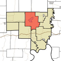 Location of Sterling Township in Crawford County | |
| Coordinates: 38°20′12″N 86°27′13″W / 38.33667°N 86.45361°WCoordinates: 38°20′12″N 86°27′13″W / 38.33667°N 86.45361°W | |
| Country | United States |
| State | Indiana |
| County | Crawford |
| Government | |
| • Type | Indiana township |
| Area | |
| • Total | 48.47 sq mi (125.5 km2) |
| • Land | 48.41 sq mi (125.4 km2) |
| • Water | 0.07 sq mi (0.2 km2) |
| Elevation[1] | 509 ft (155 m) |
| Population (2010) | |
| • Total | 1,635 |
| • Density | 33.8/sq mi (13.1/km2) |
| FIPS code | 18-73016[2] |
| GNIS feature ID | 453873 |
Sterling Township is one of nine townships in Crawford County, Indiana. As of the 2010 census, its population was 1,635 and it contained 860 housing units.[3]
Geography
According to the 2010 census, the township has a total area of 48.47 square miles (125.5 km2), of which 48.41 square miles (125.4 km2) (or 99.88%) is land and 0.07 square miles (0.18 km2) (or 0.14%) is water.[3] Bluegill Pond and Grant Lake are in this township.
Cities and towns
Unincorporated towns
(This list is based on USGS data and may include former settlements.)
Adjacent townships
- Southeast Township, Orange County (northeast)
- Liberty Township (east)
- Whiskey Run Township (east)
- Jennings Township (southeast)
- Ohio Township (south)
- Union Township (southwest)
- Patoka Township (west)
- Greenfield Township, Orange County (northwest)
Major highways
Cemeteries
The township contains nine cemeteries: Cunningham, Denbo, Grant, Hamilton, Land, Purkhiser, Seton, Sloan and Stewart.
References
- ↑ "US Board on Geographic Names". United States Geological Survey. 2007-10-25. Retrieved 2008-01-31.
- ↑ "American FactFinder". United States Census Bureau. Retrieved 2008-01-31.
- 1 2 "Population, Housing Units, Area, and Density: 2010 - County -- County Subdivision and Place -- 2010 Census Summary File 1". United States Census. Retrieved 2013-05-10.
External links
Municipalities and communities of Crawford County, Indiana, United States | ||
|---|---|---|
| Towns | ||
| Townships | ||
| Unincorporated communities | ||
| Footnotes | ‡This populated place also has portions in an adjacent county or counties | |
This article is issued from Wikipedia - version of the 7/31/2014. The text is available under the Creative Commons Attribution/Share Alike but additional terms may apply for the media files.