Stockwell, Indiana
| Stockwell | |
|---|---|
| Census-designated place | |
|
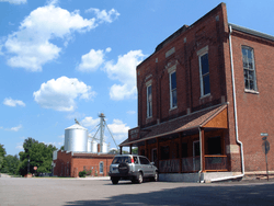
The corner of Orchard and Monroe. | |
 Tippecanoe County's location in Indiana | |
 Stockwell Location in Tippecanoe County | |
| Coordinates: 40°17′10″N 86°46′16″W / 40.28611°N 86.77111°WCoordinates: 40°17′10″N 86°46′16″W / 40.28611°N 86.77111°W | |
| Country | United States |
| State | Indiana |
| County | Tippecanoe County |
| Township | Lauramie Township |
| Founded | 1859 |
| Elevation[1] | 771 ft (235 m) |
| Time zone | EST (UTC-5) |
| • Summer (DST) | EDT (UTC-4) |
| ZIP code | 47983 |
| Area code(s) | 765 |
| GNIS feature ID | 444184 |
Stockwell, originally named Lauramie, is a census-designated place in Lauramie Township, Tippecanoe County, in the U.S. state of Indiana.[2] It was once a stop along the Indianapolis, Cincinnati and Lafayette Railroad, but the rail line has since been removed.
The community is part of the Lafayette, Indiana Metropolitan Statistical Area.
History
An old variant name of the community was called Bakers Corner.[3]
A post office was established under the name Bakers Corner in 1853, and was renamed to Stockwell in 1859. It is still currently in operation.[4]
Geography
Stockwell is located at 40°17′10″ N, 86°46′16″ W (40.286111, -86.771111) at an elevation of 776 feet. The town sits near a bend in Lauramie Creek in Lauramie Township, less than two miles west of U.S. Route 52. Stockwell had a population of 545 at the 2010 census.
References
- ↑ "US Board on Geographic Names". United States Geological Survey. October 25, 2007. Retrieved 2016-07-25.
- ↑ "Stockwell, Indiana". Geographic Names Information System. United States Geological Survey. Retrieved 2016-07-25.
- ↑ "USGS detail on Stockwell - Variant Citation". Retrieved 2016-07-25.
- ↑ "Tippecanoe County". Jim Forte Postal History. Retrieved July 25, 2016.
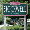 A sign welcomes visitors to Stockwell.
 A July 2007 wedding at the town's gazebo.
 Stockwell in 1878.
Municipalities and communities of Tippecanoe County, Indiana, United States | ||
|---|---|---|
| Cities | ||
| Towns | ||
| Townships | ||
| CDPs | ||
| Other unincorporated communities |
| |
| Ghost towns | ||
| Footnotes | ‡This populated place also has portions in an adjacent county or counties | |