Stornoway, Quebec
| Stornoway | |
|---|---|
| Municipality | |
 | |
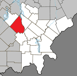 Location within Le Granit RCM. | |
 Stornoway Location in southern Quebec. | |
| Coordinates: 45°43′N 71°10′W / 45.717°N 71.167°WCoordinates: 45°43′N 71°10′W / 45.717°N 71.167°W[1] | |
| Country |
|
| Province |
|
| Region | Estrie |
| RCM | Le Granit |
| Constituted | January 1, 1858 |
| Government[2] | |
| • Mayor | Pierre-André Gagné |
| • Federal riding | Mégantic—L'Érable |
| • Prov. riding | Mégantic |
| Area[2][3] | |
| • Total | 184.60 km2 (71.27 sq mi) |
| • Land | 181.47 km2 (70.07 sq mi) |
| Population (2011)[3] | |
| • Total | 559 |
| • Density | 3.1/km2 (8/sq mi) |
| • Pop 2006-2011 |
|
| • Dwellings | 250 |
| Time zone | EST (UTC−5) |
| • Summer (DST) | EDT (UTC−4) |
| Postal code(s) | G0Y 1N0 |
| Area code(s) | 819 |
| Highways |
|
| Website |
www |
Stornoway, Scottish Gaelic: Steòrnabhagh is a small village of 600 people. It is a municipality in Quebec, in the regional county municipality of Le Granit in the administrative region of Estrie. It is named after Stornoway, a burgh on the Isle of Lewis, in the Outer Hebrides of Scotland.
It is at the intersection of two provincial highways, Route 108 and Route 161.
References
- Répertoire des municipalités du Québec
- Commission de toponymie du Québec
- Affaires municipales et régions - cartes régionales
- Municipalité de Stornoway
External links
 |
Sainte-Praxède | | ||
| Stratford Lingwick |
|
Saint-Romain | ||
| ||||
| | ||||
| Milan | Nantes |
| Cities | |
|---|---|
| Municipalities | |
| Parishes | |
| Townships | |
| |
This article is issued from Wikipedia - version of the 6/11/2015. The text is available under the Creative Commons Attribution/Share Alike but additional terms may apply for the media files.