Strathy

Coordinates: 58°33′N 4°00′W / 58.55°N 4.00°W
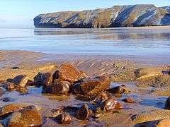
Strathy (from Scottish Gaelic Srathaidh, meaning "place of the strath")[1] is a scattered community in Sutherland in the Scottish Highlands.
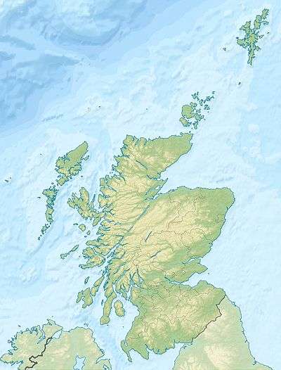
Strathy is on the north coast of Scotland, on the A836 road some twenty miles west of Thurso. The village itself includes at least three distinct areas:
- Strathy East (on the right-hand side when passing through the village in the direction of Bettyhill, accessed by two roads leading towards Strathy Beach),
- Strathy West (immediately to the south of Strathy East)
- Strathy Point.
These generally enclose the rest of the village, mainly comprising Steven Terrace. If welcoming signposts are taken to represent the limits of the village, Strathy is contained in these areas. However, some would say that Strathy also takes in the settlement of Baligill to the east, and also Brawl, Aultiphurst and Laidnagullin to the west, essentially the entire community found between the Baligill Burn and the Armadale 'Big' Burn.
Climate
| Climate data for Strathy East 1981-2010 | |||||||||||||
|---|---|---|---|---|---|---|---|---|---|---|---|---|---|
| Month | Jan | Feb | Mar | Apr | May | Jun | Jul | Aug | Sep | Oct | Nov | Dec | Year |
| Average high °C (°F) | 6.2 (43.2) |
6.6 (43.9) |
8.0 (46.4) |
10.2 (50.4) |
12.7 (54.9) |
14.6 (58.3) |
16.6 (61.9) |
16.6 (61.9) |
14.6 (58.3) |
11.6 (52.9) |
8.5 (47.3) |
6.6 (43.9) |
11.07 (51.94) |
| Average low °C (°F) | 0.8 (33.4) |
0.8 (33.4) |
1.7 (35.1) |
3.2 (37.8) |
5.2 (41.4) |
8.1 (46.6) |
10.1 (50.2) |
10.2 (50.4) |
8.2 (46.8) |
5.8 (42.4) |
3.2 (37.8) |
1.1 (34) |
4.87 (40.78) |
| Average precipitation mm (inches) | 100.4 (3.953) |
79.4 (3.126) |
82.3 (3.24) |
58.0 (2.283) |
55.3 (2.177) |
63.7 (2.508) |
70.5 (2.776) |
76.3 (3.004) |
96.8 (3.811) |
104.0 (4.094) |
115.5 (4.547) |
100.4 (3.953) |
1,002.6 (39.472) |
| Average rainy days | 18.6 | 15.9 | 16.2 | 12.8 | 12.0 | 12.6 | 13.7 | 15.1 | 15.5 | 17.6 | 18.5 | 17.6 | 186.1 |
| Mean monthly sunshine hours | 36.6 | 67.9 | 96.4 | 145.3 | 196.3 | 157.3 | 140.9 | 135.2 | 114.1 | 76.2 | 45.7 | 28.7 | 1,240.6 |
| Source: Met Office[2] | |||||||||||||
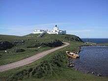 Strathy Point Lighthouse in July 2007 | |
 Scotland | |
| Location |
Strathy Point Highland Scotland United Kingdom |
|---|---|
| Coordinates | 58°35′56″N 4°01′07″W / 58.598752°N 4.018545°W |
| Year first constructed | 1958 |
| Automated | 1997 |
| Deactivated | 2012 |
| Construction | masonry tower |
| Tower shape | square parallelepiped tower on the top of the keeper’s house |
| Markings / pattern | white tower, black lantern, ochre trim |
| Height | 14 metres (46 ft) |
| Focal height | 45 metres (148 ft) |
| Range | 26 nautical miles (48 km; 30 mi) |
| Characteristic | Fl W 20s. |
| Admiralty number | A3590 |
| NGA number | 3048 |
| ARLHS number | SCO-227 |
| Managing agent |
private[3] [4] |
See also
References
- ↑ Gaelic and Norse in the Landscape: Placenames in Caithness and Sutherland. Scottish National Heritage.
- ↑ http://www.metoffice.gov.uk/public/weather/climate/gfmjjhy0r
- ↑ Strathy Point The Lighthouse Directory. University of North Carolina at Chapel Hill. Retrieved 17 May 2016
- ↑ Strathy Point Northern Lighthouse Board. Retrieved 17 May 2016