Mull of Galloway
| Mull of Galloway | |
| Scottish Gaelic: Maol nan Gall | |
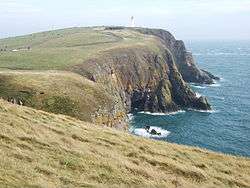 Mull of Galloway headland |
|
 Mull of Galloway |
|
| OS grid reference | NX158303 |
|---|---|
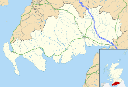
| Council area | Dumfries and Galloway |
| Lieutenancy area | Wigtownshire |
| Country | Scotland |
| Sovereign state | United Kingdom |
| Post town | STRANRAER |
| Postcode district | DG9 |
| Dialling code | 01776 |
| Police | Scottish |
| Fire | Scottish |
| Ambulance | Scottish |
| EU Parliament | Scotland |
| UK Parliament | Dumfries and Galloway |
| Scottish Parliament | Galloway and West Dumfries |
Coordinates: 54°38′06″N 4°51′23″W / 54.635083°N 4.856336°W
 Lighthouse on the Mull of Galloway | |
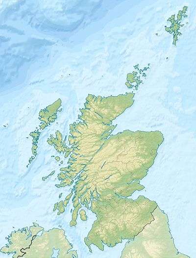 Scotland | |
| Location |
Mull of Galloway Wigtownshire Scotland United Kingdom |
|---|---|
| Coordinates | 54°38′06″N 4°51′27″W / 54.635005°N 4.857416°W |
| Year first constructed | 1830 |
| Automated | 1988 |
| Construction | masonry tower |
| Tower shape | cylindrical tower with balcony and lantern |
| Markings / pattern | white tower, black lantern, ochre trim |
| Height | 26 metres (85 ft) |
| Focal height | 99 metres (325 ft) |
| Range | 28 nautical miles (52 km; 32 mi) |
| Characteristic | Fl W 20s. |
| Admiralty number | A4610 |
| NGA number | 4816 |
| ARLHS number | SCO-144 |
| Managing agent |
South Rhins Community Development Trust [1] [2] |
The Mull of Galloway (Scottish Gaelic: Maol nan Gall, pronounced [mɯːlˠ̪ nəŋ kaulˠ̪]) (grid reference NX158303) is the southernmost point of Scotland. It is situated in Wigtownshire, Dumfries and Galloway.
The Mull has one of the last remaining sections of natural coastal habitat on the Galloway coast and as such supports a wide variety of plant and animal species. It is now a nature reserve managed by the RSPB. Mull means rounded hill or mountain.
Lighthouse
An active lighthouse is positioned at the point . Built in 1830 by engineer Robert Stevenson, the white-painted round tower is 26 metres (85 ft) high. The light is 99 metres (325 ft) above sea level and has a range of 28 nautical miles (52 km).[3]
During World War II, on 8 June 1944 at 7.30pm a French member of the British Air Transport Auxiliary (ATA), Cladius Echallier, died by striking the Lighthouse in a Beaufighter, while making a low landfall from the Irish Sea. [4]
The lighthouse is now automatic, and an old outhouse has been converted into a visitor centre, run by the South Rhins Community Development Trust, a group of local people and businesses. In 2013 there was a community buyout and the Mull of Galloway Trust purchased land and buildings, with the exception of the tower, from Northern Lighthouse Board. In 2004 a new café was built at the Mull of Galloway, called the "Gallie Craig". Its design incorporates into the landscape with a turf roof, giving views across to Ireland and South to the Isle of Man.
See also
- List of lighthouses in Scotland
- List of Northern Lighthouse Board lighthouses
- Dunnet Head - Scotland's most northerly point on the mainland
- Corrachadh Mòr - Scotland's most westerly point on the mainland
- Keith Inch - Scotland's most easterly point on the mainland
References
- ↑ Mull of Galloway The Lighthouse Directory. University of North Carolina at Chapel Hill. Retrieved 16 May 2016
- ↑ Mull of Galloway Northern Lighthouse Board. Retrieved 16 May 2016
- ↑ http://www.nlb.org.uk/ourlights/Mull%20of%20Galloway%20leaflet.pdf
- ↑ The Forgotten Pilots, Lettice Curtis, Page 153
External links
- Northern Lighthouse Board
- Area website
- Webcam of the views from the lighthouse
- Profile on VisitScotland website
| Wikimedia Commons has media related to Mull of Galloway Lighthouse. |